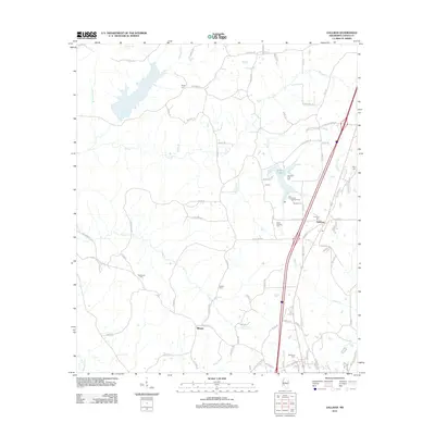
2012 Map of Gallman
USGS Topo · Published 2012About this map
The settlement of Gallman serves as the focal point of this Copiah County survey, situated along the primary transportation corridor that bisects the landscape. This area of Mississippi is defined by its numerous small burial grounds and rural hubs, including Tillman and the religious and social gathering place at Camp Wesley Pines. The terrain is deeply carved by a network of waterways such as Copiah Cr and Turkey Cr, which feed into larger bodies like Lake Copiah.
Find a feature on this map
91 named features on this map. Tap any name to fly to it.
Don’t see what you’re looking for? This feature index may not catch every label — zoom into the map to look around manually.
Map Details
Editions of this 2012 Gallman Map
This is the sole edition of this map. No revisions or reprints were ever made.
Other maps of this area

1903 · Jackson
USGS Topo · 1:125,000

1937 · Terry
USGS Topo · 1:48,000

1943 · Terry
USGS Topo · 1:62,500

1953 · Natchez
USGS Topo · 1:250,000

1955 · Jackson
USGS Topo · 1:250,000

1956 · Natchez
USGS Topo · 1:250,000

1959 · Natchez
USGS Topo · 1:250,000

1961 · Jackson
USGS Topo · 1:250,000

1962 · Jackson
USGS Topo · 1:250,000

1963 · Dentville
USGS Topo · 1:24,000