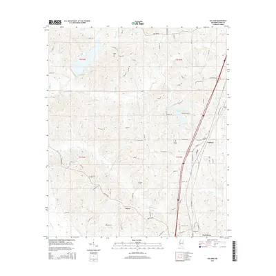
2015 Map of Gallman
USGS Topo · Published 2015About this map
Gallman and the northern outskirts of Hazlehurst anchor this portion of Copiah County, where the landscape is defined by the drainage basins of Copiah Cr and Bayou Pierre. The area is notably dense with small family and community burial grounds, including the Wiltshire-King Cem near Lake Copiah and the Clear Springs Cem south of Byrdtown Rd. These sites, along with others like Pisgah Cem and Deaton Cem, point to a long-established rural settlement pattern that persists alongside modern transit corridors.
Find a feature on this map
84 named features on this map. Tap any name to fly to it.
Don’t see what you’re looking for? This feature index may not catch every label — zoom into the map to look around manually.
Map Details
Editions of this 2015 Gallman Map
This is the sole edition of this map. No revisions or reprints were ever made.
Other maps of this area

1903 · Jackson
USGS Topo · 1:125,000

1937 · Terry
USGS Topo · 1:48,000

1943 · Terry
USGS Topo · 1:62,500

1953 · Natchez
USGS Topo · 1:250,000

1955 · Jackson
USGS Topo · 1:250,000

1956 · Natchez
USGS Topo · 1:250,000

1959 · Natchez
USGS Topo · 1:250,000

1961 · Jackson
USGS Topo · 1:250,000

1962 · Jackson
USGS Topo · 1:250,000

1963 · Dentville
USGS Topo · 1:24,000