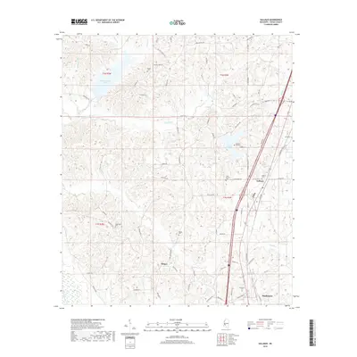
2018 Map of Gallman
USGS Topo · Published 2018About this map
Gallman and the northern outskirts of Hazlehurst anchor this portion of Copiah County, where the landscape is defined by the winding drainages of Copiah Cr and Long Cr. The map documents a rural network of named roads like Dentville Rd and New Zion Rd that connect several small settlements and community landmarks. Genealogists will find a high density of burial sites across the township lines of T2N and T1N, including Pisgah Cem in the north and the Damascus Cem near the southern edge. The terrain is notably water-rich, featuring large recreational and storage bodies such as Calling Panther Lake and Lake Copiah, while the western reach is drained by Bayou Pierre. These waterways and the road placements reflect a settlement pattern deeply tied to the natural topography of south-central Mississippi.
Find a feature on this map
73 named features on this map. Tap any name to fly to it.
Don’t see what you’re looking for? This feature index may not catch every label — zoom into the map to look around manually.
Map Details
Editions of this 2018 Gallman Map
This is the sole edition of this map. No revisions or reprints were ever made.
Other maps of this area

1903 · Jackson
USGS Topo · 1:125,000

1937 · Terry
USGS Topo · 1:48,000

1943 · Terry
USGS Topo · 1:62,500

1953 · Natchez
USGS Topo · 1:250,000

1955 · Jackson
USGS Topo · 1:250,000

1956 · Natchez
USGS Topo · 1:250,000

1959 · Natchez
USGS Topo · 1:250,000

1961 · Jackson
USGS Topo · 1:250,000

1962 · Jackson
USGS Topo · 1:250,000

1963 · Dentville
USGS Topo · 1:24,000