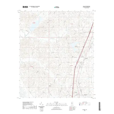
2020 Map of Gallman
USGS Topo · Published 2020About this map
Gallman and Tillman anchor this central Mississippi landscape, situated just north of the larger community of Hazlehurst. The terrain is defined by a dense network of tributaries including Copiah Cr, Turkey Creek, and Long Cr, which carve through the wooded hills of Copiah County. This survey highlights the region's deep community roots through its numerous small burial grounds and churches, such as the Greater Damascus Church of Christ Cem and the Clear Springs Cem. The mapping of local transport routes like New Zion RD and Dentville RD provides a clear view of how these rural settlements are interconnected. Notable family-named landmarks and cemeteries, including the Wiltshire-King Cem and Alford Cem, serve as essential points of reference for those tracing local lineages or studying the spatial layout of historic church congregations in the area.
Find a feature on this map
80 named features on this map. Tap any name to fly to it.
Don’t see what you’re looking for? This feature index may not catch every label — zoom into the map to look around manually.
Map Details
Editions of this 2020 Gallman Map
This is the sole edition of this map. No revisions or reprints were ever made.
Other maps of this area

1903 · Jackson
USGS Topo · 1:125,000

1937 · Terry
USGS Topo · 1:48,000

1943 · Terry
USGS Topo · 1:62,500

1953 · Natchez
USGS Topo · 1:250,000

1955 · Jackson
USGS Topo · 1:250,000

1956 · Natchez
USGS Topo · 1:250,000

1959 · Natchez
USGS Topo · 1:250,000

1961 · Jackson
USGS Topo · 1:250,000

1962 · Jackson
USGS Topo · 1:250,000

1963 · Dentville
USGS Topo · 1:24,000