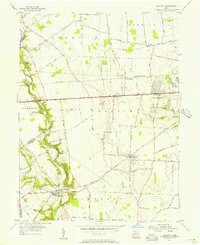
1955 Map of Galloway
USGS Topo · Published 1956About this map
Big Darby Creek carves a winding path along the western edge of this mid-century landscape, marking the boundary between Madison and Franklin counties. The area is characterized by a transition from traditional rural townships like Brown and Prairie to early suburban nodes such as New Rome and Alton. The transportation backbone of the region is defined by the National Road and the Pennsylvania Railroad, which intersect at Alton Station, facilitating the movement of goods and people across the Ohio interior.
Find a feature on this map
47 named features on this map. Tap any name to fly to it.
Don’t see what you’re looking for? This feature index may not catch every label — zoom into the map to look around manually.
Map Details
Editions of this 1955 Galloway Map
This is the sole edition of this map. No revisions or reprints were ever made.
Other maps of this area

1901 · Dublin
USGS Topo · 1:62,500

1903 · Dublin
USGS Topo · 1:62,500

1907 · London
USGS Topo · 1:62,500

1916 · Milford Center
USGS Topo · 1:62,500

1923 · West Columbus
USGS Topo · 1:62,500

1925 · West Columbus
USGS Topo · 1:62,500

1944 · Milford Center
USGS Topo · 1:62,500

1947 · Columbus
USGS Topo · 1:250,000

1950 · Marion
USGS Topo · 1:250,000
1954 · Hilliard
USGS Topo · 1:24,000
Featured Places
- Columbus, OH
- Hilliard, Norwich Township
- Norwich Township, OH
- Fairfield Township, OH
- Jefferson Township, OH