
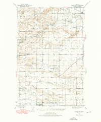
1938 Map of Gallup City
USGS Topo · Published 1942About this map
The high plains of Pondera and Teton counties are defined by a network of wide, flat benches and the winding coulees that drain them during the late 1930s. Gallup City serves as a central point in this ranching landscape, surrounded by an extensive system of rural schools including Lincoln Sch, Erickson Sch, and Porter Bench Sch. The presence of numerous named homesteads, such as the Graham Ranch, Smith Ranch, and Scoffon Ranch, illustrates the settlement patterns of the era, where family-run operations anchored the local economy. Water management is critical in this environment, shown through the Agawam Canal, Bynum Canal, and Conrad Reservoir. Transportation relies on a mix of established routes like the Conrad Pendroy Road and the Montana Western railroad, which skirts the northeastern corner of the map near Manson.
Find a feature on this map
42 named features on this map. Tap any name to fly to it.
Don’t see what you’re looking for? This feature index may not catch every label — zoom into the map to look around manually.
Map Details
Editions of this 1938 Gallup City Map
2 editions found
Other maps of this area

1886 · Great Falls
USGS Topo · 1:250,000

1920 · Choteau
USGS Topo · 1:125,000

1920 · Dupuyer
USGS Topo · 1:125,000

1920 · Conrad
USGS Topo · 1:125,000

1934 · Lake Frances
USGS Topo · 1:48,000

1934 · Valier
USGS Topo · 1:62,500

1936 · Pendroy
USGS Topo · 1:48,000

1937 · Valier
USGS Topo · 1:62,500

1937 · Lake Frances
USGS Topo · 1:62,500

1941 · Pendroy
USGS Topo · 1:62,500