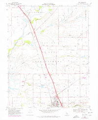
1968 Map of Galt
USGS Topo · Published 1977About this map
The Southern Pacific railroad line forms a sharp diagonal spine across this landscape, connecting the southern hub of Galt with the northern outposts of Need and Mcconnel. This 1968 survey (photorevised in 1975) details a region structured by large land grants, including the Omochumnes and San Joan tracts. The drainage of the Cosumnes River and Laguna Creek dictates the local geography, with secondary features like Deadman Gulch and Skunk Creek weaving through the agricultural parcels.
Find a feature on this map
66 named features on this map. Tap any name to fly to it.
Don’t see what you’re looking for? This feature index may not catch every label — zoom into the map to look around manually.
Map Details
Editions of this 1968 Galt Map
3 editions found
Other maps of this area

1894 · Lodi
USGS Topo · 1:125,000

1908 · Lockeford
USGS Topo · 1:31,680

1909 · Elk Grove
USGS Topo · 1:31,680

1909 · Clay
USGS Topo · 1:31,680

1909 · Cosumnes
USGS Topo · 1:31,680

1909 · Florin
USGS Topo · 1:31,680

1910 · New Hope
USGS Topo · 1:31,680

1910 · Woodbridge
USGS Topo · 1:31,680

1910 · Bruceville
USGS Topo · 1:31,680

1910 · Galt
USGS Topo · 1:31,680