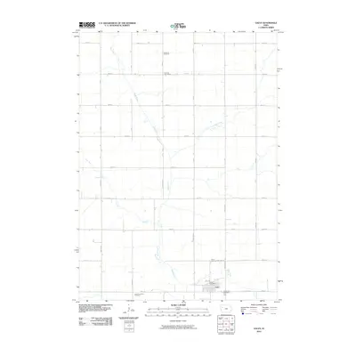
2010 Map of Galva
USGS Topo · Published 2010About this map
The town of Galva anchors the southeastern corner of this Ida County landscape, serving as a hub for the surrounding agricultural prairie. The township is characterized by a precise grid of section-line roads, including E County Rd and numerous numbered avenues and streets, which define the late 20th and early 21st-century rural layout. Waterways such as the Maple River and the Little Maple River meander through the fields, creating natural breaks in the geometric farm plots. Local history is deeply etched into the land through its burial grounds, with the Diamond Cemetery in the north and a cluster of sites near the town center, including the Galva City Cemetery, Galva Township Cemetery, and Galva Lutheran Cemetery. The presence of the Coulson Post Office label in the northern section points to a specific point of local interest along 630th St, while the Galva Post Office remains central to the town's operations.
Find a feature on this map
37 named features on this map. Tap any name to fly to it.
Don’t see what you’re looking for? This feature index may not catch every label — zoom into the map to look around manually.
Map Details
Editions of this 2010 Galva Map
This is the sole edition of this map. No revisions or reprints were ever made.
Other maps of this area

1954 · Fort Dodge
USGS Topo · 1:250,000

1957 · Fort Dodge
USGS Topo · 1:250,000

1958 · Fort Dodge
USGS Topo · 1:250,000

1967 · Holstein
USGS Topo · 1:24,000

1967 · Ida Grove NW
USGS Topo · 1:24,000

1969 · Aurelia
USGS Topo · 1:24,000

1969 · Cherokee South
USGS Topo · 1:24,000

1969 · Galva
USGS Topo · 1:24,000

1969 · Quimby SE
USGS Topo · 1:24,000

1979 · Alta
USGS Topo · 1:24,000