
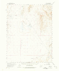
1960 Map of Gandy
USGS Topo · Published 1962About this map
Snake Valley serves as the central corridor of this arid basin landscape, where water sources dictated the patterns of human presence. The small settlement of Gandy sits at the base of the Marble Wash, while to the northeast, the Smithville (Site) indicates a former community near the shores of Salt Marsh Lake. The reliance on local hydrology is evident through the concentration of names in the Bishop Springs Area, including Foote Reservoir and Twin Springs.
Find a feature on this map
27 named features on this map. Tap any name to fly to it.
Don’t see what you’re looking for? This feature index may not catch every label — zoom into the map to look around manually.
Map Details
Editions of this 1960 Gandy Map
2 editions found
Other maps of this area

1908 · Fish Springs
USGS Topo · 1:250,000

1910 · Fish Springs
USGS Topo · 1:250,000

1953 · Delta
USGS Topo · 1:250,000

1956 · Ely
USGS Topo · 1:250,000

1958 · Delta
USGS Topo · 1:250,000

1959 · Ely
USGS Topo · 1:250,000

1959 · Cowboy Pass
USGS Topo · 1:62,500

1960 · Granite Mountain
USGS Topo · 1:62,500

1960 · Conger Range
USGS Topo · 1:62,500

1960 · Conger Mountain
USGS Topo · 1:62,500