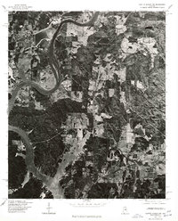
1975 Map of Gantts Quarry NW
USGS Topo · Published 1977About this map
Coosa River dominates this mid-1970s orthophotoquad, winding through the western portion of the terrain as it feeds into the expansive waters of Lay Lake. The imagery, captured in 1975, provides a literal overhead perspective of the rural landscape near the settlement of Wilsonville. Unlike traditional topographic maps, this orthophotograph reveals the actual density of forest cover and the precise patterns of agricultural clearing across the Alabama countryside. The sharp contrast between the dark, wooded ridges and the pale, open fields illustrates the land-use patterns of the era, while the intricate shoreline of the lake highlights the impact of the river's impoundment on the local geography. This visual record is particularly valuable for documenting property boundaries and environmental features as they existed before further modern development.
Find a feature on this map
3 named features on this map. Tap any name to fly to it.
Don’t see what you’re looking for? This feature index may not catch every label — zoom into the map to look around manually.
Map Details
Editions of this 1975 Gantts Quarry NW Map
This is the sole edition of this map. No revisions or reprints were ever made.
Other maps of this area

1890 · Bessemer
USGS Topo · 1:125,000

1890 · Talladega
USGS Topo · 1:125,000

1892 · Talladega
USGS Topo · 1:125,000

1892 · Bessemer
USGS Topo · 1:125,000

1906 · Vandiver
USGS Topo · 1:62,500

1908 · Vandiver
USGS Topo · 1:62,500

1909 · Columbiana
USGS Topo · 1:62,500

1911 · Columbiana
USGS Topo · 1:62,500

1915 · Gantts Quarry
USGS Topo · 1:48,000

1917 · Gantts Quarry
USGS Topo · 1:62,500