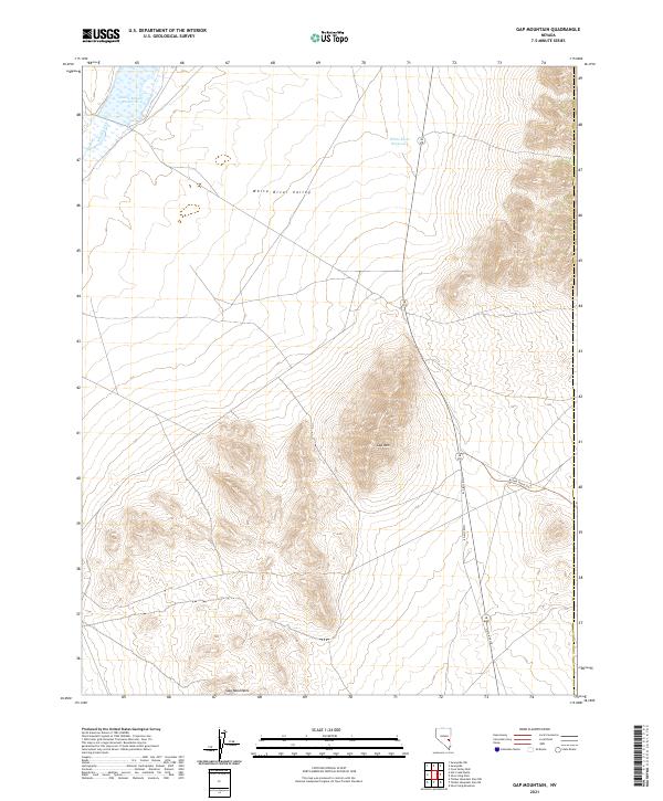
2021 Map of Gap Mountain
USGS Topo · Published 2021About this map
White River Valley serves as a vital corridor through this arid high-desert landscape in northern Nye County. The water management system is the primary human imprint on the land, anchored by the Adams-McGill Reservoir in the north and the White River Reservoir further downstream. These features, along with the seasonal flow of the White River, define the agricultural and ranching potential of the valley floor. To the east, the terrain rises sharply into the Gap Mountains, dominated by the central peak of Gap Mtn. Transportation is limited to the north-south artery of State Hwy 318 and the Access Route Trl, which provides rugged access into the eastern highlands. The map illustrates a remote Great Basin environment where settlement is sparse and life is dictated by the availability of water and the passage through mountain gaps.
Find a feature on this map
13 named features on this map. Tap any name to fly to it.
Don’t see what you’re looking for? This feature index may not catch every label — zoom into the map to look around manually.
Map Details
Editions of this 2021 Gap Mountain Map
This is the sole edition of this map. No revisions or reprints were ever made.
Other maps of this area

1956 · Lund
USGS Topo · 1:250,000

1960 · Lund
USGS Topo · 1:250,000

1969 · Gap Mountain
USGS Topo · 1:24,000

1969 · Sunnyside
USGS Topo · 1:24,000

1969 · Hot Creek Butte
USGS Topo · 1:24,000

1969 · Sunnyside NW
USGS Topo · 1:24,000
1971 · Timber Mtn Pass NW
USGS Topo · 1:24,000
1971 · Timber Mtn Pass NE
USGS Topo · 1:24,000

1971 · Cave Valley Well
USGS Topo · 1:24,000

1971 · Silver King Mtn
USGS Topo · 1:24,000