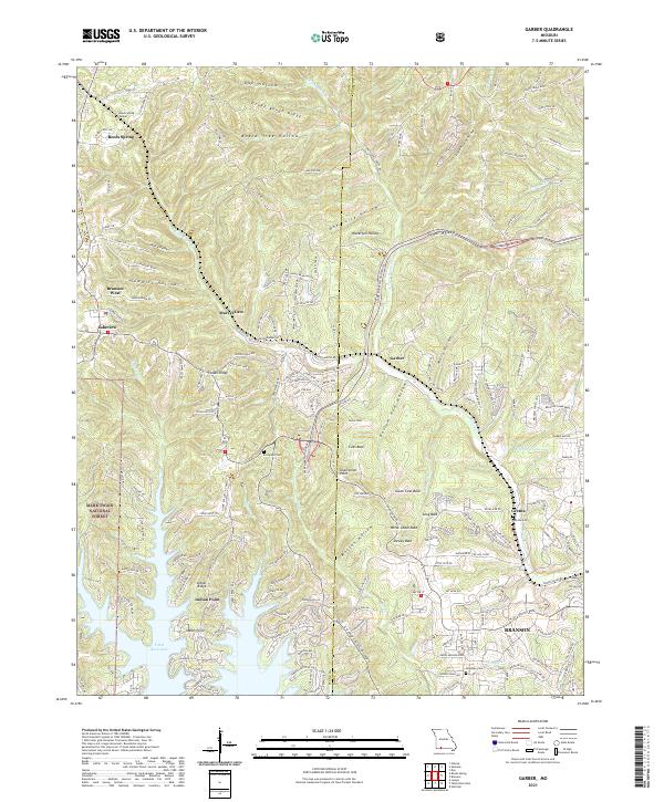
2021 Map of Garber
USGS Topo · Published 2021About this map
Marvel Cave and the high ridges above the northern reach of Table Rock Lake anchor this 2021 landscape near the border of Stone and Taney Counties. The terrain is defined by a series of bald summits, including Garber Bald, Coxs Bald, and Dewey Bald, which overlook deep hollows like Mutton Hollow and Possum Haw Hollow. These limestone-rich uplands have long been central to the area's identity, evidenced by Inspiration Point and the transition from the Mark Twain National Forest into the developing corridors of Branson West and Branson.
Find a feature on this map
168 named features on this map. Tap any name to fly to it.
Don’t see what you’re looking for? This feature index may not catch every label — zoom into the map to look around manually.
Map Details
Editions of this 2021 Garber Map
This is the sole edition of this map. No revisions or reprints were ever made.
Other maps of this area

1907 · Forsyth
USGS Topo · 1:125,000

1945 · Harrison
USGS Topo · 1:250,000

1949 · Harrison
USGS Topo · 1:250,000

1950 · Garber
USGS Topo · 1:24,000

1954 · Harrison
USGS Topo · 1:250,000

1955 · Day
USGS Topo · 1:24,000

1956 · Lampe
USGS Topo · 1:24,000

1956 · Table Rock Dam
USGS Topo · 1:24,000

1956 · Garber
USGS Topo · 1:24,000
1956 · Spokane
USGS Topo · 1:24,000