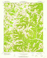
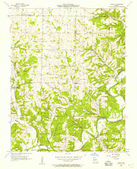
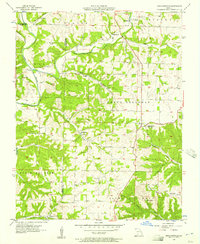
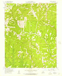
1956 Map of Spokane
USGS Topo · Published 1957About this map
Ponce de Leon and Spokane anchor this mid-century survey of the Ozark highlands where Christian, Stone, and Taney Counties meet. The landscape is defined by the winding drainages of East Prong Goff Creek and Hurricane Creek, carving through ridges like Chestnut Ridge. Local social centers are well-represented, from the Eisenhour Ch and Keystone Ch to the Drive-in Theater located near the intersection of modern-day highways. Geologic interest centers on Old Spanish Cave, while the southern reaches show the early development of Stults near Stults Dam. The map provides a look at the rural Missouri road network before significant modernization, showing numerous family-named landmarks such as Schupbach Cem and Seaton Cem that remain vital for genealogical research in these hills.
Find a feature on this map
38 named features on this map. Tap any name to fly to it.
Don’t see what you’re looking for? This feature index may not catch every label — zoom into the map to look around manually.
Map Details
Editions of this 1956 Spokane Map
2 editions found
Other maps of this area

1907 · Forsyth
USGS Topo · 1:125,000

1945 · Harrison
USGS Topo · 1:250,000

1949 · Harrison
USGS Topo · 1:250,000

1950 · Garber
USGS Topo · 1:24,000

1954 · Harrison
USGS Topo · 1:250,000
1955 · Selmore
USGS Topo · 1:24,000
1955 · Day
USGS Topo · 1:24,000
1955 · Hurley
USGS Topo · 1:24,000
1955 · Highlandville
USGS Topo · 1:24,000
1956 · Garber
USGS Topo · 1:24,000