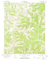
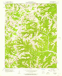
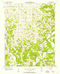
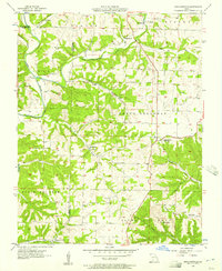
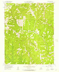
1956 Map of Spokane
USGS Topo · Published 1977About this map
Ponce de Leon and Spokane anchor this mid-century survey of the Ozark highlands, where the boundaries of Stone, Christian, and Taney counties converge. The landscape is defined by the high crest of Chestnut Ridge and a complex drainage system including Bear Creek and Hurricane Creek. Small rural communities like Abesville and Chestnutridge are connected by winding roads that follow the high ground between hollows such as Pignut Hollow. Local history is preserved in several family and community landmarks, including Stutts Cem and Schupbach Cem. Religious life is centered at Eisenhour Ch and Keystone Ch. Of particular interest is the Old Spanish Cave, a notable subterranean feature in the rugged terrain, while a Drive-in Theater reflects the mid-century social habits of the region's residents.
Find a feature on this map
33 named features on this map. Tap any name to fly to it.
Don’t see what you’re looking for? This feature index may not catch every label — zoom into the map to look around manually.
Map Details
Editions of this 1956 Spokane Map
2 editions found
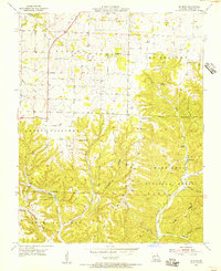
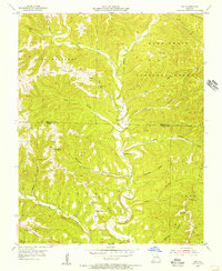
Other maps of this area

1907 · Forsyth
USGS Topo · 1:125,000

1945 · Harrison
USGS Topo · 1:250,000

1949 · Harrison
USGS Topo · 1:250,000

1950 · Garber
USGS Topo · 1:24,000

1954 · Harrison
USGS Topo · 1:250,000
1955 · Selmore
USGS Topo · 1:24,000
1955 · Day
USGS Topo · 1:24,000
1955 · Hurley
USGS Topo · 1:24,000
1955 · Highlandville
USGS Topo · 1:24,000
1956 · Garber
USGS Topo · 1:24,000