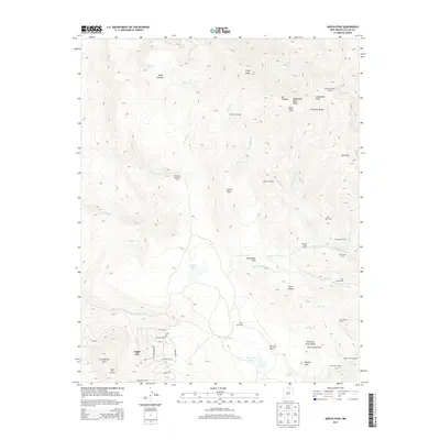
2013 Map of Garcia Peak
USGS Topo · Published 2013About this map
Philmont Scout Ranch dominates the eastern half of this high-altitude landscape, featuring a network of backcountry camps and trails such as Apache Springs Camp, Crooked Creek Camp, and Bear Canyon Camp. The topography is defined by the Cimarron Range, with significant elevations marked by Mt Phillips, Comanche Peak, and Garcia Peak. The contrast between the rugged wilderness of the Scout ranch and the developing recreational hub of Angel Fire is evident in the southwest, where the Angel Fire Ski Area and local residential streets like Crystal Mountain Rd are established.
Find a feature on this map
59 named features on this map. Tap any name to fly to it.
Don’t see what you’re looking for? This feature index may not catch every label — zoom into the map to look around manually.
Map Details
Editions of this 2013 Garcia Peak Map
This is the sole edition of this map. No revisions or reprints were ever made.
Other maps of this area

1954 · Raton
USGS Topo · 1:250,000

1955 · Ute Park
USGS Topo · 1:62,500

1956 · Tooth Of Time
USGS Topo · 1:62,500

1958 · Raton
USGS Topo · 1:250,000

1963 · Eagle Nest
USGS Topo · 1:24,000

1965 · Osha Mountain
USGS Topo · 1:24,000

1965 · Palo Flechado Pass
USGS Topo · 1:24,000

1982 · Wheeler Peak
USGS Topo · 1:100,000

1983 · Taos
USGS Topo · 1:100,000
1987 · Ute Park
USGS Topo · 1:24,000