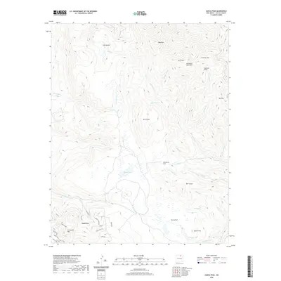
2020 Map of Garcia Peak
USGS Topo · Published 2020About this map
Angel Fire anchors the southwestern corner of this survey, where residential street grids like Mountain Park Way and Squaw Valley Ln meet the rising slopes of the Cimarron Range. The landscape is defined by high-elevation transition zones between the developed valley and the surrounding peaks, including Cieneguilla Mtn and Garcia Peak. To the north and east, the map traces an intricate network of alpine drainage systems, from the headwaters of Agua Fria Cr to the high meadows of Tolby Meadow.
Find a feature on this map
48 named features on this map. Tap any name to fly to it.
Don’t see what you’re looking for? This feature index may not catch every label — zoom into the map to look around manually.
Map Details
Editions of this 2020 Garcia Peak Map
This is the sole edition of this map. No revisions or reprints were ever made.
Other maps of this area

1954 · Raton
USGS Topo · 1:250,000

1955 · Ute Park
USGS Topo · 1:62,500

1956 · Tooth Of Time
USGS Topo · 1:62,500

1958 · Raton
USGS Topo · 1:250,000

1963 · Eagle Nest
USGS Topo · 1:24,000

1965 · Osha Mountain
USGS Topo · 1:24,000

1965 · Palo Flechado Pass
USGS Topo · 1:24,000

1982 · Wheeler Peak
USGS Topo · 1:100,000

1983 · Taos
USGS Topo · 1:100,000
1987 · Ute Park
USGS Topo · 1:24,000