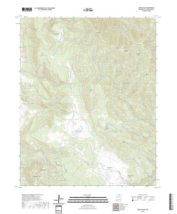
2023 Map of Garcia Peak
USGS Topo · Published 2023About this map
Angel Fire anchors the southwestern corner of this survey, where residential development and resort infrastructure like Ski Lift Dr and Mountain Park Way meet the high-altitude terrain of the Cimarron Range. The landscape is defined by a dense network of mountain peaks and watercourses, including Mount Phillips, Comanche Peak, and the prominent Garcia Peak. The drainage patterns are complex, with headwaters such as Tolby Creek and American Creek flowing from the high ridges toward open areas like Tolby Meadow.
Find a feature on this map
41 named features on this map. Tap any name to fly to it.
Don’t see what you’re looking for? This feature index may not catch every label — zoom into the map to look around manually.
Map Details
Editions of this 2023 Garcia Peak Map
This is the sole edition of this map. No revisions or reprints were ever made.
Other maps of this area

1954 · Raton
USGS Topo · 1:250,000

1955 · Ute Park
USGS Topo · 1:62,500

1956 · Tooth Of Time
USGS Topo · 1:62,500

1958 · Raton
USGS Topo · 1:250,000

1963 · Eagle Nest
USGS Topo · 1:24,000

1965 · Osha Mountain
USGS Topo · 1:24,000

1965 · Palo Flechado Pass
USGS Topo · 1:24,000

1982 · Wheeler Peak
USGS Topo · 1:100,000

1983 · Taos
USGS Topo · 1:100,000
1987 · Ute Park
USGS Topo · 1:24,000