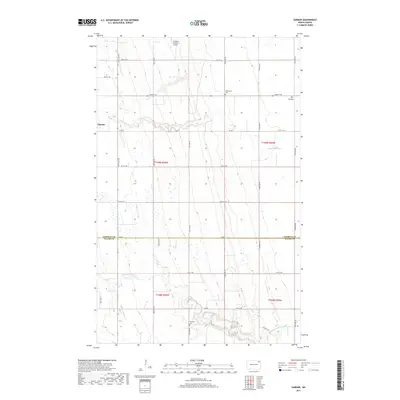
2017 Map of Gardar
USGS Topo · Published 2017About this map
Gardar sits in the corner of this prairie landscape, where the agricultural grid of northern North Dakota is broken by the winding courses of the N Br Park River and the Middle Br Park River. The terrain is characterized by the subtle drainage patterns of The Coulee and numerous small prairie potholes that dot the sections between the county roads. This 2017 survey shows the enduring organization of the land across the Pembina Co and Walsh Co line, marked by long-standing local landmarks like the Stokesville Cem and Lampton Cem. The presence of the Olafson Brothers Airport in the northern sections underscores the modern aviation needs of this expansive rural region, while the dense network of numbered roads like Co RD 7 and Co RD 1 highlights the continued importance of the township and range system in managing this productive agricultural frontier.
Find a feature on this map
21 named features on this map. Tap any name to fly to it.
Don’t see what you’re looking for? This feature index may not catch every label — zoom into the map to look around manually.
Map Details
Editions of this 2017 Gardar Map
This is the sole edition of this map. No revisions or reprints were ever made.
Other maps of this area
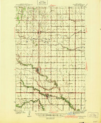
1944 · Crystal
USGS Topo · 1:62,500
1952 · Thief River Falls
USGS Topo · 1:250,000
1956 · Thief River Falls
USGS Topo · 1:250,000
1957 · Thief River Falls
USGS Topo · 1:250,000
1963 · Crystal
USGS Topo · 1:24,000
1963 · Edinburg
USGS Topo · 1:24,000
1963 · Gardar
USGS Topo · 1:24,000
1963 · Park River
USGS Topo · 1:24,000
1964 · Mountain
USGS Topo · 1:24,000
1964 · Hensel
USGS Topo · 1:24,000