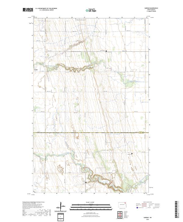
2024 Map of Gardar
USGS Topo · Published 2024About this map
The settlement of Gardar sits at the western edge of this prairie landscape, where the North Branch Park River carves a winding path through the Pembina and Walsh county line. This contemporary survey details a predominantly agricultural region defined by a precise grid of rural roads, including Co Rd 7 and Co Rd 1, which connect isolated homesteads and local landmarks. Genealogists and local historians will find significant value in the placement of several rural burial grounds, such as Stokesville Cem, Lampton Cem, and Hvideso Cem, which are scattered across the townships of T159N and T158N. The terrain is further marked by the Middle Branch Park River in the south and the Olafson Brothers Airport in the north, illustrating the long-standing aviation and water-resource infrastructure that supports this corner of North Dakota.
Find a feature on this map
21 named features on this map. Tap any name to fly to it.
Don’t see what you’re looking for? This feature index may not catch every label — zoom into the map to look around manually.
Map Details
Editions of this 2024 Gardar Map
This is the sole edition of this map. No revisions or reprints were ever made.
Other maps of this area

1944 · Crystal
USGS Topo · 1:62,500

1952 · Thief River Falls
USGS Topo · 1:250,000

1956 · Thief River Falls
USGS Topo · 1:250,000

1957 · Thief River Falls
USGS Topo · 1:250,000

1963 · Crystal
USGS Topo · 1:24,000

1963 · Edinburg
USGS Topo · 1:24,000

1963 · Gardar
USGS Topo · 1:24,000

1963 · Park River
USGS Topo · 1:24,000

1964 · Mountain
USGS Topo · 1:24,000
1964 · Hensel
USGS Topo · 1:24,000