
1963 Map of Gardar
USGS Topo · Published 1964About this map
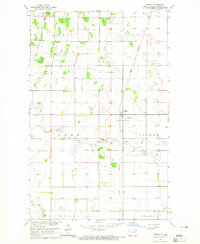
Gardar serves as the primary settlement in this early 1960s study of the Red River Valley upland, where the township boundaries of Gardar, Crystal, Lampton, and Dundee meet. The landscape is defined by the winding paths of the North Branch Park River and the Middle Branch Park River, which carve distinct drainage patterns across the prairie. The map provides specific locations for local heritage sites, including the Stokesville Cem and the Hvidsten Ch Cem, alongside numerous Gravel Pits that suggest the area's geological and industrial utility during this era. A significant administrative line, the Pembina Co Walsh Co boundary, bisects the lower half of the quadrangle, marking the transition between these two northeastern North Dakota jurisdictions.
Find a feature on this map
12 named features on this map. Tap any name to fly to it.
Don’t see what you’re looking for? This feature index may not catch every label — zoom into the map to look around manually.
Map Details
Editions of this 1963 Gardar Map
This is the sole edition of this map. No revisions or reprints were ever made.
Other maps of this area

1944 · Crystal
USGS Topo · 1:62,500

1952 · Thief River Falls
USGS Topo · 1:250,000

1956 · Thief River Falls
USGS Topo · 1:250,000

1957 · Thief River Falls
USGS Topo · 1:250,000

1963 · Crystal
USGS Topo · 1:24,000

1963 · Edinburg
USGS Topo · 1:24,000

1963 · Park River
USGS Topo · 1:24,000

1964 · Mountain
USGS Topo · 1:24,000
1964 · Hensel
USGS Topo · 1:24,000
1964 · Concrete
USGS Topo · 1:24,000