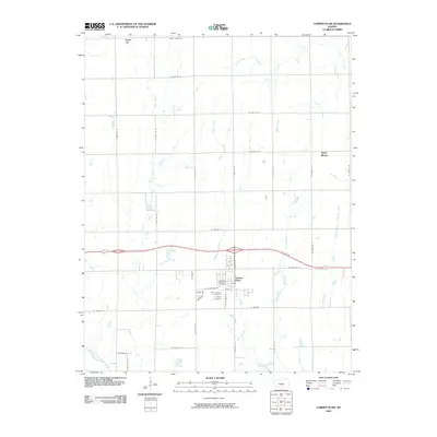
2009 Map of Garden Plain
USGS Topo · Published 2009About this map
Garden Plain serves as the primary hub of this Western Sedgwick County landscape, established at the intersection of US Hwy 54 and N Main St. The settlement's institutional core is clearly defined by the Garden Plain Post Office and nearby religious sites including Saint Anthony Cemetery and Calvary Cemetery. Smaller community nodes like Saint Joe in the north and Saint Marys in the east reflect the dispersed rural settlement patterns typical of the Kansas plains.
Find a feature on this map
45 named features on this map. Tap any name to fly to it.
Don’t see what you’re looking for? This feature index may not catch every label — zoom into the map to look around manually.
Map Details
Editions of this 2009 Garden Plain Map
This is the sole edition of this map. No revisions or reprints were ever made.
Other maps of this area

1889 · Cheney
USGS Topo · 1:125,000

1891 · Cheney
USGS Topo · 1:125,000

1901 · Cheney
USGS Topo · 1:125,000

1955 · Wichita
USGS Topo · 1:250,000

1958 · Wichita
USGS Topo · 1:250,000
1958 · Colwich
USGS Topo · 1:24,000

1959 · Mount Hope
USGS Topo · 1:24,000

1964 · Cheney
USGS Topo · 1:24,000

1965 · Garden Plain
USGS Topo · 1:24,000

1965 · Cheney SE
USGS Topo · 1:24,000