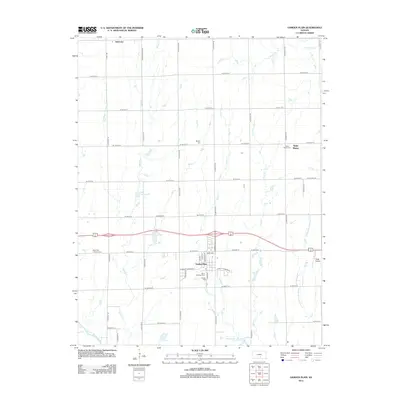
2012 Map of Garden Plain
USGS Topo · Published 2012About this map
Garden Plain serves as the central hub of this Kansas landscape, reflecting a well-organized grid of rural roads and residential development. The town's historical and communal identity is anchored by several religious and memorial sites, including the Saint Anthony Cem and Calvary Cem near the town center, and the Saint Paul Lutheran Cem further west. This 2012 survey illustrates how the drainage patterns of Spring Cr, Sand Cr, and Polecat Cr intersect with the rigid section-line road network, such as W 21st St N and S 311th St W. To the east, the settlement of Saint Marys and its associated Saint Marys Cem suggest a history of localized township growth. Unique landmarks like Yoder Airpark and the impounded waters of Lake Forty-eight highlight how the modern prairie landscape has been adapted for recreation and small-scale aviation.
Find a feature on this map
56 named features on this map. Tap any name to fly to it.
Don’t see what you’re looking for? This feature index may not catch every label — zoom into the map to look around manually.
Map Details
Editions of this 2012 Garden Plain Map
This is the sole edition of this map. No revisions or reprints were ever made.
Other maps of this area

1889 · Cheney
USGS Topo · 1:125,000

1891 · Cheney
USGS Topo · 1:125,000

1901 · Cheney
USGS Topo · 1:125,000

1955 · Wichita
USGS Topo · 1:250,000

1958 · Wichita
USGS Topo · 1:250,000
1958 · Colwich
USGS Topo · 1:24,000

1959 · Mount Hope
USGS Topo · 1:24,000

1964 · Cheney
USGS Topo · 1:24,000

1965 · Garden Plain
USGS Topo · 1:24,000

1965 · Cheney SE
USGS Topo · 1:24,000