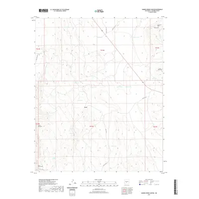
2020 Map of Garden Spring Canyon
USGS Topo · Published 2020About this map
The settlement of Coane sits at the heart of this high-desert landscape in Socorro County, where life is dictated by the availability of water. The terrain is defined by dramatic elevations, from the Oscura Mountains and North Oscura Peak in the southwest to the broad Chupadera Mesa in the northeast. This 2020 survey reveals an extensive network of water management features essential for ranching and survival in the arid environment, including namesake Garden Spring and numerous family-named catchments such as Hefner Tank and Lonnie Moon Tank.
Find a feature on this map
35 named features on this map. Tap any name to fly to it.
Don’t see what you’re looking for? This feature index may not catch every label — zoom into the map to look around manually.
Map Details
Editions of this 2020 Garden Spring Canyon Map
This is the sole edition of this map. No revisions or reprints were ever made.
Other maps of this area

1918 · Oscura Peak
USGS Topo · 1:125,000

1948 · Broken Back Crater
USGS Topo · 1:62,500

1948 · Bingham
USGS Topo · 1:62,500

1948 · Chihuahua Ranch
USGS Topo · 1:62,500

1948 · Mockingbird Gap
USGS Topo · 1:62,500

1954 · Tularosa
USGS Topo · 1:250,000

1958 · Tularosa
USGS Topo · 1:250,000
1981 · Cooper Canyon
USGS Topo · 1:24,000
1981 · Trinity Site
USGS Topo · 1:24,000
1981 · Wrye Peak NW
USGS Topo · 1:24,000