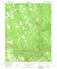
1949 Map of Garden Valley
USGS Topo · Published 1968About this map
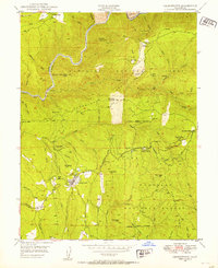
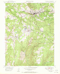
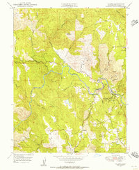
South Fork American River carves a deep path through the southern reaches of this landscape, defining a region of steep canyons and timbered ridges within the Eldorado National Forest. The late 1940s topography reveals a territory still shaped by its mineral wealth, with historical workings like Taylor Mine, Black Oak Mine, and Alhambra Mine dotting the hillsides near Garden Valley. This settlement, along with Kelsey and the small station at Chili Bar, serves as the primary hub for a community rooted in the drainage basins of Manhattan Creek and Johntown Creek. Local infrastructure is marked by several rural education centers, including Garden Valley Sch and Union School, while the presence of the American River Powerhouse and a complex flume system reflects the industrial management of the local waterways during this post-war era.
Find a feature on this map
49 named features on this map. Tap any name to fly to it.
Don’t see what you’re looking for? This feature index may not catch every label — zoom into the map to look around manually.
Map Details
Editions of this 1949 Garden Valley Map
4 editions found
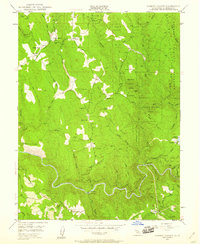
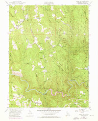

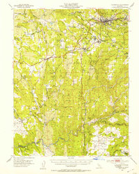
Other maps of this area

1891 · Placerville
USGS Topo · 1:125,000

1892 · Placerville
USGS Topo · 1:125,000

1893 · Placerville
USGS Topo · 1:125,000

1947 · Sacramento
USGS Topo · 1:250,000

1948 · Sacramento
USGS Topo · 1:250,000

1949 · Georgetown
USGS Topo · 1:62,500
1949 · Placerville
USGS Topo · 1:62,500
1949 · Georgetown
USGS Topo · 1:24,000
1949 · Placerville
USGS Topo · 1:24,000
1949 · Coloma
USGS Topo · 1:24,000