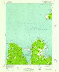
1956 Map of Gardiners Island West
USGS Topo · Published 1957About this map
Gardiners Island anchors the eastern edge of this coastal survey, where maritime history is preserved in labels like the Captain Kidd Monument and Captain Kidd Hollow. Across the waters of Gardiners Bay, the East Hampton mainland features a dense network of harbor-facing landings and early summer camps. The landscape is deeply carved by Threemile Harbor and Northwest Harbor, with the latter being fed by the winding Alewife Brook.
Find a feature on this map
75 named features on this map. Tap any name to fly to it.
Don’t see what you’re looking for? This feature index may not catch every label — zoom into the map to look around manually.
Map Details
Editions of this 1956 Gardiners Island West Map
3 editions found
Other maps of this area

1903 · Sag Harbor
USGS Topo · 1:62,500

1903 · Gardiners Island
USGS Topo · 1:62,500

1904 · Sag Harbor
USGS Topo · 1:62,500

1904 · Shelter Island
USGS Topo · 1:62,500

1904 · Easthampton
USGS Topo · 1:62,500

1904 · Gardiners Island
USGS Topo · 1:62,500

1921 · Gardiners Island
USGS Topo · 1:62,500

1921 · Easthampton
USGS Topo · 1:62,500

1943 · Gardiners Island East
USGS Topo · 1:24,000

1944 · Gardiners Island West
USGS Topo · 1:24,000
Featured Places
- East Hampton, NY
- Southold, NY
- Springs, East Hampton
- Northwest Harbor, East Hampton
- Amagansett, East Hampton