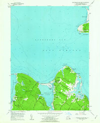
1956 Map of Gardiners Island West
USGS Topo · Published 1963About this map
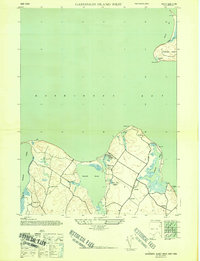
Gardiners Island and the coastal reaches of East Hampton define this mid-century survey, showcasing a landscape shaped by maritime tradition and summer recreation. The shoreline is punctuated by sheltered waters like Three Mile Harbor and Acabonack Harbor, where landings such as Lafarges Landing and Hands Creek Landing provided access to the sea. The interior reveals a network of old roads like Acabonack Road and Old House Landing Road, connecting the hamlet of Springs to outlying areas. On the southwestern tip of Gardiners Island, the Captain Kidd Monument stands near Captain Kidd Pond, referencing the area's legendary history. The map also documents the social fabric of the 1950s, recording numerous seasonal sites including the Fireplace Lodge Girls Camp, Blue Bay Girl Scout Camp, and Boys Harbor Summer Camp. Notable local landmarks such as Our Lady of the Wayside Chapel and the Green River Cem offer significant points of interest for genealogists tracing families in this corner of Suffolk County.
Find a feature on this map
77 named features on this map. Tap any name to fly to it.
Don’t see what you’re looking for? This feature index may not catch every label — zoom into the map to look around manually.
Map Details
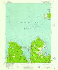
Editions of this 1956 Gardiners Island West Map
3 editions found

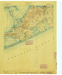
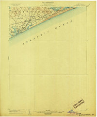
Other maps of this area

1903 · Sag Harbor
USGS Topo · 1:62,500

1903 · Gardiners Island
USGS Topo · 1:62,500
1904 · Sag Harbor
USGS Topo · 1:62,500

1904 · Shelter Island
USGS Topo · 1:62,500
1904 · Easthampton
USGS Topo · 1:62,500

1904 · Gardiners Island
USGS Topo · 1:62,500

1921 · Gardiners Island
USGS Topo · 1:62,500

1921 · Easthampton
USGS Topo · 1:62,500

1943 · Gardiners Island East
USGS Topo · 1:24,000
1944 · Gardiners Island West
USGS Topo · 1:24,000
Featured Places
- East Hampton, NY
- Southold, NY
- Springs, East Hampton
- Northwest Harbor, East Hampton
- Amagansett, East Hampton