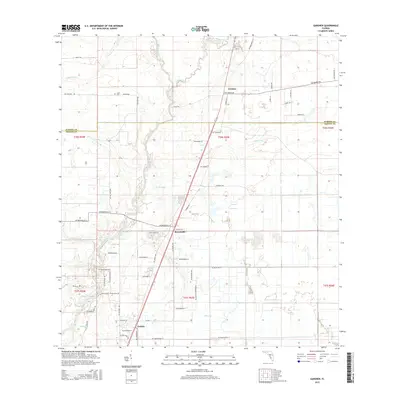
2015 Map of Gardner
USGS Topo · Published 2015About this map
The Peace River meanders through the heart of this landscape, defining the transition between Hardee and DeSoto Counties. This 2015 survey details the small rural settlements of Gardner, Brownville, and Cubitis, which are connected by a network of local roads including River Rd and Fish Branch Rd. The terrain is marked by numerous drainage features, such as Charlie Cr, Limestone Cr, and Sand Gully, reflecting the low-lying, hydrologically active nature of central Florida. Genealogists and local historians can locate the Coker Cem near the northern boundary, while the proliferation of named branches like Bear Br and Mare Br underscores the importance of water management in this agricultural and pastoral region. The proximity of NW Scout Ave and Tram Line Rd hints at the historic transport infrastructure used for the local citrus and ranching economies.
Find a feature on this map
54 named features on this map. Tap any name to fly to it.
Don’t see what you’re looking for? This feature index may not catch every label — zoom into the map to look around manually.
Map Details
Editions of this 2015 Gardner Map
This is the sole edition of this map. No revisions or reprints were ever made.
Other maps of this area

1956 · Gardner
USGS Topo · 1:24,000

1956 · Ona
USGS Topo · 1:24,000

1956 · Sweetwater
USGS Topo · 1:24,000

1956 · Limestone
USGS Topo · 1:24,000

1956 · Zolfo Springs
USGS Topo · 1:24,000

1956 · Nocatee
USGS Topo · 1:24,000

1956 · Crewsville SW
USGS Topo · 1:24,000

1956 · Fort Pierce
USGS Topo · 1:250,000

1957 · Long Island Marsh NW
USGS Topo · 1:24,000

1957 · Arcadia
USGS Topo · 1:24,000