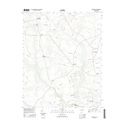
2016 Map of Gardnerville
USGS Topo · Published 2016About this map
Swift Creek and its complex of surrounding wetlands define the low-lying geography of this North Carolina landscape near the Pitt and Craven county line. The map reveals a dense network of rural crossroads and family settlements, such as Haddocks Crossroads, Helens Crossroads, and Stokestown, connected by local routes like Emma Cannon Rd and Gardnerville Rd. The terrain is marked by numerous swampy drainages including Clayroot Swamp, Indian Well Swamp, and Fork Swamp, illustrating the hydrological challenges and the drainage engineering of the Shiloh Canal. This 2016 survey documents the enduring agricultural and residential patterns of the region, from the South Oaks Aerodrome in the north down to Clayroot and Gardnerville in the south, preserving the names of local landmarks like Shelmerdine and Venters that anchor this coastal plain community.
Find a feature on this map
59 named features on this map. Tap any name to fly to it.
Don’t see what you’re looking for? This feature index may not catch every label — zoom into the map to look around manually.
Map Details
Editions of this 2016 Gardnerville Map
This is the sole edition of this map. No revisions or reprints were ever made.
Other maps of this area

1902 · Ayden
USGS Topo · 1:62,500

1902 · Vanceboro
USGS Topo · 1:62,500

1903 · Winterville
USGS Topo · 1:62,500

1903 · Chocowinity
USGS Topo · 1:62,500

1904 · Ayden
USGS Topo · 1:62,500

1904 · Vanceboro
USGS Topo · 1:62,500

1905 · Chocowinity
USGS Topo · 1:62,500

1905 · Winterville
USGS Topo · 1:62,500

1905 · Vanceboro
USGS Topo · 1:62,500

1953 · Rocky Mount
USGS Topo · 1:250,000