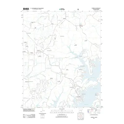
2012 Map of Garfield
USGS Topo · Published 2012About this map
Beaver Lake dominates the eastern half of this terrain, its convoluted shoreline creating numerous peninsulas and sheltered coves such as Fishtrap Hollow and Horn Hollow. This 2012 survey illustrates the modern residential development associated with the reservoir, notably at Lost Bridge Village and Vista Shores. To the west, the landscape rises into a series of named peaks and ridges, including Gentry Mountain, Rich Mountain, and the curiously named Devils Eye Brow. The settlement of Garfield sits at a crossroads in the central plateau, while the northern edge marks the boundary near Gateway where the Missouri-Arkansas line is defined by Stateline Rd. Local history is anchored by several burial grounds, such as Walnut Hill Cemetery and Bayless Cemetery, which remain as markers of the area's rural heritage amidst the evolving lakeside geography.
Find a feature on this map
156 named features on this map. Tap any name to fly to it.
Don’t see what you’re looking for? This feature index may not catch every label — zoom into the map to look around manually.
Map Details
Editions of this 2012 Garfield Map
This is the sole edition of this map. No revisions or reprints were ever made.
Other maps of this area

1899 · Fayetteville
USGS Topo · 1:125,000

1900 · Eureka Springs
USGS Topo · 1:125,000

1901 · Eureka Springs
USGS Topo · 1:125,000

1901 · Fayetteville
USGS Topo · 1:125,000

1904 · Fayetteville
USGS Topo · 1:125,000

1937 · Cassville
USGS Topo · 1:48,000

1941 · Rocky Comfort
USGS Topo · 1:62,500

1943 · Rocky Comfort
USGS Topo · 1:62,500

1944 · Cassville
USGS Topo · 1:62,500

1945 · Harrison
USGS Topo · 1:250,000