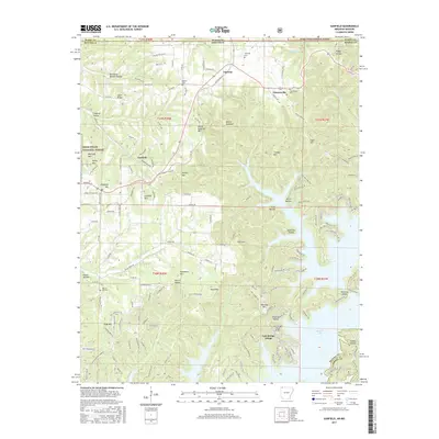
2017 Map of Garfield
USGS Topo · Published 2017About this map
Beaver Lake dominates the southeastern quadrant of this terrain, its convoluted shoreline creating deep inlets such as Hoot Owl Hollow and Fishtrap Hollow. On the higher ground above the water, the planned community of Lost Bridge Village and the Lost Bridge Village Airport represent modern development near the Benton County and Carroll County line. Further north, the landscape transitions into the wooded ridges of the Mark Twain National Forest, where named summits like Devils Eyebrow Mtn and Glasscock Mtn rise above the drainage of Beaver Creek. Small historic centers including Garfield, Gateway, and Clantonville are situated along the primary road corridors. Genealogists can identify several local burial sites, including Walnut Hill Cem and Clantonville Cem, which anchor the rural communities of this Ozark borderland between Arkansas and Missouri.
Find a feature on this map
171 named features on this map. Tap any name to fly to it.
Don’t see what you’re looking for? This feature index may not catch every label — zoom into the map to look around manually.
Map Details
Editions of this 2017 Garfield Map
This is the sole edition of this map. No revisions or reprints were ever made.
Other maps of this area

1899 · Fayetteville
USGS Topo · 1:125,000

1900 · Eureka Springs
USGS Topo · 1:125,000

1901 · Eureka Springs
USGS Topo · 1:125,000

1901 · Fayetteville
USGS Topo · 1:125,000

1904 · Fayetteville
USGS Topo · 1:125,000

1937 · Cassville
USGS Topo · 1:48,000

1941 · Rocky Comfort
USGS Topo · 1:62,500

1943 · Rocky Comfort
USGS Topo · 1:62,500

1944 · Cassville
USGS Topo · 1:62,500

1945 · Harrison
USGS Topo · 1:250,000