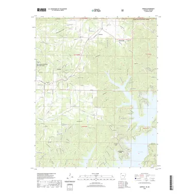
2020 Map of Garfield
USGS Topo · Published 2020About this map
Pea Ridge National Military Park occupies the western edge of this terrain, marking the significance of the Ozark highlands in local history. The landscape transitions from the high ridges of Gentry Mtn and Garfield Mtn down to the extensive shoreline of Beaver Lake. This modern survey reveals a patchwork of established communities like Garfield and Gateway alongside recreational developments such as Lost Bridge Village, which is served by its own Lost Bridge Village Airport. The topographic detail illustrates the complex drainage systems of Little Sugar Creek and Spider Creek as they carve through the limestone hollows. On the northern border, the Mark Twain National Forest extends across the state line into Missouri, while historical sites like the Walnut Hill Cem provide points of interest for genealogists tracing family roots in Benton County.
Find a feature on this map
158 named features on this map. Tap any name to fly to it.
Don’t see what you’re looking for? This feature index may not catch every label — zoom into the map to look around manually.
Map Details
Editions of this 2020 Garfield Map
This is the sole edition of this map. No revisions or reprints were ever made.
Other maps of this area

1899 · Fayetteville
USGS Topo · 1:125,000

1900 · Eureka Springs
USGS Topo · 1:125,000

1901 · Eureka Springs
USGS Topo · 1:125,000

1901 · Fayetteville
USGS Topo · 1:125,000

1904 · Fayetteville
USGS Topo · 1:125,000

1937 · Cassville
USGS Topo · 1:48,000

1941 · Rocky Comfort
USGS Topo · 1:62,500

1943 · Rocky Comfort
USGS Topo · 1:62,500

1944 · Cassville
USGS Topo · 1:62,500

1945 · Harrison
USGS Topo · 1:250,000