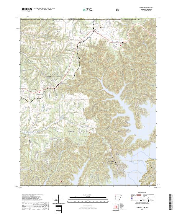
2024 Map of Garfield
USGS Topo · Published 2024About this map
Garfield and the neighboring settlements of Gateway and Clantonville anchor this survey of Benton County near the Missouri state line. The landscape is defined by the winding reaches of Beaver Lake, which floods the deep hollows and creek beds in the southeast, including Spider Creek and Beaver Creek. The map shows a transition from the structured preservation of Pea Ridge National Military Park in the west to the deeply dissected terrain of the Ozarks, where numerous family-named peaks like Gentry Mtn and Glasscock Mtn rise above intricate drainage systems. Genealogists will find several small burial grounds across the area, such as Walnut Hill Cem and Bayless Cem, many situated along older routes like Old Highway Rd. The inclusion of the Lost Bridge Village Airport and various residential developments near the lakeshore illustrates the modern evolution of this region from its traditional forest and mountain character.
Find a feature on this map
51 named features on this map. Tap any name to fly to it.
Don’t see what you’re looking for? This feature index may not catch every label — zoom into the map to look around manually.
Map Details
Editions of this 2024 Garfield Map
This is the sole edition of this map. No revisions or reprints were ever made.
Other maps of this area

1899 · Fayetteville
USGS Topo · 1:125,000

1900 · Eureka Springs
USGS Topo · 1:125,000

1901 · Eureka Springs
USGS Topo · 1:125,000

1901 · Fayetteville
USGS Topo · 1:125,000

1904 · Fayetteville
USGS Topo · 1:125,000

1937 · Cassville
USGS Topo · 1:48,000

1941 · Rocky Comfort
USGS Topo · 1:62,500

1943 · Rocky Comfort
USGS Topo · 1:62,500

1944 · Cassville
USGS Topo · 1:62,500

1945 · Harrison
USGS Topo · 1:250,000