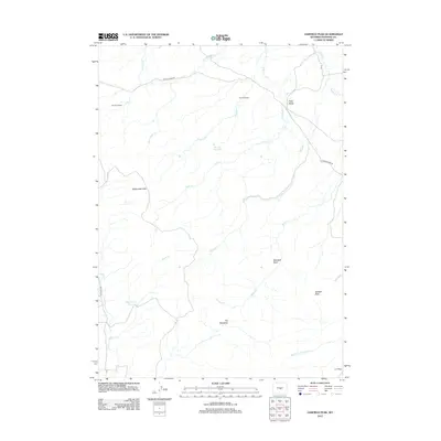
2012 Map of Garfield Peak
USGS Topo · Published 2012About this map
Garfield Peak anchors this corner of Natrona County, rising above a landscape defined by ranching operations and isolated water sources. Ranch life is represented by Jameson Ranch and Sixmile Ranch, connected by the winding Poison Spider Rd and other local tracks like Cord and Dry Creek Rd. The drainage network is complex, with Wallace Cr, Fales Cr, and Murphy Cr carving through the terrain towards the Middle Fork Casper Cr.
Find a feature on this map
22 named features on this map. Tap any name to fly to it.
Don’t see what you’re looking for? This feature index may not catch every label — zoom into the map to look around manually.
Map Details
Editions of this 2012 Garfield Peak Map
This is the sole edition of this map. No revisions or reprints were ever made.
Other maps of this area

1952 · Ervay Basin SW
USGS Topo · 1:24,000

1952 · Ervay Basin
USGS Topo · 1:24,000

1955 · Casper
USGS Topo · 1:250,000

1958 · Casper
USGS Topo · 1:250,000

1959 · Broad Mesa
USGS Topo · 1:24,000
1959 · Mc Rae Gap
USGS Topo · 1:24,000
1959 · Stinking Water Creek
USGS Topo · 1:24,000

1959 · Saddle Rock
USGS Topo · 1:24,000

1959 · Blackjack Ranch
USGS Topo · 1:24,000

1959 · Barlow Gap
USGS Topo · 1:24,000