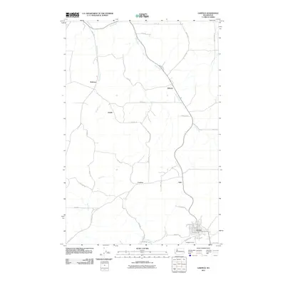
2011 Map of Garfield
USGS Topo · Published 2011About this map
Garfield serves as the primary hub in this corner of Whitman County, anchored by a grid of residential streets including W Main St and W Spokane St near the banks of Silver Creek. The surrounding Palouse landscape is defined by a network of rural settlements and family-named roads that suggest a deeply rooted agricultural community. Small clusters at Belmont, Crabtree, and Eden mark the path of local travel, while the Garfield Cemetery sits just south of the main town site, providing a focal point for genealogical interest.
Find a feature on this map
41 named features on this map. Tap any name to fly to it.
Don’t see what you’re looking for? This feature index may not catch every label — zoom into the map to look around manually.
Map Details
Editions of this 2011 Garfield Map
This is the sole edition of this map. No revisions or reprints were ever made.
Other maps of this area
1903 · Oakesdale
USGS Topo · 1:125,000
1905 · Oakesdale
USGS Topo · 1:125,000
1910 · Pullman
USGS Topo · 1:125,000
1955 · Pullman
USGS Topo · 1:250,000
1955 · Spokane
USGS Topo · 1:250,000
1958 · Spokane
USGS Topo · 1:250,000
1958 · Pullman
USGS Topo · 1:250,000
1964 · Oakesdale
USGS Topo · 1:24,000
1964 · Elberton
USGS Topo · 1:24,000
1964 · Colfax North
USGS Topo · 1:24,000