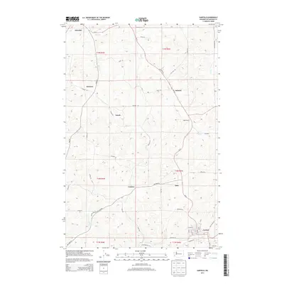
2014 Map of Garfield
USGS Topo · Published 2014About this map
Garfield and Oakesdale anchor this corner of Whitman County, illustrating a landscape defined by the drainage networks of the Palouse. The map traces the winding paths of Spring Cr and Kelley Cr as they cut through the agricultural highlands. Small named clusters like Belmont, Robinson, and Sokulk appear alongside a dense grid of rural roads, including Huggins Rd and Peringer Rd, which connect isolated homesteads to the larger rail and road corridors. The presence of settlements like Crabtree and Eden provides a look at the dispersed population centers typical of eastern Washington's wheat-growing regions. Modern infrastructure is represented by Wa-27, which serves as a primary north-south artery through the hills, while numerous family-named routes such as Auvil Wagner Rd and Pfaff Rd reflect the deep-rooted land ownership patterns of the area.
Find a feature on this map
59 named features on this map. Tap any name to fly to it.
Don’t see what you’re looking for? This feature index may not catch every label — zoom into the map to look around manually.
Map Details
Editions of this 2014 Garfield Map
This is the sole edition of this map. No revisions or reprints were ever made.
Other maps of this area

1903 · Oakesdale
USGS Topo · 1:125,000

1905 · Oakesdale
USGS Topo · 1:125,000

1910 · Pullman
USGS Topo · 1:125,000

1955 · Pullman
USGS Topo · 1:250,000

1955 · Spokane
USGS Topo · 1:250,000

1958 · Spokane
USGS Topo · 1:250,000

1958 · Pullman
USGS Topo · 1:250,000

1964 · Oakesdale
USGS Topo · 1:24,000

1964 · Elberton
USGS Topo · 1:24,000

1964 · Colfax North
USGS Topo · 1:24,000