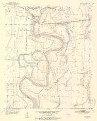
1952 Map of Garland
USGS Topo · Published 1953About this map
Garland sits at a sharp bend in the Red River in the early 1950s, serving as a focal point for the river-and-rail economy of Miller and Lafayette counties. The St Louis Southwestern railroad cuts across the floodplain, connecting the Garland City Sta to the wider region. This landscape is defined by the shifting course of the river, leaving behind a complex network of oxbows and backwaters including Spirit Lake, Keller Lake, and Cypress City Lake.
Find a feature on this map
41 named features on this map. Tap any name to fly to it.
Don’t see what you’re looking for? This feature index may not catch every label — zoom into the map to look around manually.
Map Details
Editions of this 1952 Garland Map
4 editions found
Other maps of this area

1952 · Garland
USGS Topo · 1:24,000

1952 · Fouke SE
USGS Topo · 1:24,000

1952 · Bradley NE
USGS Topo · 1:24,000

1952 · Old Town
USGS Topo · 1:24,000

1952 · Doddridge NE
USGS Topo · 1:24,000

1952 · Canfield
USGS Topo · 1:24,000

1952 · Lewisville
USGS Topo · 1:24,000

1952 · Fouke NE
USGS Topo · 1:24,000

1952 · Boyd Hill
USGS Topo · 1:24,000

1953 · El Dorado
USGS Topo · 1:250,000