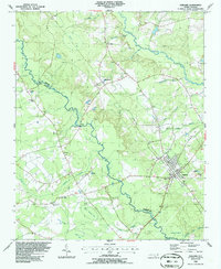
1986 Map of Garland
USGS Topo · Published 1986About this map
South River and Little Coharie Creek define the hydrologic character of this coastal plain landscape, where the meandering waterways meet distinctive Carolina Bays like Dismal Bay, Marry Branch Bay, and Beaver Dam Bay. The town of Garland serves as the primary population center, showing a grid of streets and municipal infrastructure including a Sewage Disposal Pond and nearby Landing Strip. Smaller settlements such as Parkersburg appear alongside an extensive network of rural landmarks, particularly small churches and numerous unmarked cemeteries that reflect the area's deep-rooted community history.
Find a feature on this map
37 named features on this map. Tap any name to fly to it.
Don’t see what you’re looking for? This feature index may not catch every label — zoom into the map to look around manually.
Map Details
Editions of this 1986 Garland Map
This is the sole edition of this map. No revisions or reprints were ever made.
Other maps of this area

1953 · Florence
USGS Topo · 1:250,000

1954 · Florence
USGS Topo · 1:250,000

1954 · White Lake
USGS Topo · 1:62,500

1955 · Elizabethtown
USGS Topo · 1:62,500

1959 · Roseboro
USGS Topo · 1:62,500

1959 · Garland
USGS Topo · 1:62,500

1982 · Elizabethtown
USGS Topo · 1:100,000
1986 · Ingold
USGS Topo · 1:24,000
1986 · Clinton South
USGS Topo · 1:24,000
1986 · Bonnetsville
USGS Topo · 1:24,000