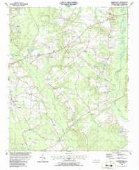
1986 Map of Bonnetsville
USGS Topo · Published 1986About this map
Bonnetsville and the surrounding coastal plains of Sampson County are defined by a complex network of wetlands and small agricultural settlements in the mid-1980s. The landscape is dominated by the winding paths of Bearskin Swamp and Great Coharie Creek, which dictate the placement of local roads and farmsteads. Smaller communities like Snow Hill, Highsmiths, and Mintz serve as local hubs, while Roseboro stands out as a more established center on the western edge.
Find a feature on this map
30 named features on this map. Tap any name to fly to it.
Don’t see what you’re looking for? This feature index may not catch every label — zoom into the map to look around manually.
Map Details
Editions of this 1986 Bonnetsville Map
This is the sole edition of this map. No revisions or reprints were ever made.
Other maps of this area

1909 · Coharie
USGS Topo · 1:62,500

1953 · Florence
USGS Topo · 1:250,000

1953 · Raleigh
USGS Topo · 1:250,000

1954 · Florence
USGS Topo · 1:250,000

1954 · Raleigh
USGS Topo · 1:250,000

1959 · Roseboro
USGS Topo · 1:62,500

1959 · Garland
USGS Topo · 1:62,500

1974 · Salemburg
USGS Topo · 1:24,000

1982 · Elizabethtown
USGS Topo · 1:100,000
1986 · Ingold
USGS Topo · 1:24,000