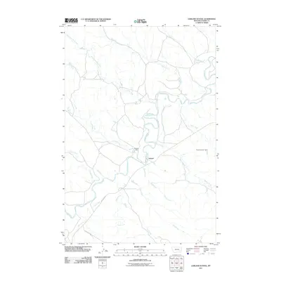
2011 Map of Garland School
USGS Topo · Published 2011About this map
The Tongue River meanders through this portion of Custer County, shaping the landscape near the small settlement of Garland. This 2011 survey reveals a highly branched drainage network defined by numerous named tributaries, including Miles Creek, Forest Creek, and Haddow Creek, which feed into the main river channel. Human modification of the watershed is evident through structures such as Shipleys Dam and the Powell Number 1 Dam further east.
Find a feature on this map
19 named features on this map. Tap any name to fly to it.
Don’t see what you’re looking for? This feature index may not catch every label — zoom into the map to look around manually.
Map Details
Editions of this 2011 Garland School Map
This is the sole edition of this map. No revisions or reprints were ever made.
Other maps of this area

1953 · Miles City
USGS Topo · 1:250,000

1954 · Hardin
USGS Topo · 1:250,000

1954 · Ekalaka
USGS Topo · 1:250,000

1954 · Forsyth
USGS Topo · 1:250,000

1956 · Ekalaka
USGS Topo · 1:250,000

1957 · Miles City
USGS Topo · 1:250,000

1957 · Hardin
USGS Topo · 1:250,000

1957 · Forsyth
USGS Topo · 1:250,000

1958 · Miles City
USGS Topo · 1:250,000

1958 · Ekalaka
USGS Topo · 1:250,000