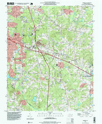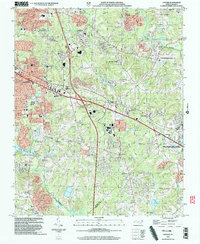
2022 Map of Garner
USGS Topo · Published 2022About this map
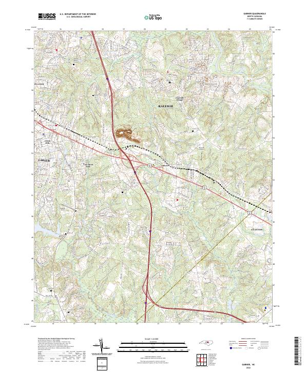
Garner and southern Raleigh anchor this 2022 survey, showing a landscape defined by rapid suburban expansion at the Wake and Johnston county line. The map highlights the sprawling residential developments of Forest Hills, Emerald Village, and Cloverdale, which now surround older rural landmarks. Despite the dense network of new roads like Scenic Woods Dr and White Oak Cir, numerous family cemeteries such as Hilliard Cem, Smith Cem, and Mitchiner Cem remain preserved within the modern street grid. The Neuse River and Swift Creek provide the primary natural drainage for the area, while smaller water bodies like Bells Lake and Austin Pond are caught between expanding neighborhoods. This edition is particularly useful for identifying the exact location of family burial grounds and small private airfields like Bagwell Airport amidst the corridor connecting to Clayton.
Find a feature on this map
242 named features on this map. Tap any name to fly to it.
Don’t see what you’re looking for? This feature index may not catch every label — zoom into the map to look around manually.
Map Details
Editions of this 2022 Garner Map
This is the sole edition of this map. No revisions or reprints were ever made.
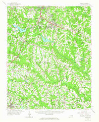
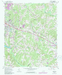
Historical Maps of Village of White Oak Through Time
5 maps found