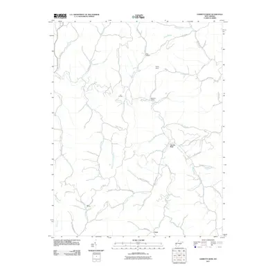
2011 Map of Garretts Bend
USGS Topo · Published 2011About this map
Garretts Bend serves as a central point in this part of Lincoln County, where the landscape is defined by an intricate network of waterways like Hazlett Fork and Bridge Creek. The area’s geography is shaped by narrow hollows and high points such as Rocky Knob, illustrating the traditional settlement patterns of West Virginia's Appalachian interior. Communities like Tango are situated along winding valley roads, often following the natural paths carved by streams like Trace Fork and Joes Creek.
Find a feature on this map
64 named features on this map. Tap any name to fly to it.
Don’t see what you’re looking for? This feature index may not catch every label — zoom into the map to look around manually.
Map Details
Editions of this 2011 Garretts Bend Map
This is the sole edition of this map. No revisions or reprints were ever made.
Other maps of this area

1892 · Huntington
USGS Topo · 1:125,000

1898 · Huntington
USGS Topo · 1:125,000

1899 · Charleston
USGS Topo · 1:125,000

1902 · Milton
USGS Topo · 1:62,500

1902 · Midkiff
USGS Topo · 1:62,500

1907 · Midkiff
USGS Topo · 1:62,500

1909 · Midkiff
USGS Topo · 1:62,500

1909 · Saint Albans
USGS Topo · 1:62,500

1911 · Madison
USGS Topo · 1:62,500

1929 · Madison
USGS Topo · 1:62,500