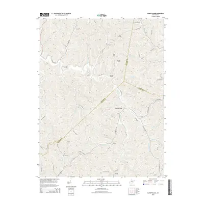
2014 Map of Garretts Bend
USGS Topo · Published 2014About this map
Garretts Bend and the small settlement of Tango sit at the center of this 2014 study of the West Virginia backcountry where Lincoln, Putnam, and Kanawha counties meet. The landscape is defined by the winding course of the Trace Fork Mud River and its numerous tributaries, including Hayzlett Fork, Joes Cr, and Rockhouse Br. This topography has historically dictated the settlement patterns of the region, with homes and roads clinging to narrow valley floors between steep ridges and high points like Rocky Knob.
Find a feature on this map
82 named features on this map. Tap any name to fly to it.
Don’t see what you’re looking for? This feature index may not catch every label — zoom into the map to look around manually.
Map Details
Editions of this 2014 Garretts Bend Map
This is the sole edition of this map. No revisions or reprints were ever made.
Other maps of this area

1892 · Huntington
USGS Topo · 1:125,000

1898 · Huntington
USGS Topo · 1:125,000

1899 · Charleston
USGS Topo · 1:125,000

1902 · Milton
USGS Topo · 1:62,500

1902 · Midkiff
USGS Topo · 1:62,500

1907 · Midkiff
USGS Topo · 1:62,500

1909 · Midkiff
USGS Topo · 1:62,500

1909 · Saint Albans
USGS Topo · 1:62,500

1911 · Madison
USGS Topo · 1:62,500

1929 · Madison
USGS Topo · 1:62,500