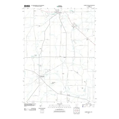
2010 Map of Garrettsville
USGS Topo · Published 2010About this map
Garrettsville serves as a primary hub in this corner of Northeast Ohio, where the village streets branch out near the Garrettsville Post Office and follow the course of Eagle Creek. The landscape transition from the village to the surrounding townships reveals a high density of early burial grounds and small settlements such as Parkman and Nelson. Topographical interest is centered on the sharp relief of Parkman Gorge and several natural water features, including Cascade Falls and Minnehaha Falls, which punctuate the path of the Grand River. In the southern portion of the quadrangle, industrial activity is marked by the presence of the Phalanx Quarry and South Phalanx Quarry near the settlement of Mahoning. This 2010 survey reflects a region where the historical agricultural and quarrying footprint remains visible alongside modern recreational developments like the Sugarbush Golf Course.
Find a feature on this map
87 named features on this map. Tap any name to fly to it.
Don’t see what you’re looking for? This feature index may not catch every label — zoom into the map to look around manually.
Map Details
Editions of this 2010 Garrettsville Map
This is the sole edition of this map. No revisions or reprints were ever made.
Other maps of this area

1905 · Bristolville
USGS Topo · 1:62,500

1905 · Garrettsville
USGS Topo · 1:62,500

1906 · Ravenna
USGS Topo · 1:62,500

1907 · Bristolville
USGS Topo · 1:62,500

1907 · Garrettsville
USGS Topo · 1:62,500

1908 · Warren
USGS Topo · 1:62,500

1908 · Ravenna
USGS Topo · 1:62,500

1950 · Cleveland
USGS Topo · 1:250,000

1952 · West Farmington
USGS Topo · 1:24,000

1952 · Southington
USGS Topo · 1:24,000