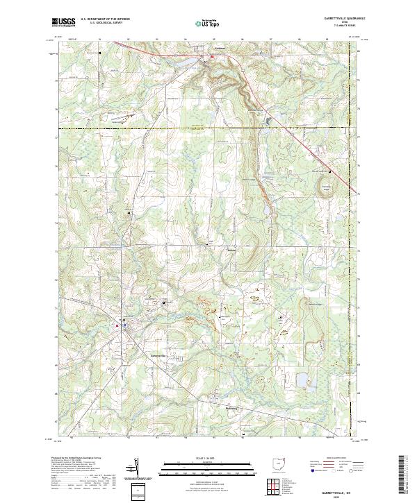
2023 Map of Garrettsville
USGS Topo · Published 2023About this map
Garrettsville and the surrounding borderlands of Geauga, Portage, and Trumbull Counties are defined by a complex network of waterways and glacial geology. The Mahoning Creek and Eagle Creek systems drain the southern landscape, while the Grand River carves through the north, creating the distinct Parkman Gorge. For those researching local lineages, the map identifies numerous family-named landmarks and rural burial grounds including Mumford Cem, Abbot Cem, and Harrington Cem. The topography is marked by significant rock formations such as Nelson Ledge and Kennedy Ledge, which include natural features like Minnehaha Falls. Small-scale aviation and agricultural land use persist at Gates Airport, while the village of Parkman serves as a northern hub along Main Market Rd, illustrating the long-standing transport patterns of this northeastern Ohio region.
Find a feature on this map
103 named features on this map. Tap any name to fly to it.
Don’t see what you’re looking for? This feature index may not catch every label — zoom into the map to look around manually.
Map Details
Editions of this 2023 Garrettsville Map
This is the sole edition of this map. No revisions or reprints were ever made.
Historical Maps of Mahoning Through Time
5 maps found

Featured Locations
- Garrettsville, OH
- Farmington Township, OH
- Southington Township, OH
- Braceville Township, OH
- Nelson, Nelson Township