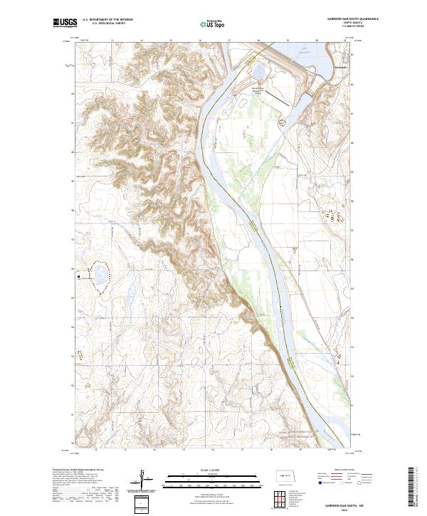
2024 Map of Garrison Dam South
USGS Topo · Published 2024About this map
The Missouri River carves a deep valley through the high plains of Mercer and McLean counties, controlled at the northern edge of this survey by the massive infrastructure of the Garrison Dam National Fish Hatchery. The settlement of Riverdale sits overlooking the banks of Lake Sakakawea, reflecting the modern development and conservation efforts that have redefined this stretch of the river. Farther downstream, the cultural heritage of the landscape is preserved within the Knife River Indian Villages National Historic Site, where the terrain begins to transition from the engineering of the dam to more traditional prairie drainages.
Find a feature on this map
34 named features on this map. Tap any name to fly to it.
Don’t see what you’re looking for? This feature index may not catch every label — zoom into the map to look around manually.
Map Details
Editions of this 2024 Garrison Dam South Map
This is the sole edition of this map. No revisions or reprints were ever made.
Other maps of this area

1922 · Garrison
USGS Topo · 1:62,500

1948 · Stanton
USGS Topo · 1:62,500

1949 · Stanton
USGS Topo · 1:62,500

1954 · McClusky
USGS Topo · 1:250,000

1958 · McClusky
USGS Topo · 1:250,000

1967 · Stanton SE
USGS Topo · 1:24,000

1967 · Emmet SE
USGS Topo · 1:24,000

1968 · Stanton
USGS Topo · 1:24,000

1968 · Hazen East
USGS Topo · 1:24,000

1969 · Hazen NE
USGS Topo · 1:24,000