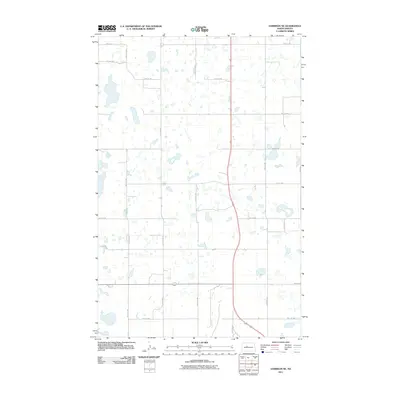
2011 Map of Garrison NE
USGS Topo · Published 2011About this map
Glacial depressions and prairie wetlands dot this McLean County landscape, where the Jeffersonian grid remains the defining human imprint. The terrain is structured by a precise network of roads such as 23rd St NW and 38th Ave NW, which follow the original Section Line boundaries of the Public Land Survey System. This agricultural layout reflects the early 21st-century rural character of the region, emphasizing the systematic division of North Dakota's central plains into square-mile sections. Small, unnamed water bodies are scattered throughout the quadrangle, illustrating the natural drainage patterns that intersect with the man-made grid of routes like 18th St NW and 31st Ave NW. This survey provides a clear view of the rural infrastructure between larger regional hubs, documenting the placement of every farmhouse access point and township road at this moment in time.
Find a feature on this map
17 named features on this map. Tap any name to fly to it.
Don’t see what you’re looking for? This feature index may not catch every label — zoom into the map to look around manually.
Map Details
Editions of this 2011 Garrison NE Map
This is the sole edition of this map. No revisions or reprints were ever made.
Other maps of this area

1922 · Garrison
USGS Topo · 1:62,500

1929 · Coleharbor
USGS Topo · 1:62,500

1929 · Benedict
USGS Topo · 1:62,500

1954 · McClusky
USGS Topo · 1:250,000

1958 · McClusky
USGS Topo · 1:250,000
1972 · Garrison Dam North
USGS Topo · 1:24,000
1972 · Coleharbor
USGS Topo · 1:24,000
1972 · Riverdale North
USGS Topo · 1:24,000
1974 · Garrison NW
USGS Topo · 1:24,000
1974 · Benedict SW
USGS Topo · 1:24,000