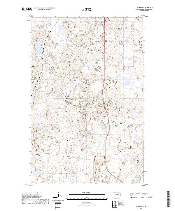
2024 Map of Garrison NE
USGS Topo · Published 2024About this map
Kloestitz German Cem and Saint Paul's Cem anchor this section of McLean County, reflecting the deep-rooted immigrant history of the North Dakota prairies. The landscape is defined by the Public Land Survey System, with a precise grid of section lines and roads such as 16th St NW and 37th Ave NW cutting through the rolling plains north of Garrison. This modern topograhic record reveals a terrain dotted with numerous small wetlands and prairie potholes, characteristic of the glaciated plains. Major regional connectors like Co Hwy 8 and Co Hwy 6 provide the primary east-west transit through this agricultural heartland. The map offers a clear view of the rural settlement pattern, where scattered farmsteads are linked by a network of numbered gravel roads and section lines.
Find a feature on this map
29 named features on this map. Tap any name to fly to it.
Don’t see what you’re looking for? This feature index may not catch every label — zoom into the map to look around manually.
Map Details
Editions of this 2024 Garrison NE Map
This is the sole edition of this map. No revisions or reprints were ever made.
Other maps of this area

1922 · Garrison
USGS Topo · 1:62,500

1929 · Coleharbor
USGS Topo · 1:62,500

1929 · Benedict
USGS Topo · 1:62,500

1954 · McClusky
USGS Topo · 1:250,000

1958 · McClusky
USGS Topo · 1:250,000
1972 · Garrison Dam North
USGS Topo · 1:24,000
1972 · Coleharbor
USGS Topo · 1:24,000
1972 · Riverdale North
USGS Topo · 1:24,000
1974 · Garrison NW
USGS Topo · 1:24,000
1974 · Benedict SW
USGS Topo · 1:24,000