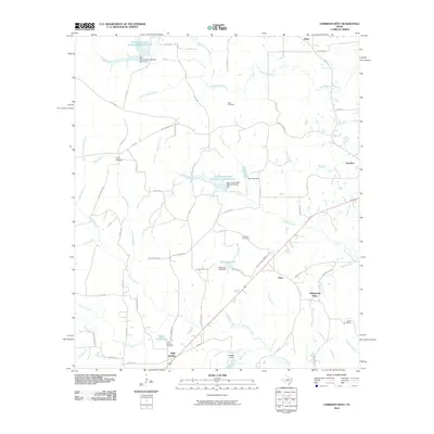
2010 Map of Garrison West
USGS Topo · Published 2010About this map
Holly Springs and the surrounding piney woods of East Texas are defined by a complex network of small creek branches and soil conservation projects. This 2010 landscape is shaped significantly by water management, featuring the Soil Conservation Service Site 3 Reservoir in the north and the Soil Conservation Service Site 20 Reservoir near the center. These reservoirs, alongside Ford Lake and McKinney Lake, illustrate the region's efforts to control erosion and manage the flow of the many tributaries feeding into Naconiche Creek.
Find a feature on this map
78 named features on this map. Tap any name to fly to it.
Don’t see what you’re looking for? This feature index may not catch every label — zoom into the map to look around manually.
Map Details
Editions of this 2010 Garrison West Map
This is the sole edition of this map. No revisions or reprints were ever made.
Other maps of this area

1952 · Nacogdoches
USGS Topo · 1:62,500

1953 · Palestine
USGS Topo · 1:250,000

1957 · Palestine
USGS Topo · 1:250,000

1958 · Martinsville
USGS Topo · 1:62,500

1958 · Timpson
USGS Topo · 1:62,500

1960 · Mount Enterprise
USGS Topo · 1:62,500
1983 · Nacogdoches North
USGS Topo · 1:24,000
1983 · Appleby
USGS Topo · 1:24,000

1984 · Palestine
USGS Topo · 1:250,000
1984 · Garrison East
USGS Topo · 1:24,000