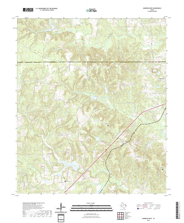
2022 Map of Garrison West
USGS Topo · Published 2022About this map
The eastern edge of Garrison and the small community of Fitze anchor this survey of the East Texas timberlands along the Rusk and Nacogdoches county line. The landscape is defined by an intricate network of waterways, including the winding Naconiche Creek and Sandy Creek, which drain a terrain of numerous named branches and springs. For genealogists, the map identifies several local burial grounds such as Walnut Grove Cem, Holly Springs Cem, and Strickland Cem, which often represent the focal points of early rural settlement patterns. The presence of Tonkawa Spring and Bellevue Spring highlights the historic importance of reliable water sources in this region. This modern topographic study also records water management features like the Soil Conservation Service Site 20 Reservoir, contrasting against older landmarks like Curtis Smith Lake.
Find a feature on this map
95 named features on this map. Tap any name to fly to it.
Don’t see what you’re looking for? This feature index may not catch every label — zoom into the map to look around manually.
Map Details
Editions of this 2022 Garrison West Map
This is the sole edition of this map. No revisions or reprints were ever made.
Other maps of this area

1952 · Nacogdoches
USGS Topo · 1:62,500

1953 · Palestine
USGS Topo · 1:250,000

1957 · Palestine
USGS Topo · 1:250,000

1958 · Martinsville
USGS Topo · 1:62,500

1958 · Timpson
USGS Topo · 1:62,500

1960 · Mount Enterprise
USGS Topo · 1:62,500
1983 · Nacogdoches North
USGS Topo · 1:24,000
1983 · Appleby
USGS Topo · 1:24,000

1984 · Palestine
USGS Topo · 1:250,000
1984 · Garrison East
USGS Topo · 1:24,000