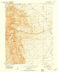
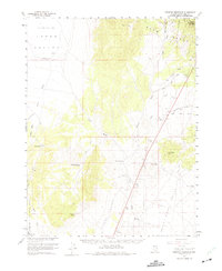
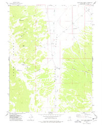
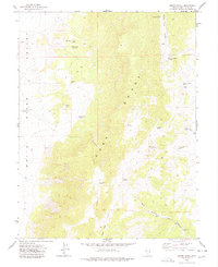
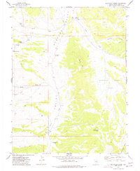
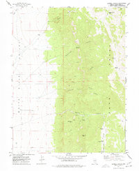
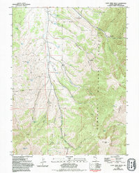
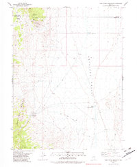
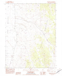
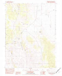
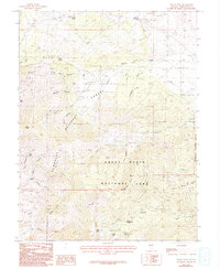
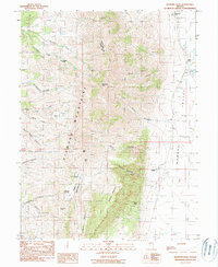
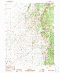
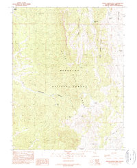
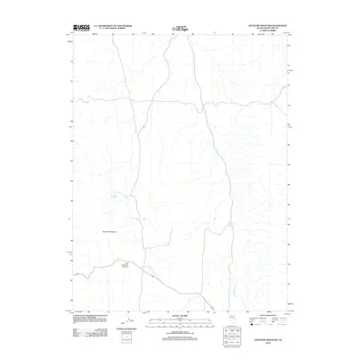
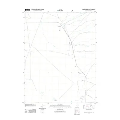
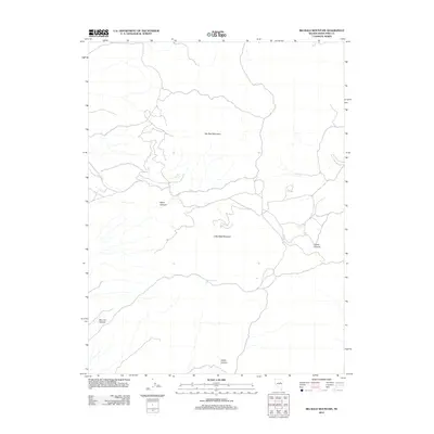
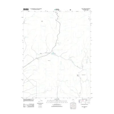
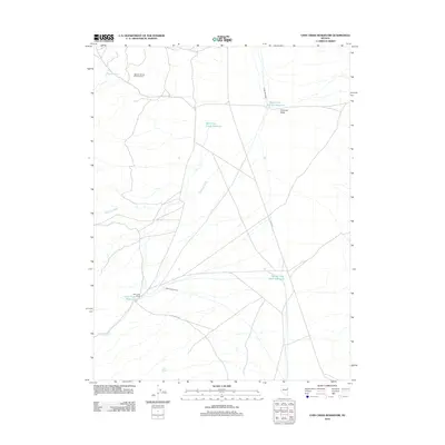
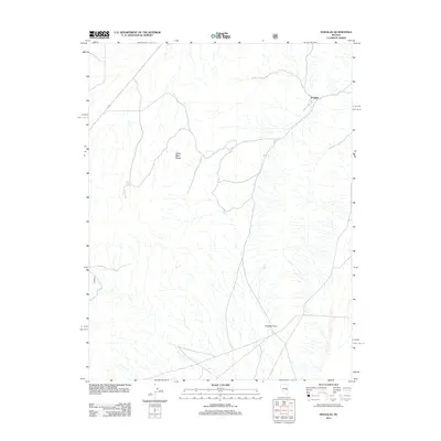
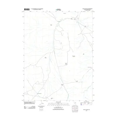
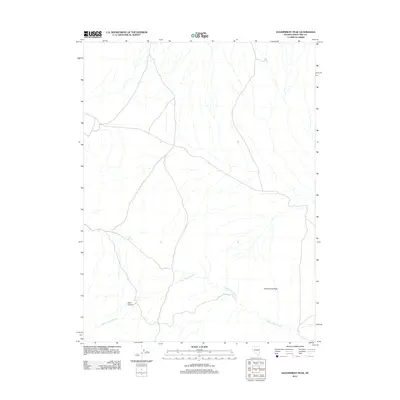
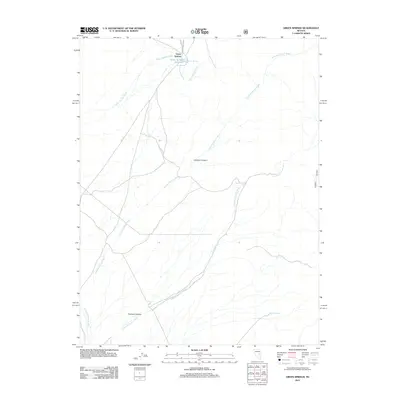
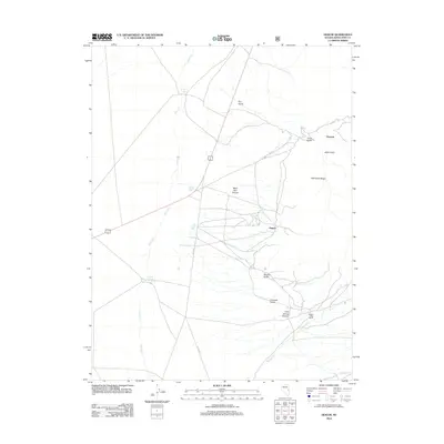
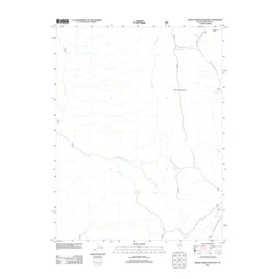
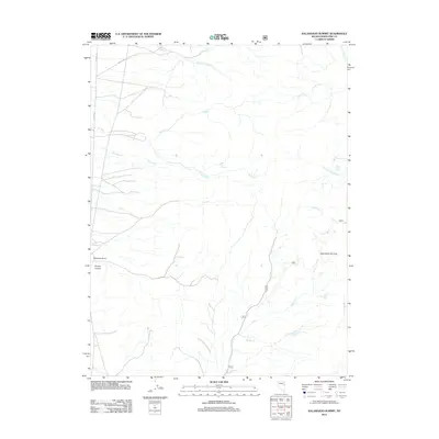
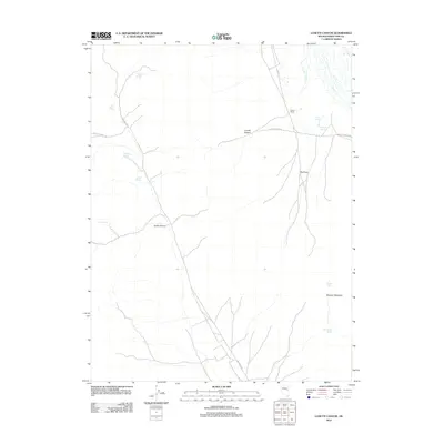
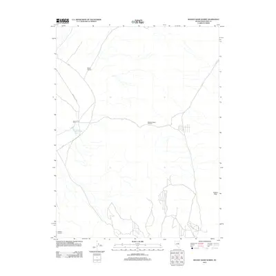
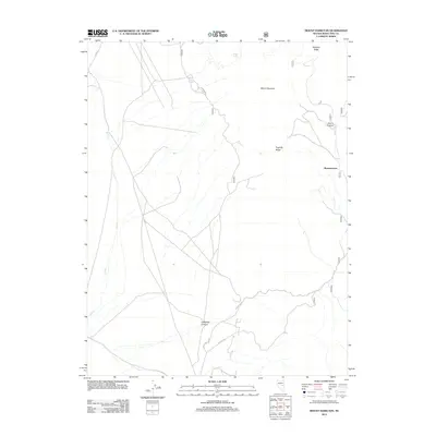
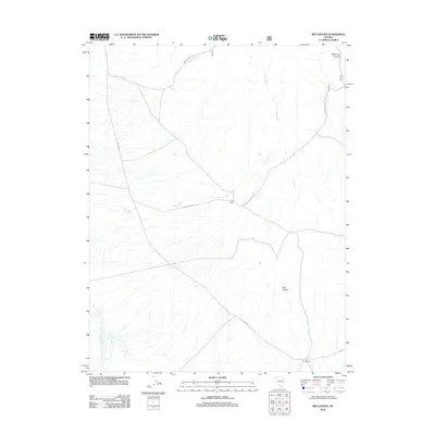
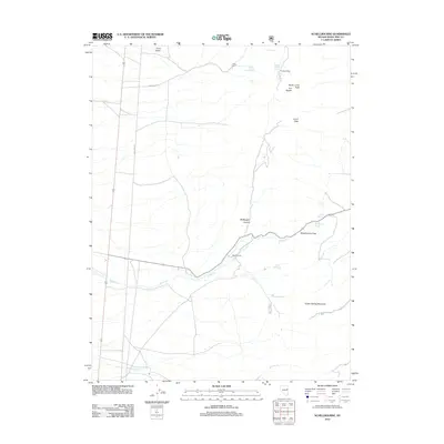
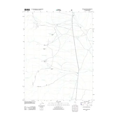
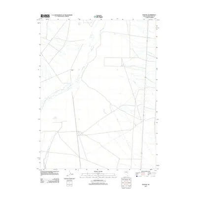
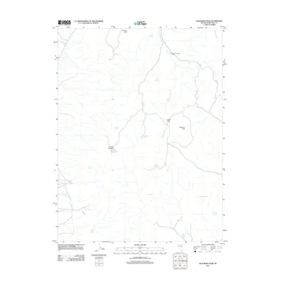
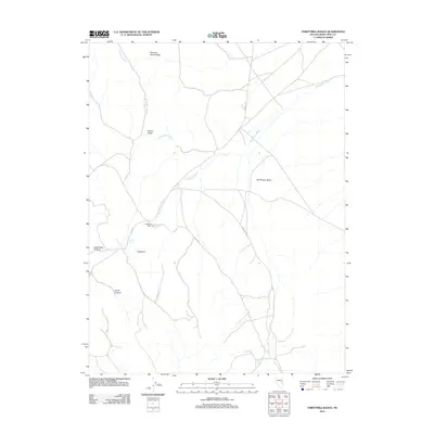
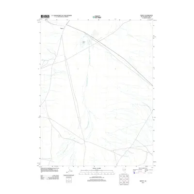
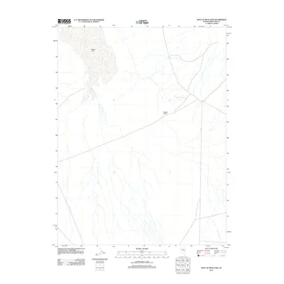
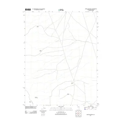
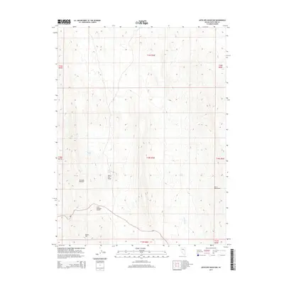
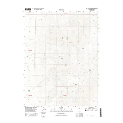
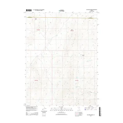
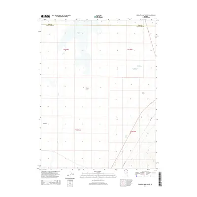
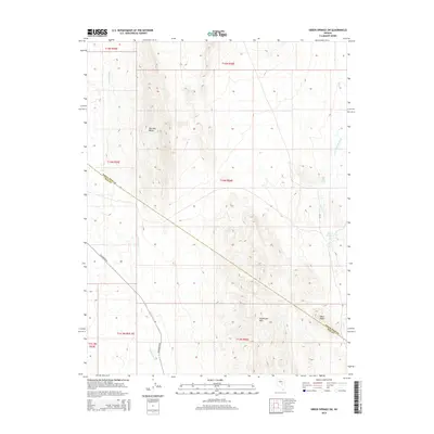
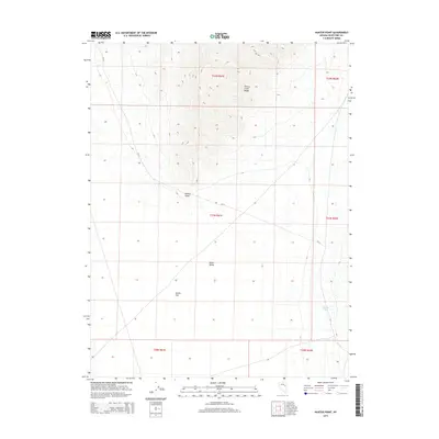
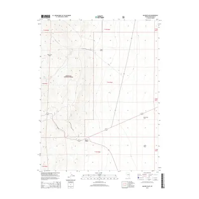
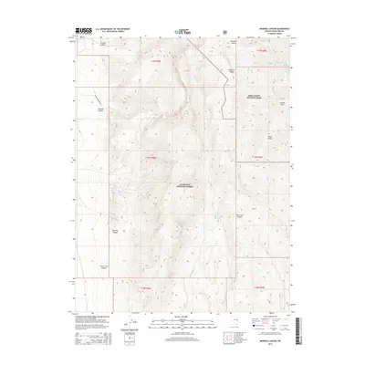
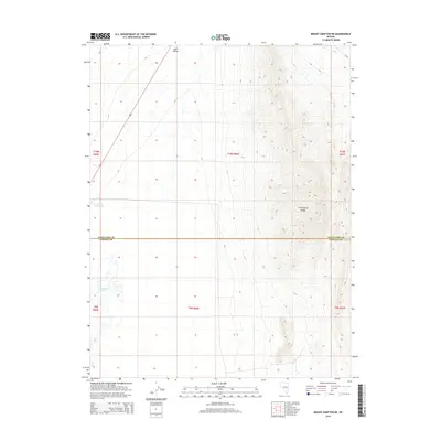
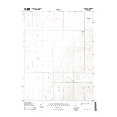
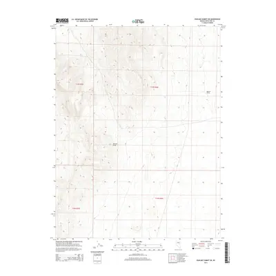
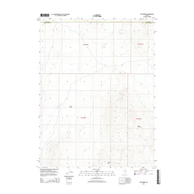
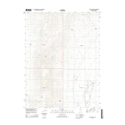
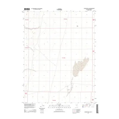
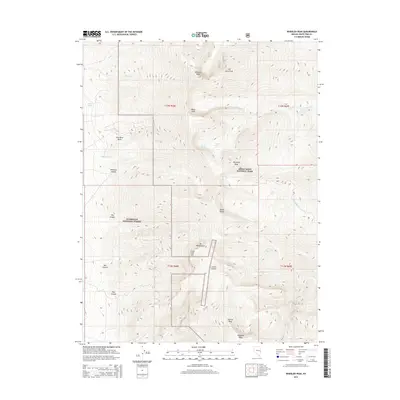
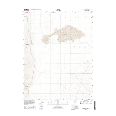
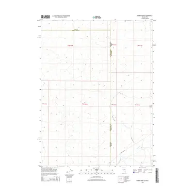
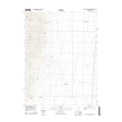
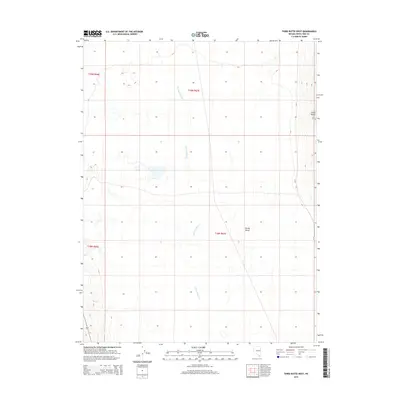
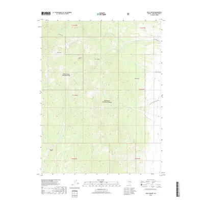
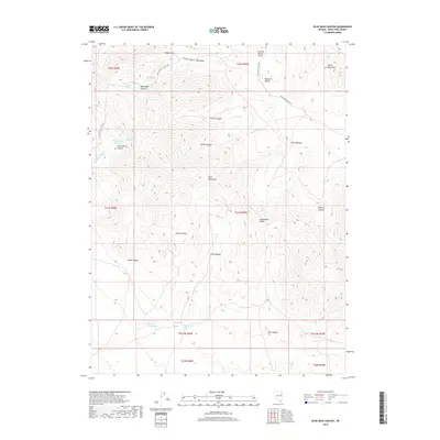
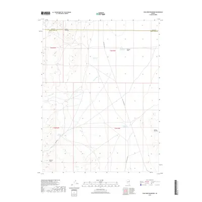
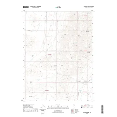
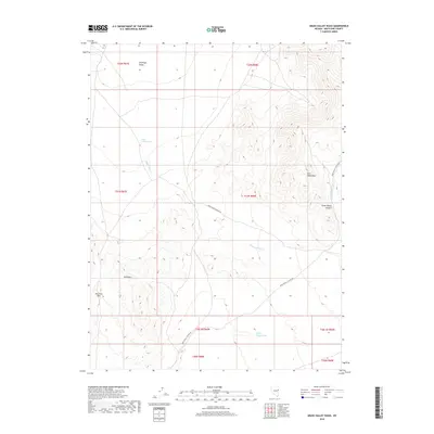
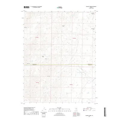
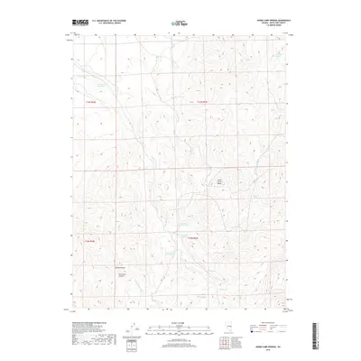
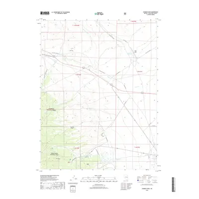
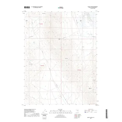
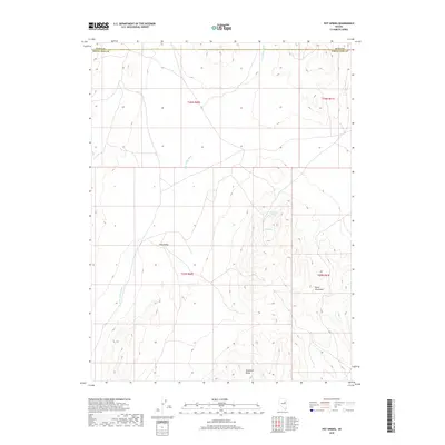
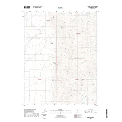
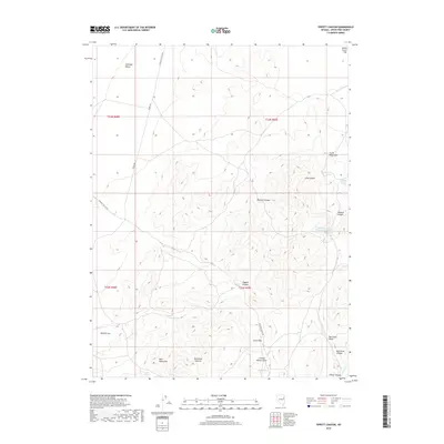
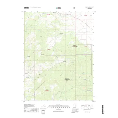
1949 Map of Garrison
USGS Topo · Published 1971About this map
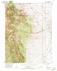
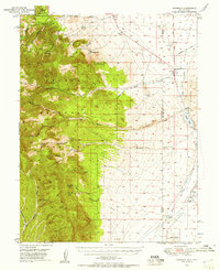
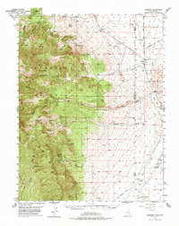
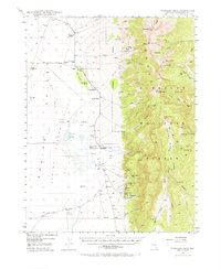
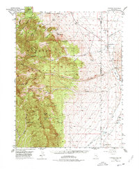
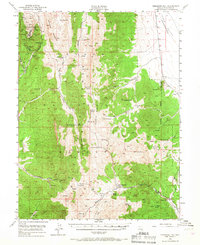
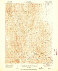
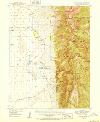
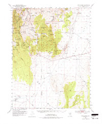
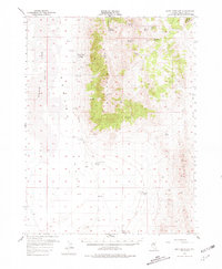
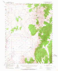
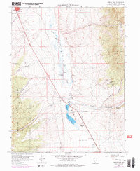
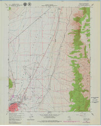
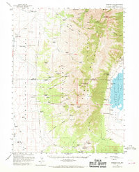
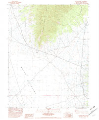
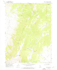
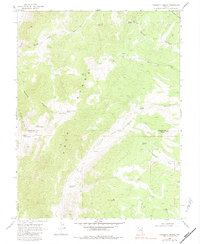
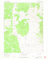
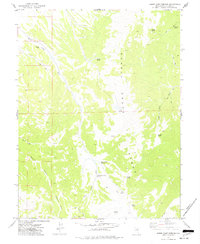
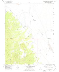
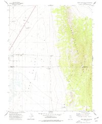
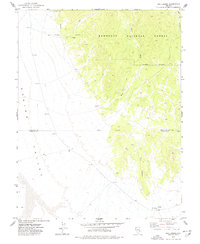
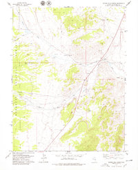
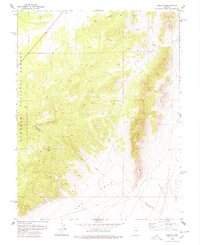
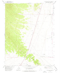
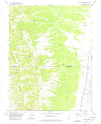
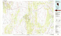
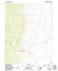
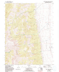
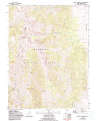
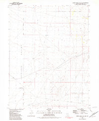
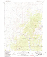
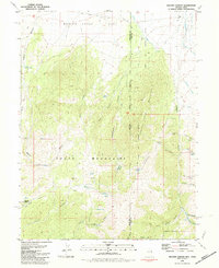
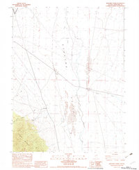
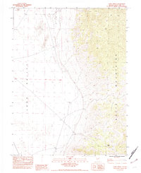
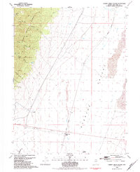
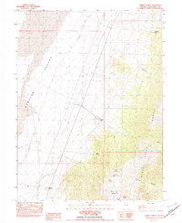
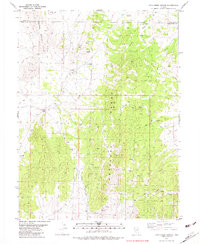
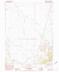
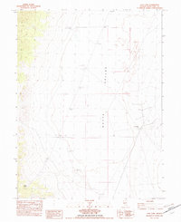
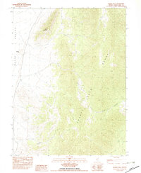
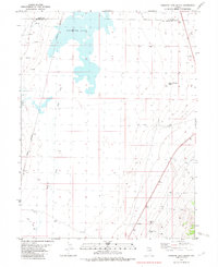
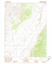
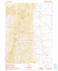
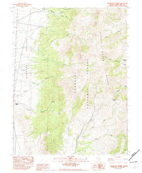
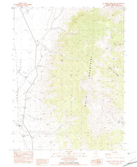
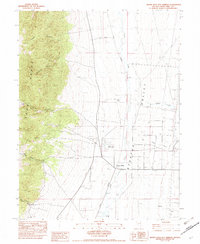
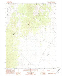
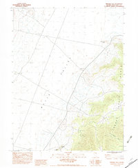
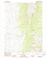
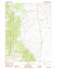
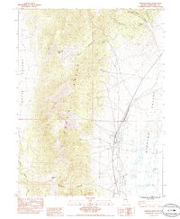
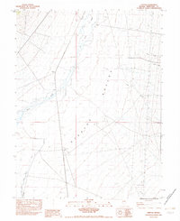
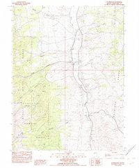
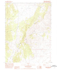
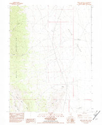
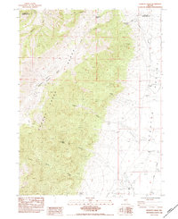
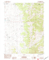
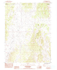
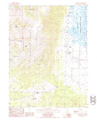
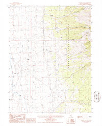
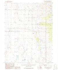
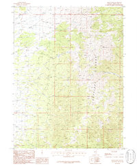
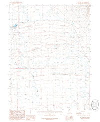
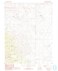
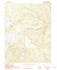
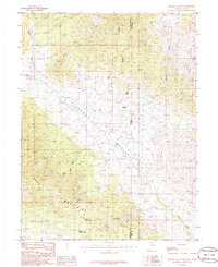
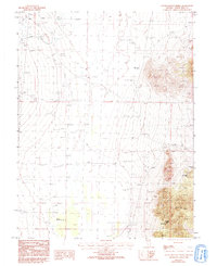
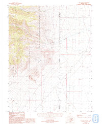
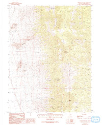
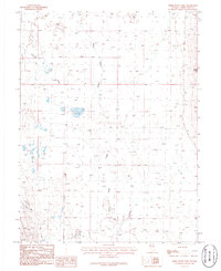
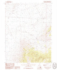
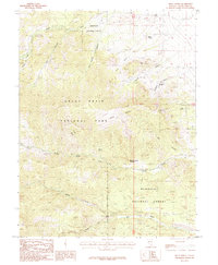
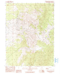
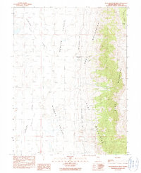
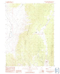
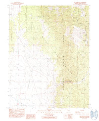
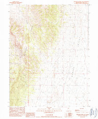
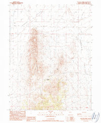
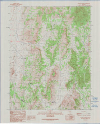
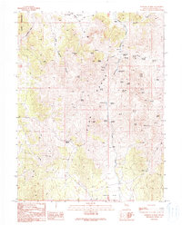
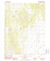
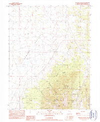
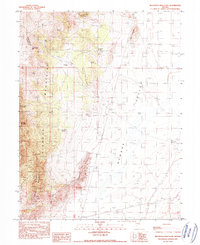
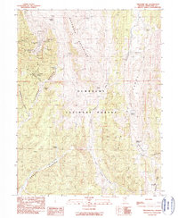
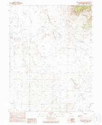
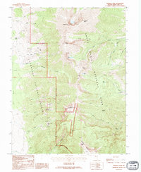
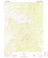
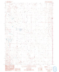
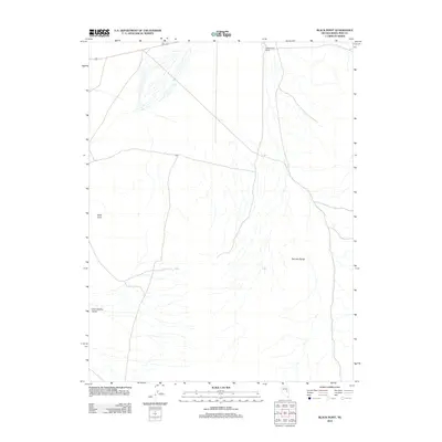
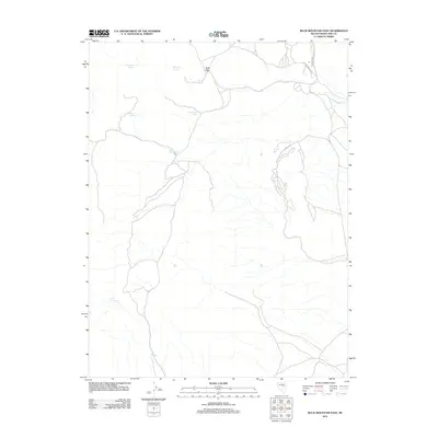
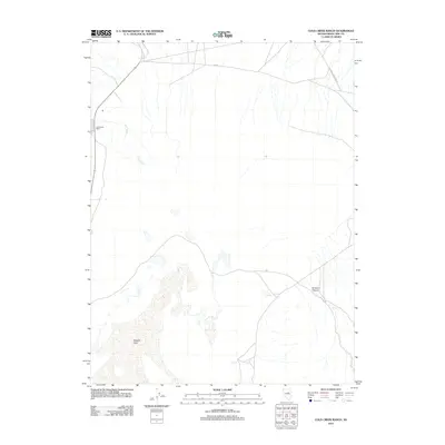
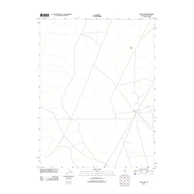
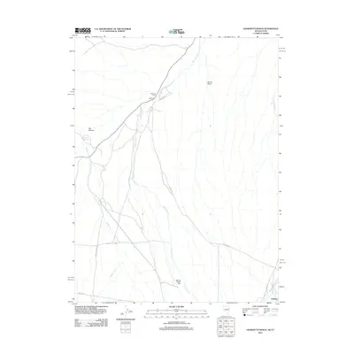
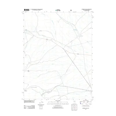
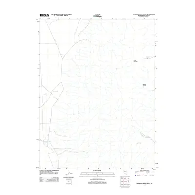
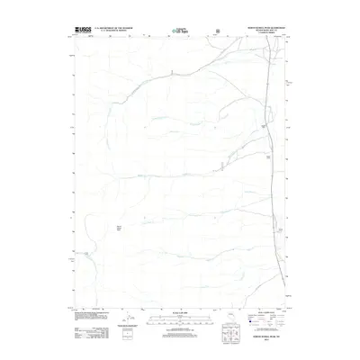
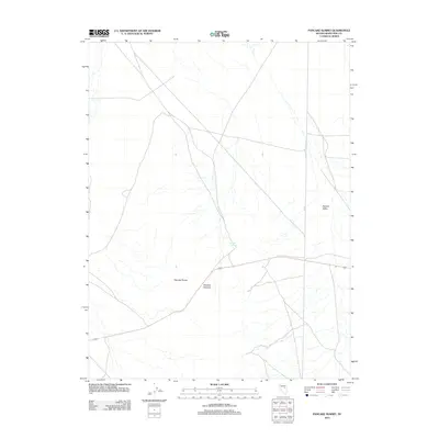
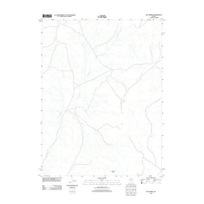
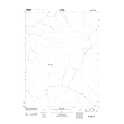
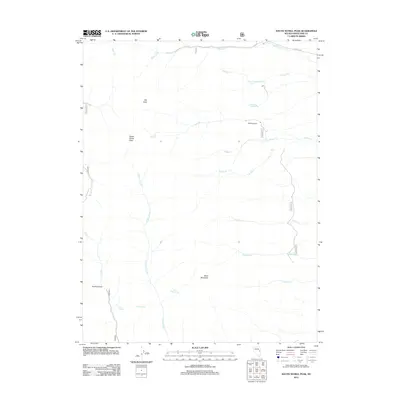
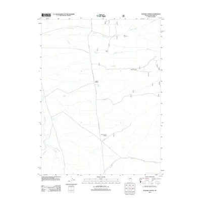
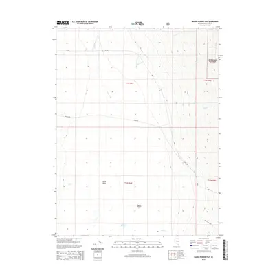
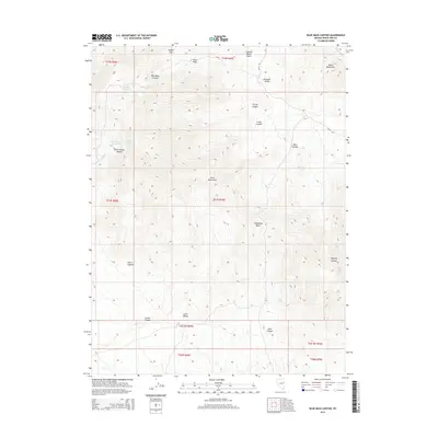
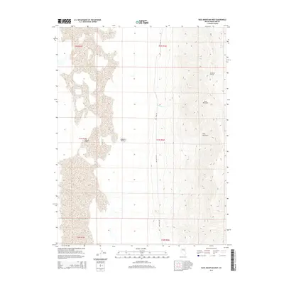
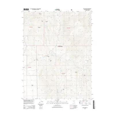
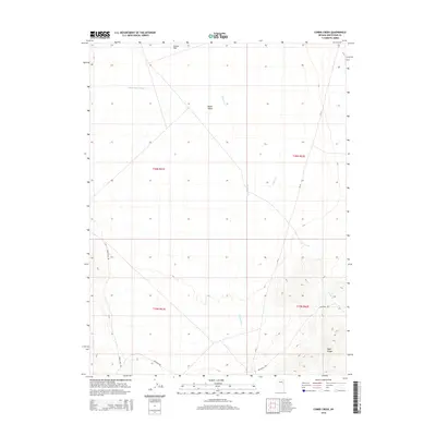
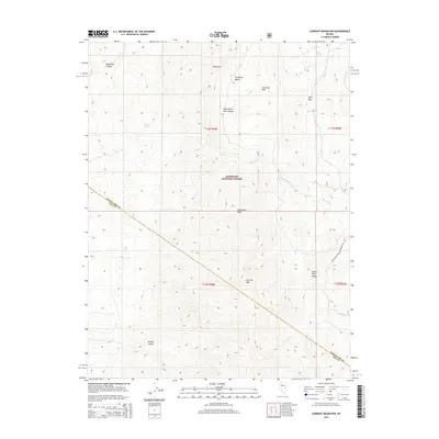
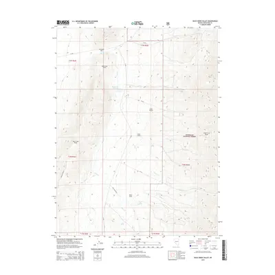
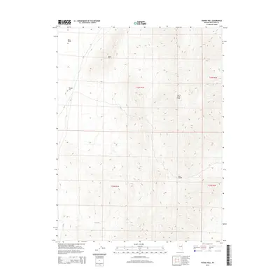
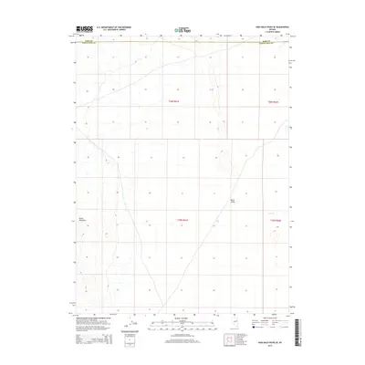
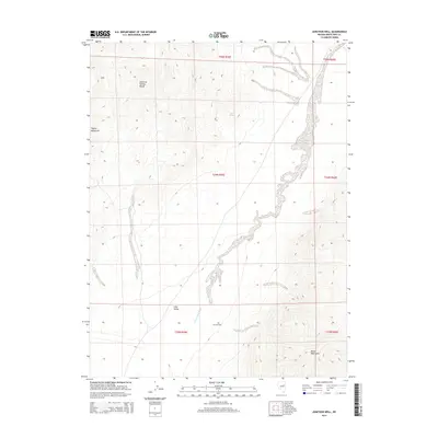
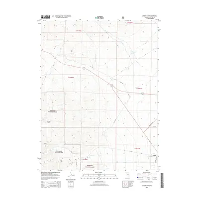
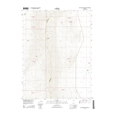
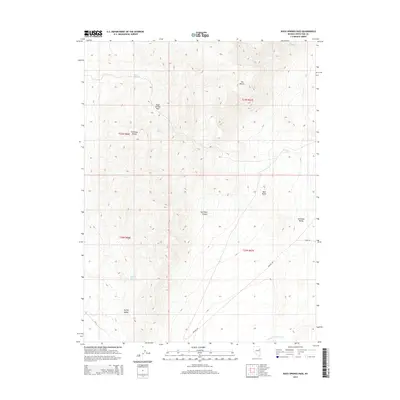
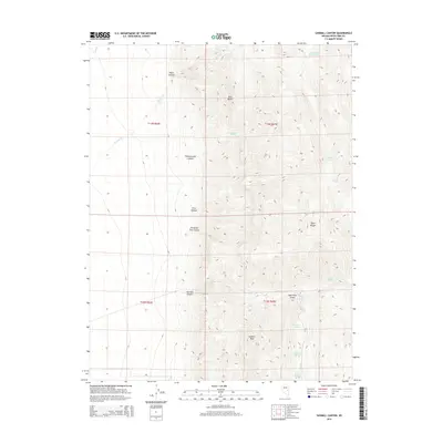
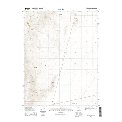
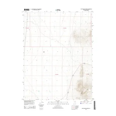
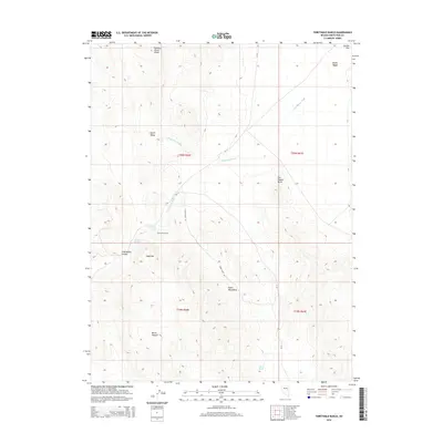
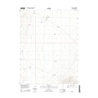
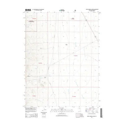
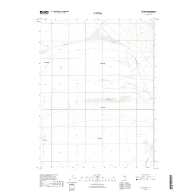
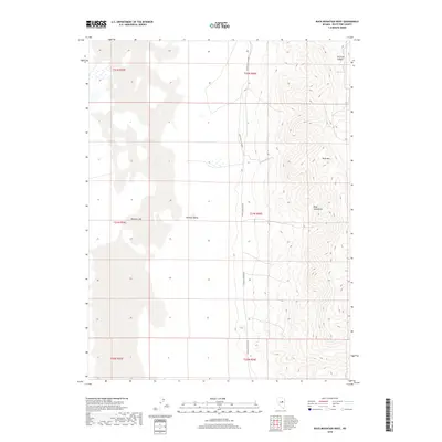
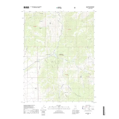
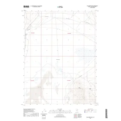
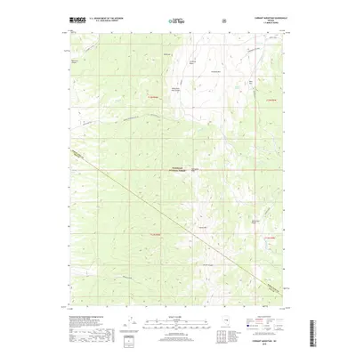
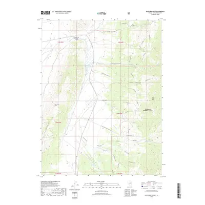
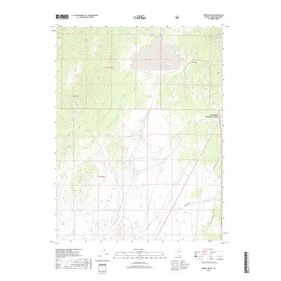
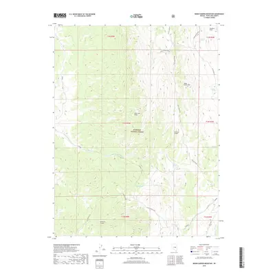
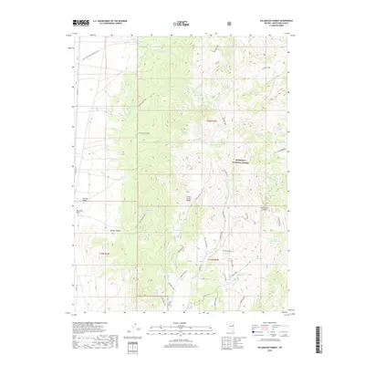
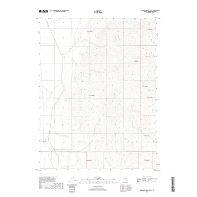
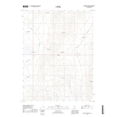
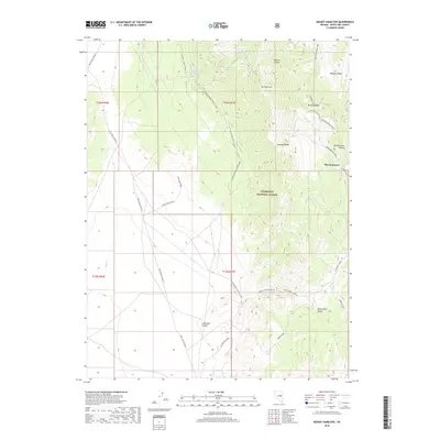
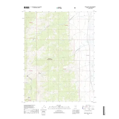
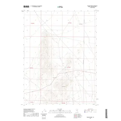
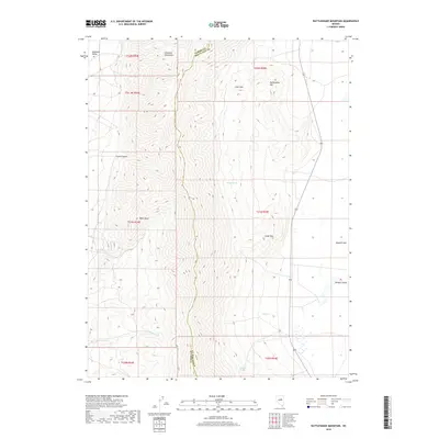
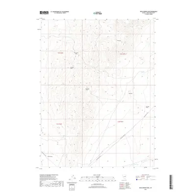
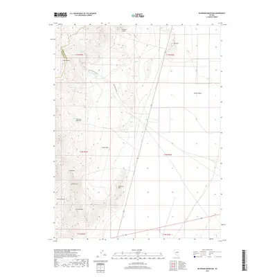
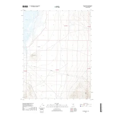
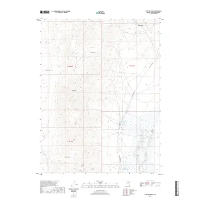
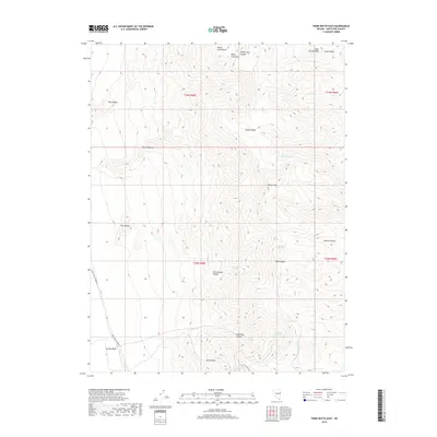
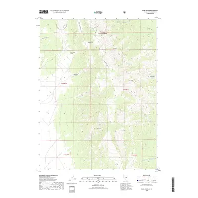
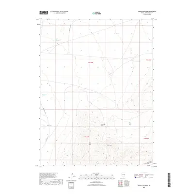
Snake Valley serves as the focal point for this late 1940s survey, where the arid high desert of eastern Nevada meets the Utah border. The settlement of Garrison stands at the junction of Snake Creek and Lake Creek, acting as a rare waypoint in a landscape dominated by the rising peaks of the Snake Range. High-altitude drainage systems like Horse Heaven Creek and Lexington Creek cut through the Humboldt National Forest, while the northern portion of the map identifies the early footprint of Lehman Caves National Monument. The reliance on water in this desert environment is evident through the naming of numerous springs, such as Kious Spr and Mahogany Spr, and the presence of established family holdings like Davies Ranch and Young Ranch. The inclusion of a Landing Field and the Ferguson Trail illustrates the diverse methods of transit used to navigate this remote borderland.
Find a feature on this map
57 named features on this map. Tap any name to fly to it.
Don’t see what you’re looking for? This feature index may not catch every label — zoom into the map to look around manually.
Map Details
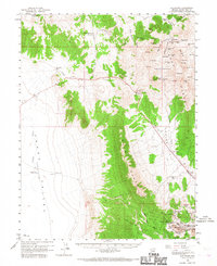
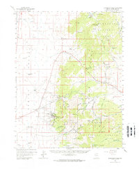
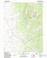
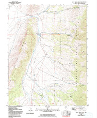
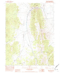
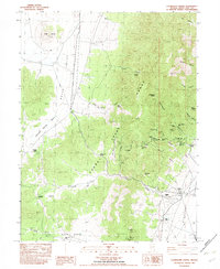
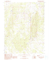
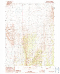
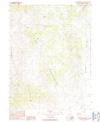
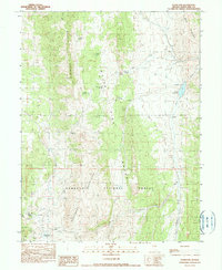
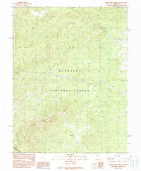
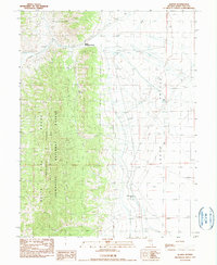
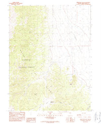
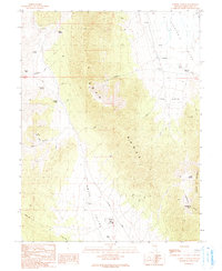
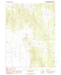
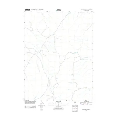
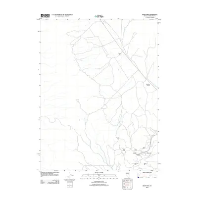
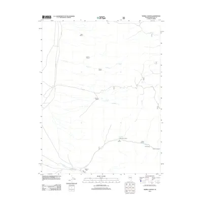
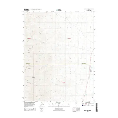
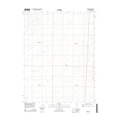
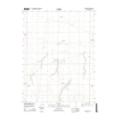
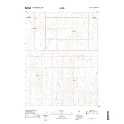
Editions of this 1949 Garrison Map
4 editions found
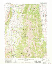
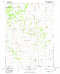
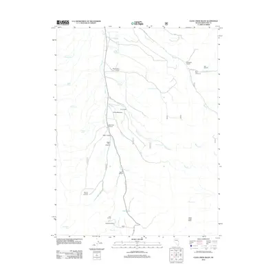
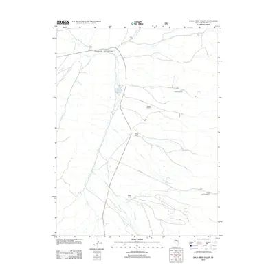
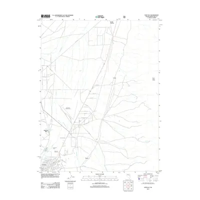
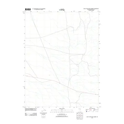
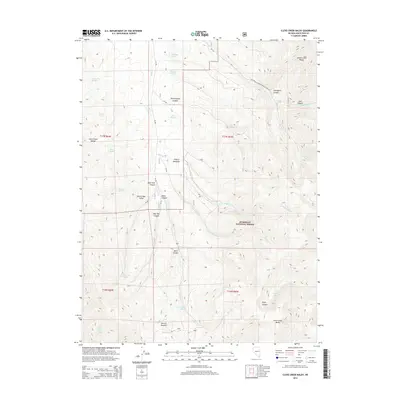
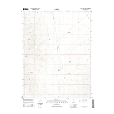
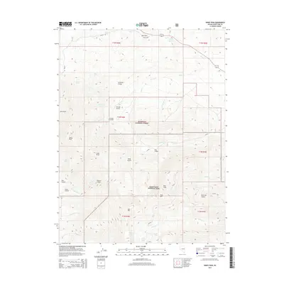
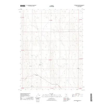
Historical Maps of Garrison Through Time
783 maps found
1948 Wheeler Peak
White Pine County, NV
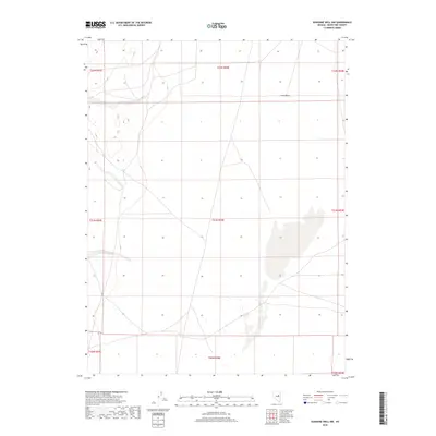
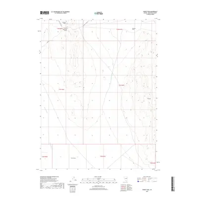
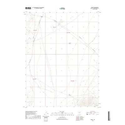
1949 Garrison
White Pine County, NV
1949 Treasure Hill
White Pine County, NV
1950 Treasure Hill
White Pine County, NV
1950 Wheeler Peak
White Pine County, NV
1951 Garrison
White Pine County, NV
1951 Green Springs
White Pine County, NV
1951 Illipah
White Pine County, NV
1951 Pancake Summit
White Pine County, NV
1953 Pinto Summit
White Pine County, NV
1957 Buck Mountain
White Pine County, NV
1957 Cold Creek Ranch
White Pine County, NV
1958 Comins Lake
White Pine County, NV
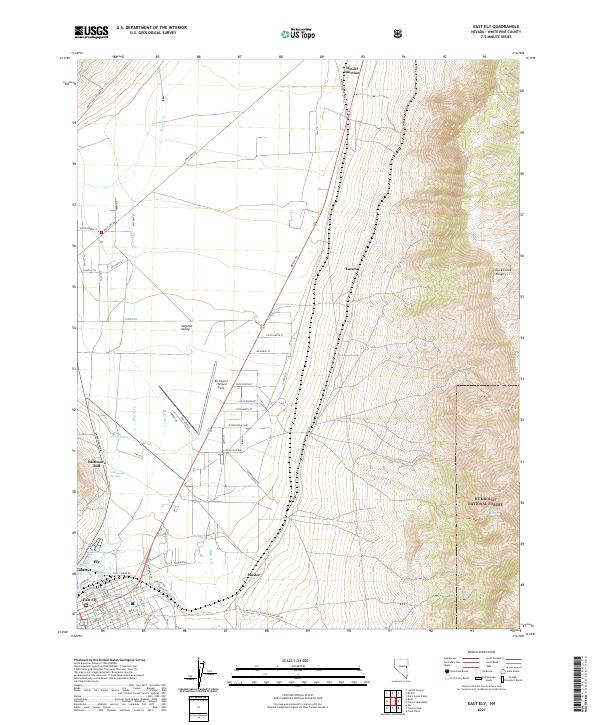
1958 East Ely
White Pine County, NV
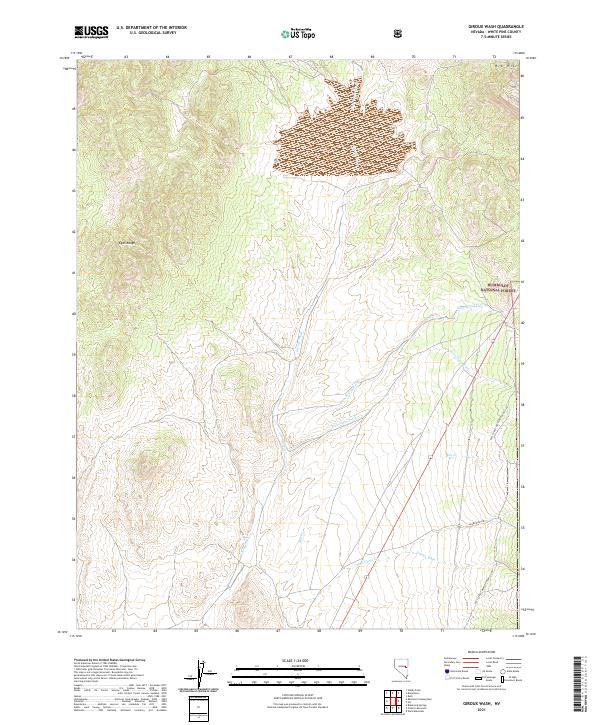
1958 Giroux Wash
White Pine County, NV
1958 Riepetown
White Pine County, NV
1959 Connors Pass
White Pine County, NV
1959 Preston Reservoir
White Pine County, NV
1959 Riepetown
White Pine County, NV
1959 Sacramento Pass
White Pine County, NV
1959 Schell Peaks
White Pine County, NV
1959 Sherman Mtn
White Pine County, NV
1962 Hunter Point
White Pine County, NV
1968 Ruby Lake SE
White Pine County, NV
1969 Haggerty Spring
White Pine County, NV
1969 Parker Station
White Pine County, NV
1969 Station Butte
White Pine County, NV
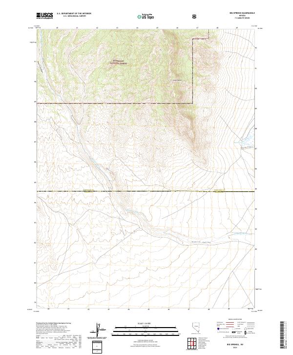
1972 Big Springs
White Pine County, NV
1973 Cattle Camp Spring
White Pine County, NV
1973 Horse Camp Springs
White Pine County, NV
1973 Indian Springs Knolls
White Pine County, NV
1973 Mount Grafton NE
White Pine County, NV

1973 North Spring Point
White Pine County, NV
1973 Red Ledges
White Pine County, NV
1973 White Rock Creek
White Pine County, NV
1977 Brown Knoll
White Pine County, NV
1977 Bullwhack Summit
White Pine County, NV
1977 Sawmill Canyon
White Pine County, NV
1978 Badger Hole Spring
White Pine County, NV
1978 Douglas
White Pine County, NV
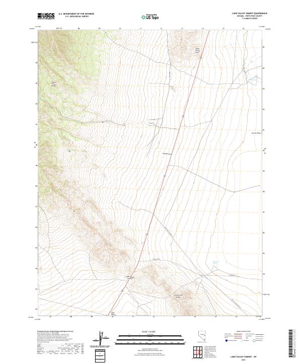
1978 Lake Valley Summit
White Pine County, NV
1978 Mt. Grafton
White Pine County, NV
1979 Mt. Hamilton
White Pine County, NV
1979 Sunset Reservoir
White Pine County, NV
1981 Cave Creek
White Pine County, NV
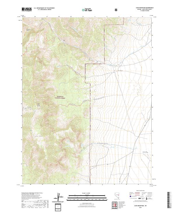
1981 Cave Mountain
White Pine County, NV
1981 Cleve Creek Baldy
White Pine County, NV
1981 Connors Pass
White Pine County, NV
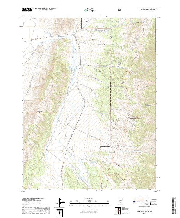
1981 Duck Creek Valley
White Pine County, NV
1981 Georgetta Ranch
White Pine County, NV
1981 Majors Place
White Pine County, NV
1981 North Schell Peak
White Pine County, NV
1981 South Schell Peak
White Pine County, NV
1981 Spring Creek Flat NW
White Pine County, NV
1981 Tippett Canyon
White Pine County, NV
1981 Weaver Canyon
White Pine County, NV
1982 Ayarbe Spring
White Pine County, NV
1982 Becky Peak
White Pine County, NV
1982 Borchert Spring
White Pine County, NV
1982 Cabin Spring
White Pine County, NV
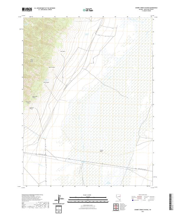
1982 Cherry Creek Station
White Pine County, NV
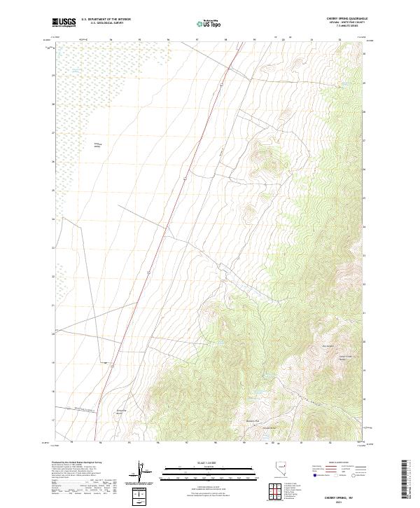
1982 Cherry Spring
White Pine County, NV
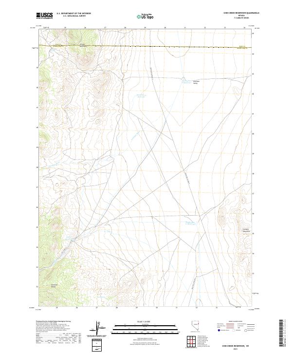
1982 Chin Creek Reservoir
White Pine County, NV
1982 Chin Creek Spring
White Pine County, NV
1982 Combs Creek
White Pine County, NV
1982 Cow Camp
White Pine County, NV
1982 Dickenson Well
White Pine County, NV
1982 Egan Canyon
White Pine County, NV
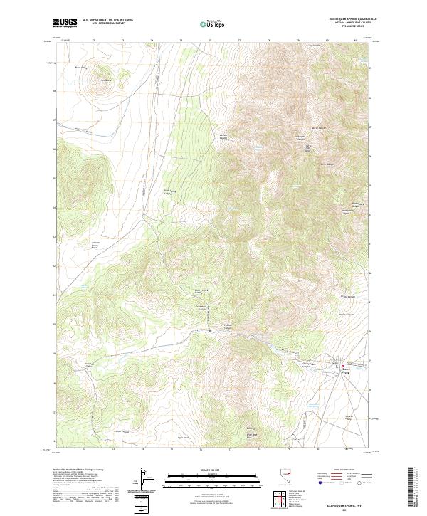
1982 Exchequer Spring
White Pine County, NV
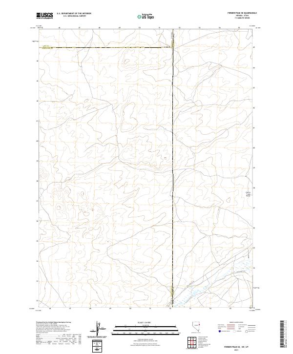
1982 Ferber Peak SE
White Pine County, NV
1982 Franks Well
White Pine County, NV
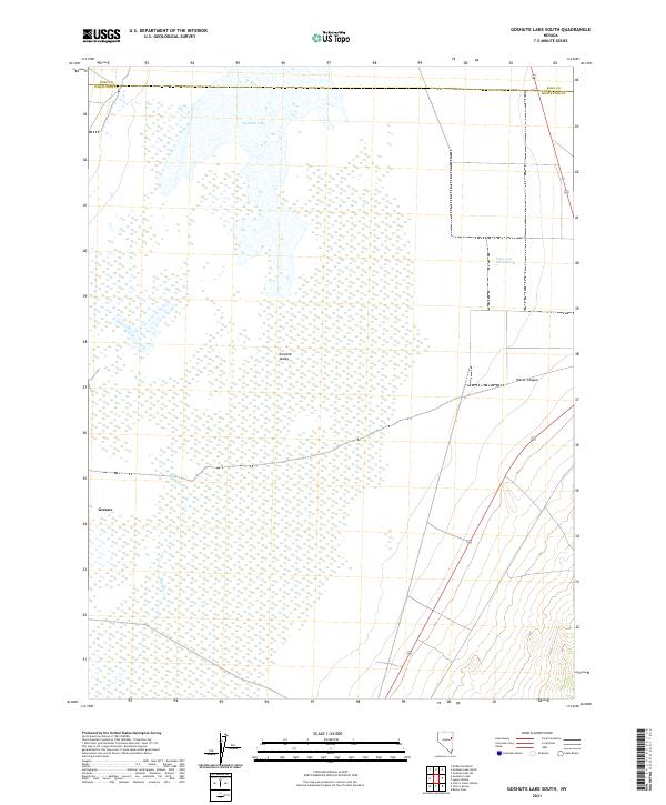
1982 Goshute Lake South
White Pine County, NV
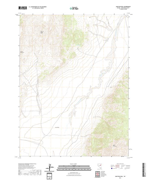
1982 Junction Well
White Pine County, NV
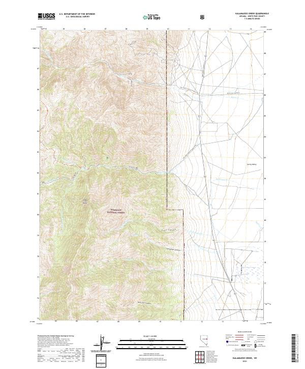
1982 Kalamazoo Creek
White Pine County, NV
1982 Kalamazoo Summit
White Pine County, NV
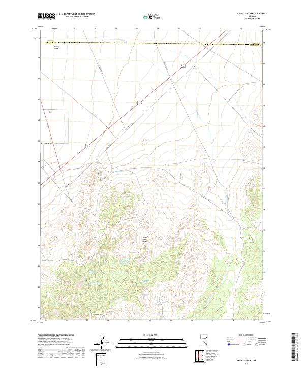
1982 Lages Station
White Pine County, NV
1982 Long Valley Slough
White Pine County, NV
1982 Mattier Creek
White Pine County, NV
1982 McBrides Sheep Well
White Pine County, NV
1982 Monte Neva Hot Springs
White Pine County, NV
1982 Ninemile Well NW
White Pine County, NV
1982 Ninemile Well
White Pine County, NV
1982 Schellbourne
White Pine County, NV
1982 Silver Canyon
White Pine County, NV
1982 Steptoe Ranch
White Pine County, NV
1982 Steptoe
White Pine County, NV
1982 Stonehouse
White Pine County, NV
1982 Sunshine Well NW
White Pine County, NV
1982 Sunshine Well
White Pine County, NV
1982 Telegraph Peak
White Pine County, NV
1982 Thirtymile Ranch
White Pine County, NV
1982 Tognini Spring
White Pine County, NV
1982 White Sage Well
White Pine County, NV
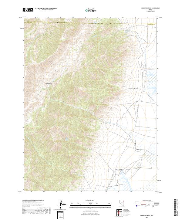
1984 Goshute Creek
White Pine County, NV

1984 High Bald Peaks SE
White Pine County, NV
1984 Paris Creek
White Pine County, NV
1984 Pot Spring
White Pine County, NV
1985 Newark Lake
White Pine County, NV
1985 Railroad Pass
White Pine County, NV
1985 Sherman Mtn
White Pine County, NV
1985 Walker Canyon
White Pine County, NV
1986 Baking Powder Flat
White Pine County, NV
1986 Baldy Peak
White Pine County, NV
1986 Big Hard Pan
White Pine County, NV
1986 Blue Mass Canyon
White Pine County, NV
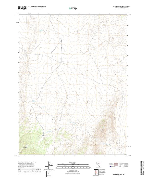
1986 Government Peak
White Pine County, NV
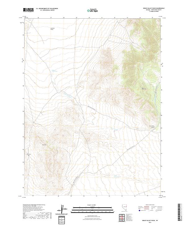
1986 Grass Valley Wash
White Pine County, NV
1986 Lehman Caves
White Pine County, NV
1986 Little Horse Canyon
White Pine County, NV
1986 Minerva
White Pine County, NV
1986 Mormon Jack Pass
White Pine County, NV
1986 Mount Moriah
White Pine County, NV
1986 Old Mans Canyon
White Pine County, NV
1986 Rock Springs Pass
White Pine County, NV
1986 Sixmile Canyon
White Pine County, NV
1986 Skinner Canyon
White Pine County, NV
1986 South Bastian Spring
White Pine County, NV
1986 The Cove
White Pine County, NV
1986 Third Butte East
White Pine County, NV
1986 Third Butte West
White Pine County, NV
1986 Tin Springs Mountain
White Pine County, NV
1986 Tippett Pass
White Pine County, NV
1986 Tippett
White Pine County, NV
1986 White Cloud Point
White Pine County, NV
1986 Yelland Dry Lake
White Pine County, NV
1987 Arch Canyon
White Pine County, NV
1987 Hogum
White Pine County, NV
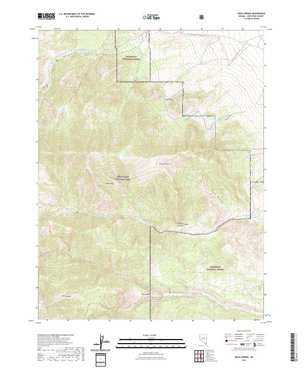
1987 Kious Spring
White Pine County, NV
1987 Minerva Canyon
White Pine County, NV
1987 Sacramento Pass
White Pine County, NV
1987 Wheeler Peak
White Pine County, NV
1987 Windy Peak
White Pine County, NV
1988 Kern Mountains
White Pine County, NV
1990 Antelope Mountain
White Pine County, NV
1990 Beck Pass
White Pine County, NV
1990 Big Bald Mountain
White Pine County, NV
1990 Blackjack Springs
White Pine County, NV
1990 Black Point
White Pine County, NV
1990 Buck Mountain East
White Pine County, NV
1990 Buck Mountain West
White Pine County, NV
1990 Cold Creek Ranch NW
White Pine County, NV
1990 Cold Creek Ranch
White Pine County, NV
1990 Currant Mountain
White Pine County, NV
1990 Diamond Peak
White Pine County, NV
1990 East of Pancake Summit
White Pine County, NV
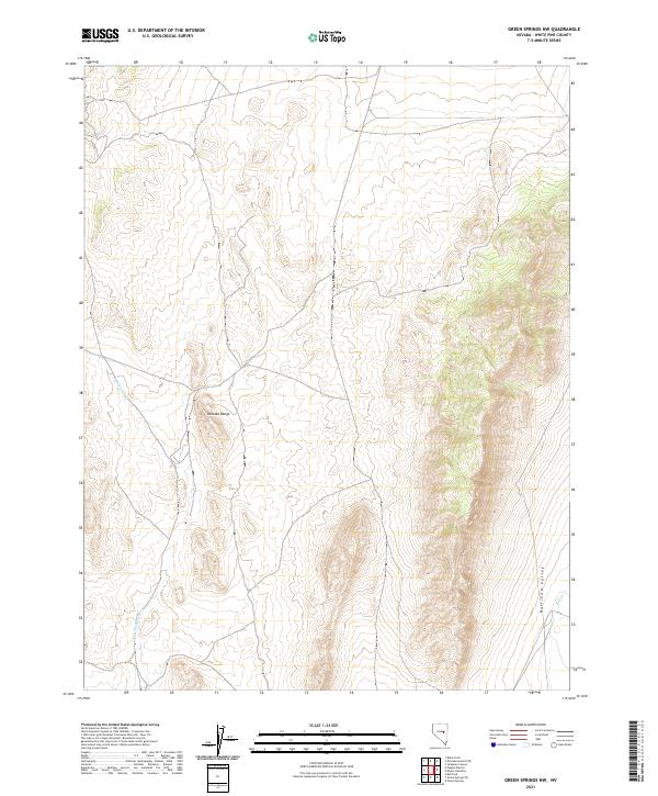
1990 Green Springs NW
White Pine County, NV
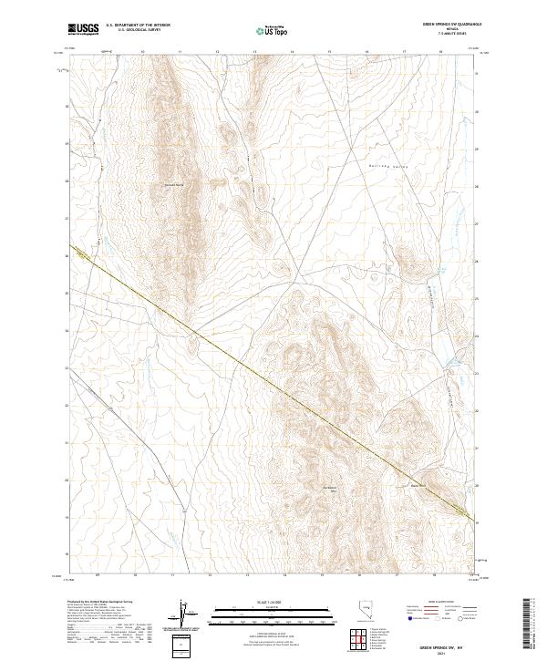
1990 Green Springs SW
White Pine County, NV
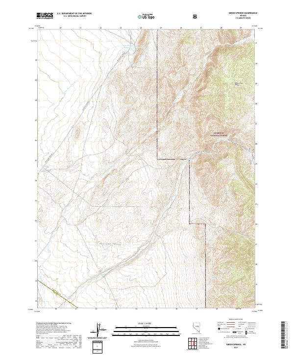
1990 Green Springs
White Pine County, NV
1990 Hamilton
White Pine County, NV
1990 Horse Track Spring
White Pine County, NV
1990 Illipah
White Pine County, NV
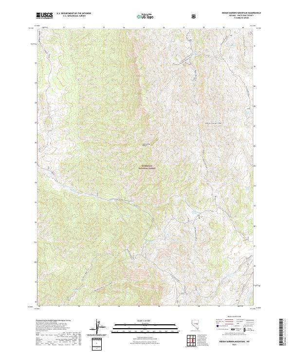
1990 Indian Garden Mtn
White Pine County, NV
1990 Limestone Peak
White Pine County, NV
1990 Lusetti Canyon
White Pine County, NV
1990 Marking Corral Summit
White Pine County, NV
1990 Mooney Basin Summit
White Pine County, NV
1990 Mt. Hamilton
White Pine County, NV
1990 Pancake Summit SW
White Pine County, NV
1990 Pancake Summit
White Pine County, NV
1990 Pogues Station
White Pine County, NV
1990 Preston Reservoir
White Pine County, NV
1990 Railroad Crossing Dam
White Pine County, NV
1990 Rattlesnake Mountain
White Pine County, NV
1990 Robinson Summit
White Pine County, NV
1990 Sammy Springs
White Pine County, NV
1990 Seligman Canyon
White Pine County, NV
1990 Silverado Mountain
White Pine County, NV
1990 Treasure Hill
White Pine County, NV
1990 Waldy Pond
White Pine County, NV
1990 Ward Charcoal Ovens
White Pine County, NV
1990 Ward Mountain
White Pine County, NV
1990 West of Beck Pass
White Pine County, NV
1990 Wheeler Peak
White Pine County, NV
1990 Willow Grove
White Pine County, NV
1993 Third Butte West
White Pine County, NV
2012 Antelope Mountain
White Pine County, NV
2012 Arch Canyon
White Pine County, NV
2012 Ayarbe Spring
White Pine County, NV
2012 Badger Hole Spring
White Pine County, NV
2012 Baking Powder Flat
White Pine County, NV
2012 Baldy Peak
White Pine County, NV
2012 Beck Pass
White Pine County, NV
2012 Becky Peak
White Pine County, NV
2012 Big Bald Mountain
White Pine County, NV
2012 Big Hard Pan
White Pine County, NV
2012 Big Springs
White Pine County, NV
2012 Blackjack Springs
White Pine County, NV
2012 Black Point
White Pine County, NV
2012 Blue Mass Canyon
White Pine County, NV
2012 Borchert Spring
White Pine County, NV
2012 Brown Knoll
White Pine County, NV
2012 Buck Mountain East
White Pine County, NV
2012 Buck Mountain West
White Pine County, NV

2012 Bullwhack Summit
White Pine County, NV
2012 Cabin Spring
White Pine County, NV
2012 Cattle Camp Spring
White Pine County, NV
2012 Cave Creek
White Pine County, NV
2012 Cave Mountain
White Pine County, NV
2012 Cherry Creek Station
White Pine County, NV
2012 Cherry Spring
White Pine County, NV
2012 Chin Creek Reservoir
White Pine County, NV
2012 Chin Creek Spring
White Pine County, NV
2012 Cleve Creek Baldy
White Pine County, NV
2012 Cold Creek Ranch NW
White Pine County, NV
2012 Cold Creek Ranch
White Pine County, NV
2012 Combs Creek
White Pine County, NV
2012 Comins Lake
White Pine County, NV
2012 Connors Pass
White Pine County, NV
2012 Cow Camp
White Pine County, NV
2012 Currant Mountain
White Pine County, NV
2012 Diamond Peak
White Pine County, NV
2012 Dickenson Well
White Pine County, NV
2012 Douglas
White Pine County, NV
2012 Duck Creek Valley
White Pine County, NV
2012 East Ely
White Pine County, NV
2012 East of Pancake Summit
White Pine County, NV
2012 Egan Canyon
White Pine County, NV
2012 Exchequer Spring
White Pine County, NV
2012 Ferber Peak SE
White Pine County, NV
2012 Franks Well
White Pine County, NV
2012 Georgetta Ranch
White Pine County, NV
2012 Giroux Wash
White Pine County, NV
2012 Goshute Creek
White Pine County, NV
2012 Goshute Lake South
White Pine County, NV
2012 Government Peak
White Pine County, NV
2012 Grass Valley Wash
White Pine County, NV
2012 Green Springs NW
White Pine County, NV
2012 Green Springs SW
White Pine County, NV
2012 Green Springs
White Pine County, NV
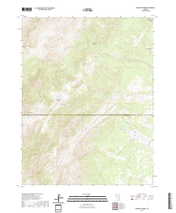
2012 Haggerty Spring
White Pine County, NV
2012 Hamilton
White Pine County, NV
2012 High Bald Peaks SE
White Pine County, NV
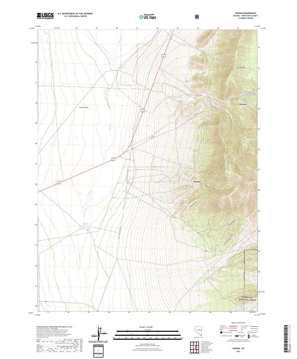
2012 Hogum
White Pine County, NV
2012 Horse Camp Springs
White Pine County, NV

2012 Horse Track Spring
White Pine County, NV
2012 Hunter Point
White Pine County, NV
2012 Illipah
White Pine County, NV
2012 Indian Garden Mountain
White Pine County, NV
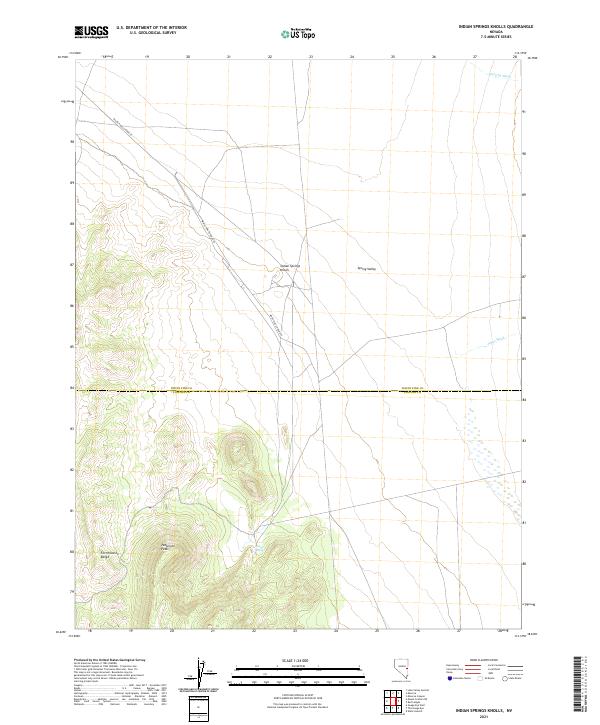
2012 Indian Springs Knolls
White Pine County, NV
2012 Junction Well
White Pine County, NV
2012 Kalamazoo Creek
White Pine County, NV
2012 Kalamazoo Summit
White Pine County, NV
2012 Kious Spring
White Pine County, NV
2012 Lages Station
White Pine County, NV
2012 Lake Valley Summit
White Pine County, NV
2012 Lehman Caves
White Pine County, NV
2012 Limestone Peak
White Pine County, NV
2012 Little Horse Canyon
White Pine County, NV
2012 Long Valley Slough
White Pine County, NV
2012 Lusetti Canyon
White Pine County, NV
2012 Majors Place
White Pine County, NV
2012 Marking Corral Summit
White Pine County, NV
2012 Mattier Creek
White Pine County, NV
2012 McBrides Sheep Well
White Pine County, NV
2012 Minerva Canyon
White Pine County, NV
2012 Minerva
White Pine County, NV
2012 Monte Neva Hot Springs
White Pine County, NV
2012 Mooney Basin Summit
White Pine County, NV
2012 Mormon Jack Pass
White Pine County, NV
2012 Mount Grafton NE
White Pine County, NV
2012 Mount Grafton
White Pine County, NV
2012 Mount Hamilton
White Pine County, NV
2012 Mount Moriah
White Pine County, NV
2012 Ninemile Well NW
White Pine County, NV
2012 Ninemile Well
White Pine County, NV
2012 North Schell Peak
White Pine County, NV
2012 North Spring Point
White Pine County, NV
2012 Old Mans Canyon
White Pine County, NV
2012 Pancake Summit SW
White Pine County, NV
2012 Pancake Summit
White Pine County, NV
2012 Paris Creek
White Pine County, NV
2012 Parker Station
White Pine County, NV
2012 Pogues Station
White Pine County, NV
2012 Pot Spring
White Pine County, NV
2012 Preston Reservoir
White Pine County, NV
2012 Railroad Crossing Dam
White Pine County, NV

2012 Railroad Pass
White Pine County, NV
2012 Rattlesnake Mountain
White Pine County, NV
2012 Red Ledges
White Pine County, NV
2012 Riepetown
White Pine County, NV
2012 Robinson Summit
White Pine County, NV
2012 Rock Springs Pass
White Pine County, NV
2012 Ruby Lake SE
White Pine County, NV
2012 Sacramento Pass
White Pine County, NV
2012 Sammy Springs
White Pine County, NV
2012 Sawmill Canyon
White Pine County, NV
2012 Schellbourne
White Pine County, NV
2012 Seligman Canyon
White Pine County, NV
2012 Sherman Mountain
White Pine County, NV
2012 Silverado Mountain
White Pine County, NV
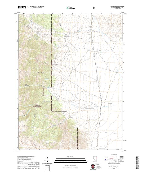
2012 Silver Canyon
White Pine County, NV
2012 Sixmile Canyon
White Pine County, NV
2012 Skinner Canyon
White Pine County, NV
2012 South Bastian Spring
White Pine County, NV
2012 South Schell Peak
White Pine County, NV
2012 Spring Creek Flat NW
White Pine County, NV
2012 Station Butte
White Pine County, NV
2012 Steptoe Ranch
White Pine County, NV
2012 Steptoe
White Pine County, NV
2012 Stonehouse
White Pine County, NV

2012 Sunset Reservoir
White Pine County, NV
2012 Sunshine Well NW
White Pine County, NV
2012 Sunshine Well
White Pine County, NV
2012 Telegraph Peak
White Pine County, NV
2012 The Cove
White Pine County, NV
2012 Third Butte East
White Pine County, NV
2012 Third Butte West
White Pine County, NV
2012 Thirtymile Ranch
White Pine County, NV
2012 Tin Springs Mountain
White Pine County, NV
2012 Tippett Canyon
White Pine County, NV
2012 Tippett Pass
White Pine County, NV
2012 Tippett
White Pine County, NV
2012 Tognini Spring
White Pine County, NV
2012 Treasure Hill
White Pine County, NV
2012 Waldy Pond
White Pine County, NV
2012 Walker Canyon
White Pine County, NV
2012 Ward Charcoal Ovens
White Pine County, NV
2012 Ward Mountain
White Pine County, NV
2012 Weaver Canyon
White Pine County, NV
2012 West of Beck Pass
White Pine County, NV
2012 Wheeler Peak
White Pine County, NV
2012 White Cloud Point
White Pine County, NV
2012 White Rock Creek
White Pine County, NV
2012 White Sage Well
White Pine County, NV
2012 Willow Grove
White Pine County, NV
2012 Windy Peak
White Pine County, NV
2012 Yelland Dry Lake
White Pine County, NV
2014 Antelope Mountain
White Pine County, NV
2014 Arch Canyon
White Pine County, NV
2014 Ayarbe Spring
White Pine County, NV
2014 Badger Hole Spring
White Pine County, NV
2014 Baking Powder Flat
White Pine County, NV
2014 Baldy Peak
White Pine County, NV
2014 Beck Pass
White Pine County, NV
2014 Becky Peak
White Pine County, NV
2014 Big Bald Mountain
White Pine County, NV
2014 Big Hard Pan
White Pine County, NV
2014 Blackjack Springs
White Pine County, NV
2014 Black Point
White Pine County, NV
2014 Blue Mass Canyon
White Pine County, NV
2014 Borchert Spring
White Pine County, NV
2014 Brown Knoll
White Pine County, NV
2014 Buck Mountain East
White Pine County, NV
2014 Buck Mountain West
White Pine County, NV
2014 Bullwhack Summit
White Pine County, NV
2014 Cabin Spring
White Pine County, NV
2014 Cattle Camp Spring
White Pine County, NV
2014 Cave Creek
White Pine County, NV
2014 Cave Mountain
White Pine County, NV
2014 Cherry Creek Station
White Pine County, NV
2014 Chin Creek Reservoir
White Pine County, NV
2014 Chin Creek Spring
White Pine County, NV
2014 Cleve Creek Baldy
White Pine County, NV
2014 Cold Creek Ranch NW
White Pine County, NV
2014 Cold Creek Ranch
White Pine County, NV
2014 Combs Creek
White Pine County, NV
2014 Comins Lake
White Pine County, NV
2014 Connors Pass
White Pine County, NV
2014 Cow Camp
White Pine County, NV
2014 Currant Mountain
White Pine County, NV
2014 Diamond Peak
White Pine County, NV
2014 Dickenson Well
White Pine County, NV
2014 Douglas
White Pine County, NV
2014 Duck Creek Valley
White Pine County, NV
2014 East Ely
White Pine County, NV
2014 East of Pancake Summit
White Pine County, NV
2014 Egan Canyon
White Pine County, NV
2014 Franks Well
White Pine County, NV
2014 Georgetta Ranch
White Pine County, NV
2014 Giroux Wash
White Pine County, NV
2014 Goshute Creek
White Pine County, NV
2014 Goshute Lake South
White Pine County, NV
2014 Government Peak
White Pine County, NV
2014 Grass Valley Wash
White Pine County, NV
2014 Green Springs NW
White Pine County, NV
2014 Green Springs SW
White Pine County, NV
2014 Green Springs
White Pine County, NV
2014 Haggerty Spring
White Pine County, NV
2014 Hamilton
White Pine County, NV
2014 High Bald Peaks SE
White Pine County, NV
2014 Hogum
White Pine County, NV
2014 Horse Camp Springs
White Pine County, NV
2014 Horse Track Spring
White Pine County, NV
2014 Hunter Point
White Pine County, NV
2014 Illipah
White Pine County, NV
2014 Indian Garden Mountain
White Pine County, NV
2014 Indian Springs Knolls
White Pine County, NV
2014 Junction Well
White Pine County, NV
2014 Kalamazoo Creek
White Pine County, NV
2014 Kalamazoo Summit
White Pine County, NV
2014 Kious Spring
White Pine County, NV
2014 Lehman Caves
White Pine County, NV
2014 Limestone Peak
White Pine County, NV
2014 Little Horse Canyon
White Pine County, NV
2014 Long Valley Slough
White Pine County, NV
2014 Majors Place
White Pine County, NV
2014 Marking Corral Summit
White Pine County, NV
2014 Mattier Creek
White Pine County, NV
2014 McBrides Sheep Well
White Pine County, NV
2014 Minerva Canyon
White Pine County, NV
2014 Minerva
White Pine County, NV
2014 Mooney Basin Summit
White Pine County, NV
2014 Mormon Jack Pass
White Pine County, NV
2014 Mount Grafton NE
White Pine County, NV
2014 Mount Grafton
White Pine County, NV
2014 Mount Hamilton
White Pine County, NV
2014 Ninemile Well NW
White Pine County, NV
2014 Ninemile Well
White Pine County, NV
2014 North Schell Peak
White Pine County, NV
2014 North Spring Point
White Pine County, NV
2014 Old Mans Canyon
White Pine County, NV
2014 Pancake Summit SW
White Pine County, NV
2014 Pancake Summit
White Pine County, NV
2014 Parker Station
White Pine County, NV
2014 Pogues Station
White Pine County, NV
2014 Pot Spring
White Pine County, NV
2014 Preston Reservoir
White Pine County, NV
2014 Railroad Crossing Dam
White Pine County, NV
2014 Railroad Pass
White Pine County, NV
2014 Rattlesnake Mountain
White Pine County, NV
2014 Red Ledges
White Pine County, NV
2014 Riepetown
White Pine County, NV
2014 Robinson Summit
White Pine County, NV
2014 Rock Springs Pass
White Pine County, NV
2014 Ruby Lake SE
White Pine County, NV
2014 Sacramento Pass
White Pine County, NV
2014 Sammy Springs
White Pine County, NV
2014 Sawmill Canyon
White Pine County, NV
2014 Schellbourne
White Pine County, NV
2014 Seligman Canyon
White Pine County, NV
2014 Sherman Mountain
White Pine County, NV
2014 Silverado Mountain
White Pine County, NV
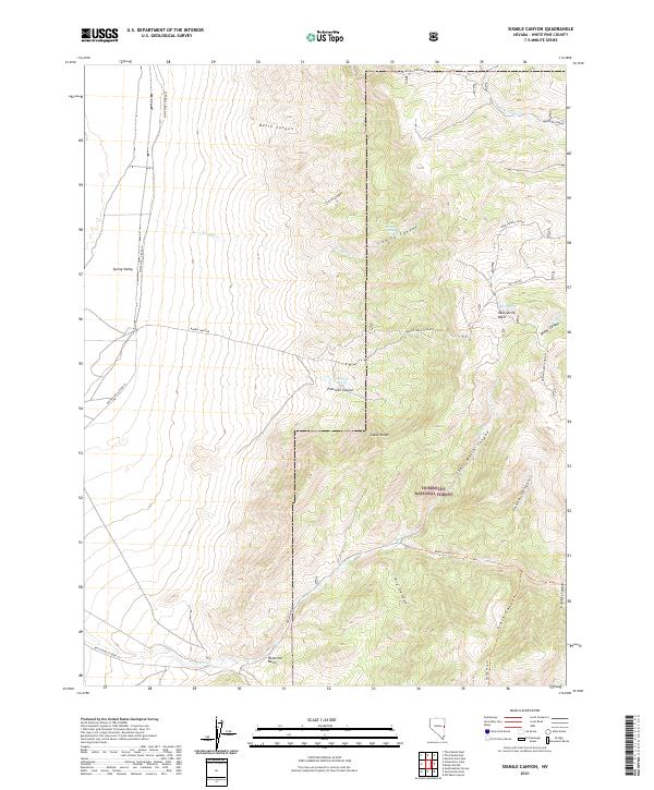
2014 Silver Canyon
White Pine County, NV
2014 Sixmile Canyon
White Pine County, NV
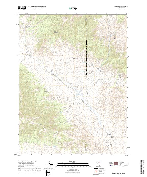
2014 Skinner Canyon
White Pine County, NV
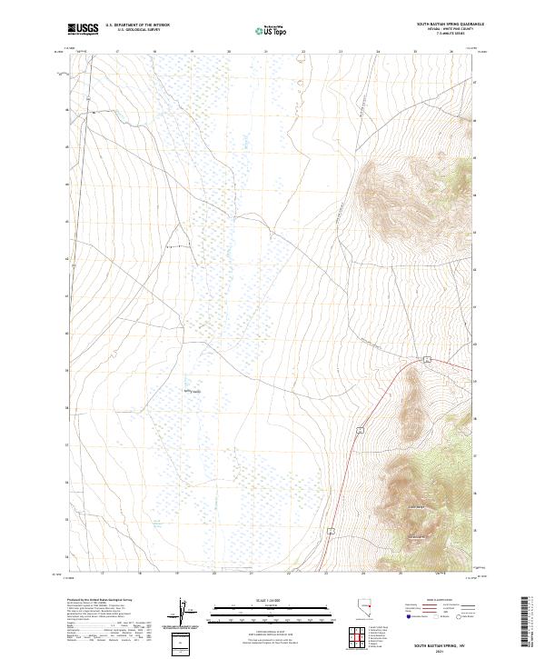
2014 South Bastian Spring
White Pine County, NV
2014 South Schell Peak
White Pine County, NV
2014 Spring Creek Flat NW
White Pine County, NV
2014 Station Butte
White Pine County, NV
2014 Steptoe Ranch
White Pine County, NV
2014 Steptoe
White Pine County, NV
2014 Stonehouse
White Pine County, NV
2014 Sunset Reservoir
White Pine County, NV
2014 Sunshine Well NW
White Pine County, NV
2014 Sunshine Well
White Pine County, NV
2014 Telegraph Peak
White Pine County, NV
2014 Third Butte East
White Pine County, NV
2014 Thirtymile Ranch
White Pine County, NV
2014 Tin Springs Mountain
White Pine County, NV
2014 Tippett Canyon
White Pine County, NV
2014 Tippett Pass
White Pine County, NV
2014 Tippett
White Pine County, NV
2014 Tognini Spring
White Pine County, NV
2014 Treasure Hill
White Pine County, NV

2014 Waldy Pond
White Pine County, NV
2014 Walker Canyon
White Pine County, NV
2014 Ward Charcoal Ovens
White Pine County, NV
2014 Ward Mountain
White Pine County, NV
2014 Weaver Canyon
White Pine County, NV
2014 West of Beck Pass
White Pine County, NV
2014 Wheeler Peak
White Pine County, NV
2014 White Cloud Point
White Pine County, NV
2014 White Sage Well
White Pine County, NV
2014 Willow Grove
White Pine County, NV
2014 Yelland Dry Lake
White Pine County, NV
2015 Big Springs
White Pine County, NV
2015 Cherry Spring
White Pine County, NV
2015 Exchequer Spring
White Pine County, NV
2015 Ferber Peak SE
White Pine County, NV
2015 Lages Station
White Pine County, NV
2015 Lake Valley Summit
White Pine County, NV
2015 Lusetti Canyon
White Pine County, NV
2015 Monte Neva Hot Springs
White Pine County, NV
2015 Mount Moriah
White Pine County, NV
2015 Paris Creek
White Pine County, NV
2015 The Cove
White Pine County, NV
2015 Third Butte West
White Pine County, NV
2015 White Rock Creek
White Pine County, NV
2015 Windy Peak
White Pine County, NV
2018 Antelope Mountain
White Pine County, NV
2018 Arch Canyon
White Pine County, NV
2018 Ayarbe Spring
White Pine County, NV
2018 Badger Hole Spring
White Pine County, NV
2018 Baking Powder Flat
White Pine County, NV
2018 Baldy Peak
White Pine County, NV
2018 Beck Pass
White Pine County, NV
2018 Becky Peak
White Pine County, NV
2018 Big Bald Mountain
White Pine County, NV
2018 Big Hard Pan
White Pine County, NV
2018 Big Springs
White Pine County, NV
2018 Blackjack Springs
White Pine County, NV
2018 Black Point
White Pine County, NV
2018 Blue Mass Canyon
White Pine County, NV
2018 Borchert Spring
White Pine County, NV
2018 Brown Knoll
White Pine County, NV
2018 Buck Mountain East
White Pine County, NV
2018 Buck Mountain West
White Pine County, NV
2018 Bullwhack Summit
White Pine County, NV
2018 Cabin Spring
White Pine County, NV
2018 Cattle Camp Spring
White Pine County, NV
2018 Cave Creek
White Pine County, NV
2018 Cave Mountain
White Pine County, NV
2018 Cherry Creek Station
White Pine County, NV
2018 Cherry Spring
White Pine County, NV
2018 Chin Creek Reservoir
White Pine County, NV
2018 Chin Creek Spring
White Pine County, NV
2018 Cleve Creek Baldy
White Pine County, NV
2018 Cold Creek Ranch NW
White Pine County, NV
2018 Cold Creek Ranch
White Pine County, NV
2018 Combs Creek
White Pine County, NV
2018 Comins Lake
White Pine County, NV
2018 Connors Pass
White Pine County, NV

2018 Cow Camp
White Pine County, NV
2018 Currant Mountain
White Pine County, NV
2018 Diamond Peak
White Pine County, NV
2018 Dickenson Well
White Pine County, NV
2018 Douglas
White Pine County, NV
2018 Duck Creek Valley
White Pine County, NV
2018 East Ely
White Pine County, NV
2018 East of Pancake Summit
White Pine County, NV
2018 Egan Canyon
White Pine County, NV
2018 Exchequer Spring
White Pine County, NV
2018 Ferber Peak SE
White Pine County, NV
2018 Franks Well
White Pine County, NV
2018 Georgetta Ranch
White Pine County, NV
2018 Giroux Wash
White Pine County, NV
2018 Goshute Creek
White Pine County, NV
2018 Goshute Lake South
White Pine County, NV
2018 Government Peak
White Pine County, NV
2018 Grass Valley Wash
White Pine County, NV
2018 Green Springs NW
White Pine County, NV
2018 Green Springs SW
White Pine County, NV
2018 Green Springs
White Pine County, NV
2018 Haggerty Spring
White Pine County, NV
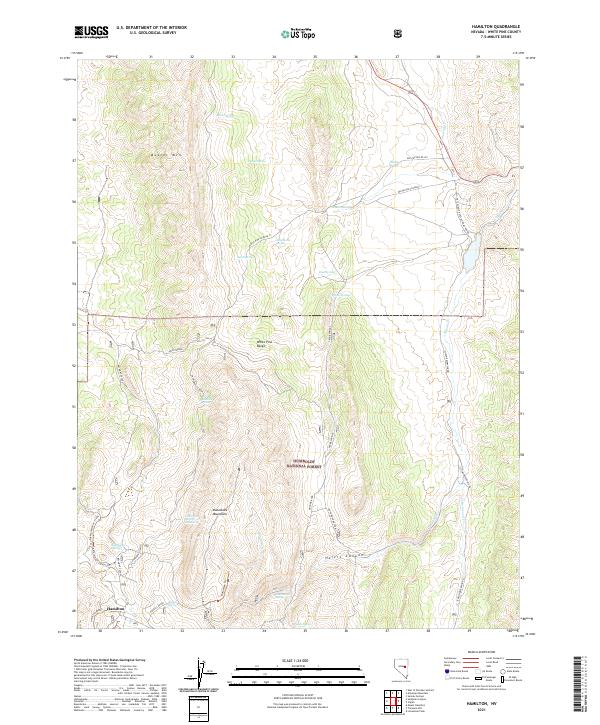
2018 Hamilton
White Pine County, NV
2018 High Bald Peaks SE
White Pine County, NV
2018 Hogum
White Pine County, NV
2018 Horse Camp Springs
White Pine County, NV
2018 Horse Track Spring
White Pine County, NV
2018 Hunter Point
White Pine County, NV
2018 Illipah
White Pine County, NV
2018 Indian Garden Mountain
White Pine County, NV
2018 Indian Springs Knolls
White Pine County, NV
2018 Junction Well
White Pine County, NV
2018 Kalamazoo Creek
White Pine County, NV
2018 Kalamazoo Summit
White Pine County, NV
2018 Kious Spring
White Pine County, NV
2018 Lages Station
White Pine County, NV
2018 Lake Valley Summit
White Pine County, NV
2018 Lehman Caves
White Pine County, NV
2018 Limestone Peak
White Pine County, NV
2018 Little Horse Canyon
White Pine County, NV
2018 Long Valley Slough
White Pine County, NV
2018 Lusetti Canyon
White Pine County, NV
2018 Majors Place
White Pine County, NV
2018 Marking Corral Summit
White Pine County, NV
2018 Mattier Creek
White Pine County, NV
2018 McBrides Sheep Well
White Pine County, NV
2018 Minerva Canyon
White Pine County, NV
2018 Minerva
White Pine County, NV
2018 Monte Neva Hot Springs
White Pine County, NV
2018 Mooney Basin Summit
White Pine County, NV
2018 Mormon Jack Pass
White Pine County, NV
2018 Mount Grafton NE
White Pine County, NV
2018 Mount Grafton
White Pine County, NV
2018 Mount Hamilton
White Pine County, NV
2018 Mount Moriah
White Pine County, NV
2018 Ninemile Well NW
White Pine County, NV
2018 Ninemile Well
White Pine County, NV
2018 North Schell Peak
White Pine County, NV
2018 North Spring Point
White Pine County, NV
2018 Old Mans Canyon
White Pine County, NV
2018 Pancake Summit SW
White Pine County, NV
2018 Pancake Summit
White Pine County, NV
2018 Paris Creek
White Pine County, NV
2018 Parker Station
White Pine County, NV
2018 Pogues Station
White Pine County, NV
2018 Pot Spring
White Pine County, NV
2018 Preston Reservoir
White Pine County, NV
2018 Railroad Crossing Dam
White Pine County, NV
2018 Railroad Pass
White Pine County, NV
2018 Rattlesnake Mountain
White Pine County, NV
2018 Red Ledges
White Pine County, NV
2018 Riepetown
White Pine County, NV
2018 Robinson Summit
White Pine County, NV
2018 Rock Springs Pass
White Pine County, NV
2018 Ruby Lake SE
White Pine County, NV
2018 Sacramento Pass
White Pine County, NV
2018 Sammy Springs
White Pine County, NV
2018 Sawmill Canyon
White Pine County, NV
2018 Schellbourne
White Pine County, NV
2018 Seligman Canyon
White Pine County, NV
2018 Sherman Mountain
White Pine County, NV
2018 Silverado Mountain
White Pine County, NV
2018 Silver Canyon
White Pine County, NV
2018 Sixmile Canyon
White Pine County, NV
2018 Skinner Canyon
White Pine County, NV
2018 South Bastian Spring
White Pine County, NV
2018 South Schell Peak
White Pine County, NV
2018 Spring Creek Flat NW
White Pine County, NV
2018 Station Butte
White Pine County, NV
2018 Steptoe Ranch
White Pine County, NV
2018 Steptoe
White Pine County, NV
2018 Stonehouse
White Pine County, NV
2018 Sunset Reservoir
White Pine County, NV
2018 Sunshine Well NW
White Pine County, NV
2018 Sunshine Well
White Pine County, NV
2018 Telegraph Peak
White Pine County, NV
2018 The Cove
White Pine County, NV
2018 Third Butte East
White Pine County, NV
2018 Third Butte West
White Pine County, NV
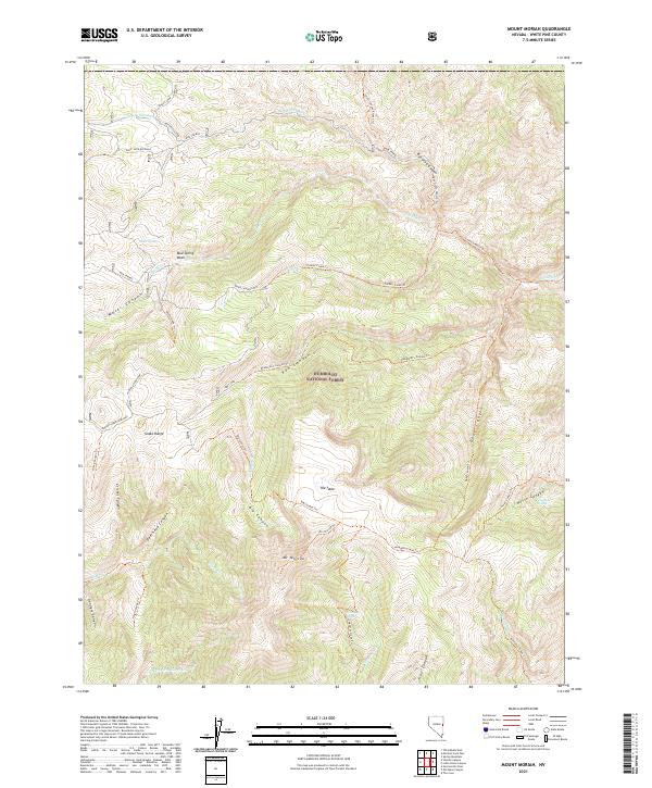
2018 Thirtymile Ranch
White Pine County, NV
2018 Tin Springs Mountain
White Pine County, NV
2018 Tippett Canyon
White Pine County, NV
2018 Tippett Pass
White Pine County, NV
2018 Tippett
White Pine County, NV
2018 Tognini Spring
White Pine County, NV
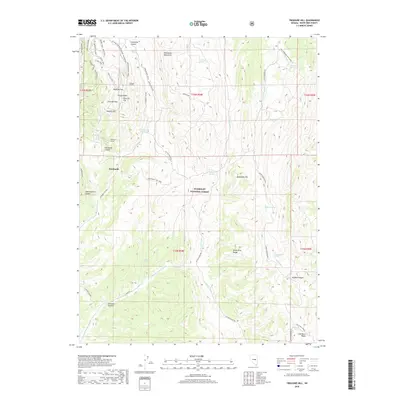
2018 Treasure Hill
White Pine County, NV
2018 Waldy Pond
White Pine County, NV
2018 Walker Canyon
White Pine County, NV
2018 Ward Charcoal Ovens
White Pine County, NV
2018 Ward Mountain
White Pine County, NV
2018 Weaver Canyon
White Pine County, NV
2018 West of Beck Pass
White Pine County, NV
2018 Wheeler Peak
White Pine County, NV
2018 White Cloud Point
White Pine County, NV
2018 White Rock Creek
White Pine County, NV
2018 White Sage Well
White Pine County, NV
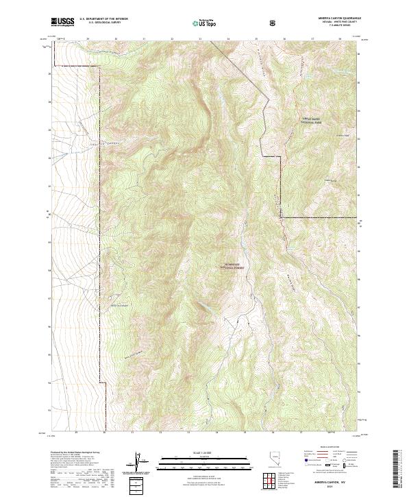
2018 Willow Grove
White Pine County, NV
2018 Windy Peak
White Pine County, NV
2018 Yelland Dry Lake
White Pine County, NV
2021 Antelope Mountain
White Pine County, NV
2021 Arch Canyon
White Pine County, NV
2021 Ayarbe Spring
White Pine County, NV
2021 Badger Hole Spring
White Pine County, NV
2021 Baking Powder Flat
White Pine County, NV
2021 Baldy Peak
White Pine County, NV
2021 Beck Pass
White Pine County, NV
2021 Becky Peak
White Pine County, NV
2021 Big Bald Mountain
White Pine County, NV
2021 Big Hard Pan
White Pine County, NV
2021 Big Springs
White Pine County, NV
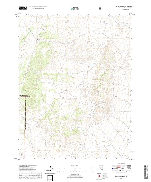
2021 Blackjack Springs
White Pine County, NV
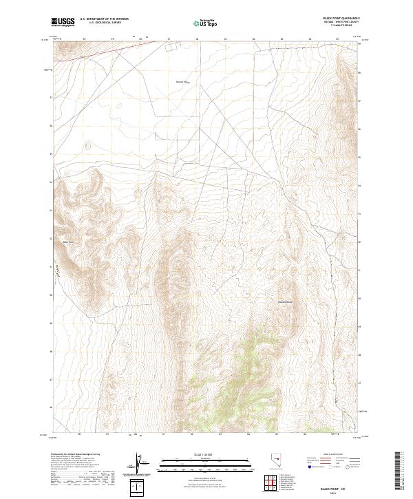
2021 Black Point
White Pine County, NV
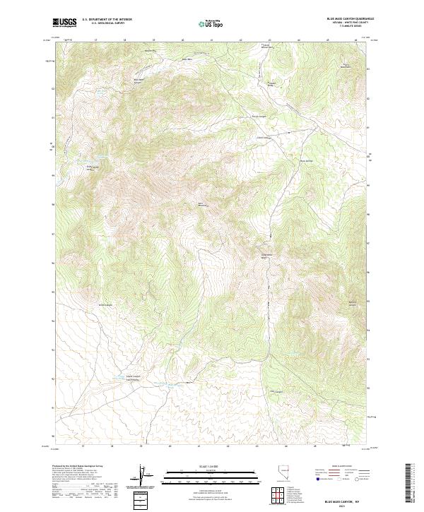
2021 Blue Mass Canyon
White Pine County, NV
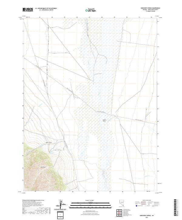
2021 Borchert Spring
White Pine County, NV
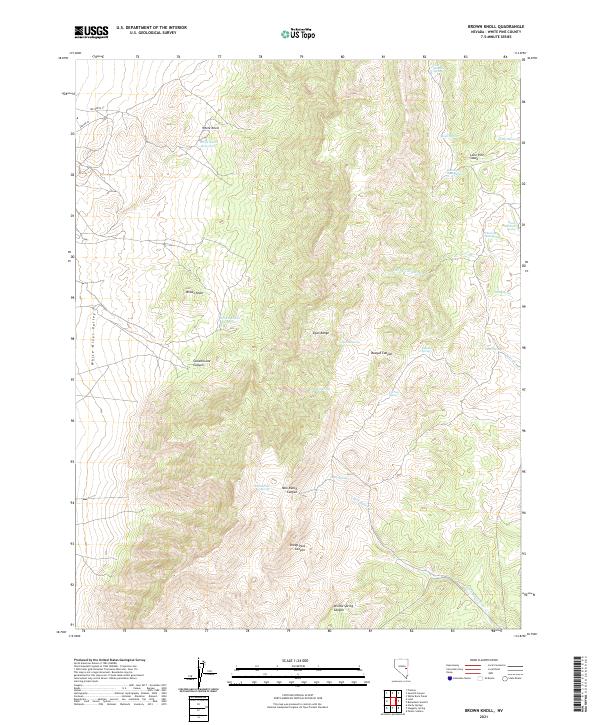
2021 Brown Knoll
White Pine County, NV
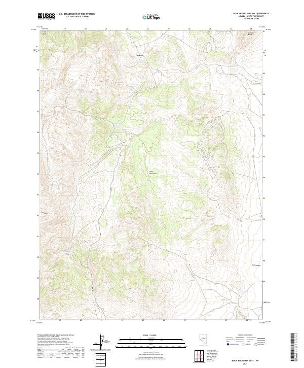
2021 Buck Mountain East
White Pine County, NV
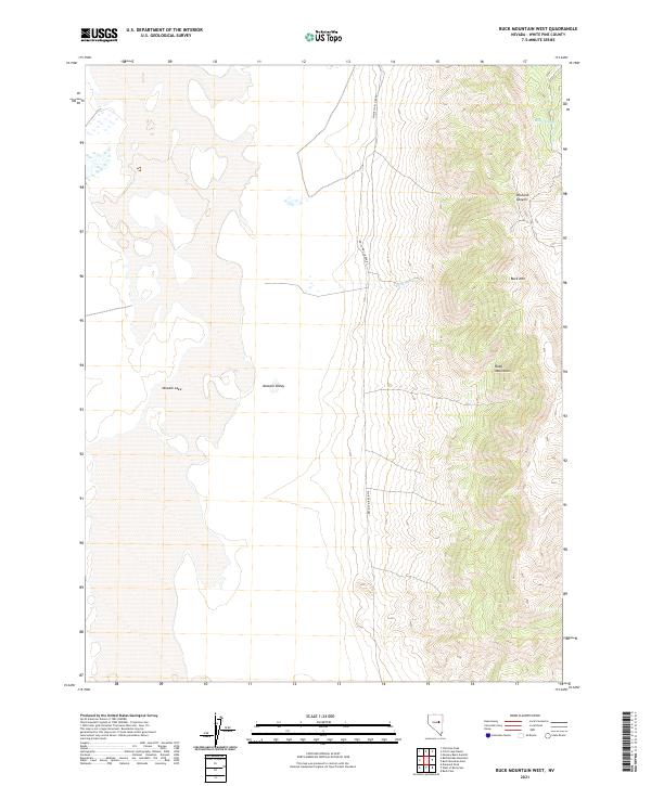
2021 Buck Mountain West
White Pine County, NV
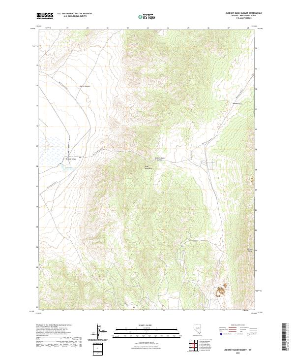
2021 Bullwhack Summit
White Pine County, NV
2021 Cabin Spring
White Pine County, NV
2021 Cattle Camp Spring
White Pine County, NV
2021 Cave Creek
White Pine County, NV
2021 Cave Mountain
White Pine County, NV
2021 Cherry Creek Station
White Pine County, NV
2021 Cherry Spring
White Pine County, NV
2021 Chin Creek Reservoir
White Pine County, NV
2021 Chin Creek Spring
White Pine County, NV
2021 Cleve Creek Baldy
White Pine County, NV
2021 Cold Creek Ranch NW
White Pine County, NV
2021 Cold Creek Ranch
White Pine County, NV
2021 Combs Creek
White Pine County, NV
2021 Comins Lake
White Pine County, NV
2021 Connors Pass
White Pine County, NV
2021 Cow Camp
White Pine County, NV
2021 Currant Mountain
White Pine County, NV
2021 Diamond Peak
White Pine County, NV
2021 Dickenson Well
White Pine County, NV
2021 Douglas
White Pine County, NV
2021 Duck Creek Valley
White Pine County, NV
2021 East Ely
White Pine County, NV
2021 East of Pancake Summit
White Pine County, NV
2021 Egan Canyon
White Pine County, NV
2021 Exchequer Spring
White Pine County, NV
2021 Ferber Peak SE
White Pine County, NV
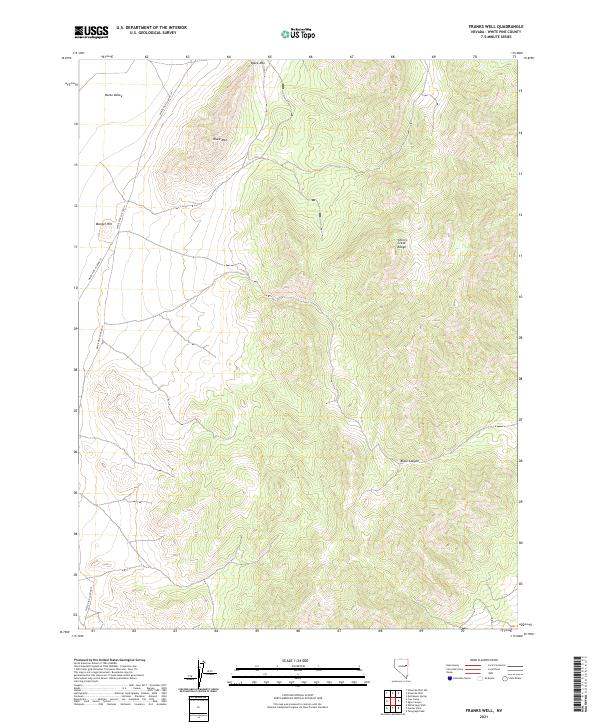
2021 Franks Well
White Pine County, NV
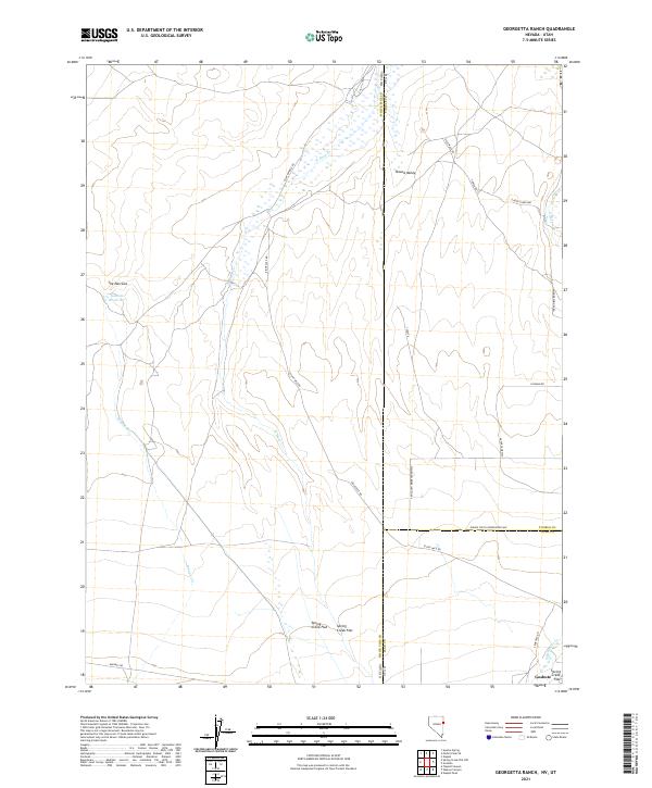
2021 Georgetta Ranch
White Pine County, NV
2021 Giroux Wash
White Pine County, NV
2021 Goshute Creek
White Pine County, NV
2021 Goshute Lake South
White Pine County, NV
2021 Government Peak
White Pine County, NV
2021 Grass Valley Wash
White Pine County, NV
2021 Green Springs NW
White Pine County, NV
2021 Green Springs SW
White Pine County, NV
2021 Green Springs
White Pine County, NV
2021 Haggerty Spring
White Pine County, NV
2021 Hamilton
White Pine County, NV
2021 High Bald Peaks SE
White Pine County, NV
2021 Hogum
White Pine County, NV
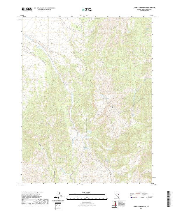
2021 Horse Camp Springs
White Pine County, NV
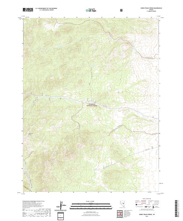
2021 Horse Track Spring
White Pine County, NV
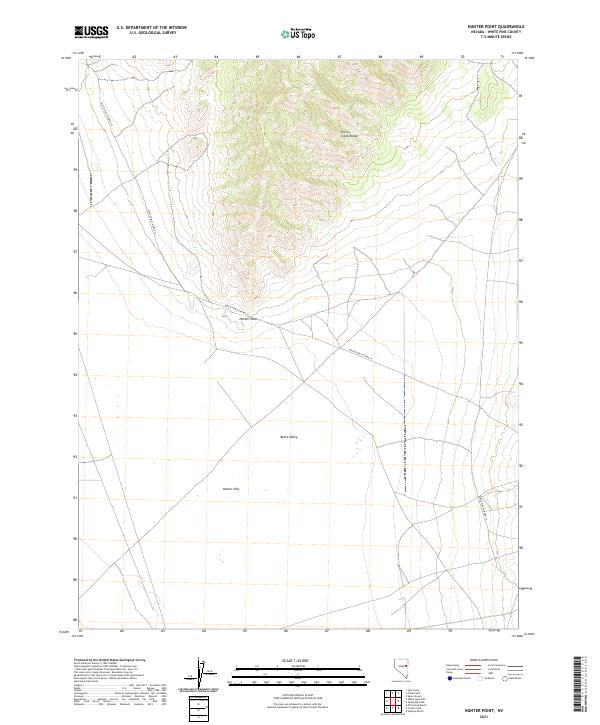
2021 Hunter Point
White Pine County, NV
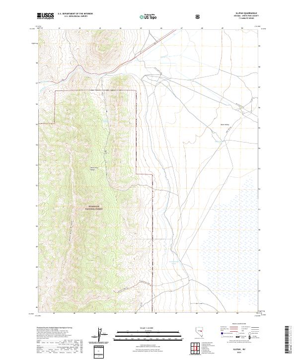
2021 Illipah
White Pine County, NV
2021 Indian Garden Mountain
White Pine County, NV
2021 Indian Springs Knolls
White Pine County, NV
2021 Junction Well
White Pine County, NV
2021 Kalamazoo Creek
White Pine County, NV
2021 Kalamazoo Summit
White Pine County, NV
2021 Kious Spring
White Pine County, NV
2021 Lages Station
White Pine County, NV
2021 Lake Valley Summit
White Pine County, NV
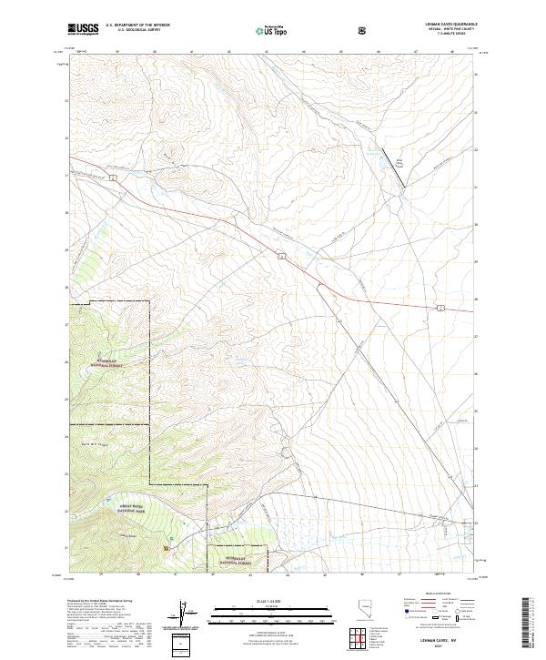
2021 Lehman Caves
White Pine County, NV
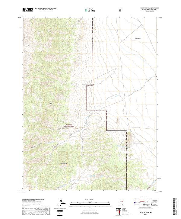
2021 Limestone Peak
White Pine County, NV
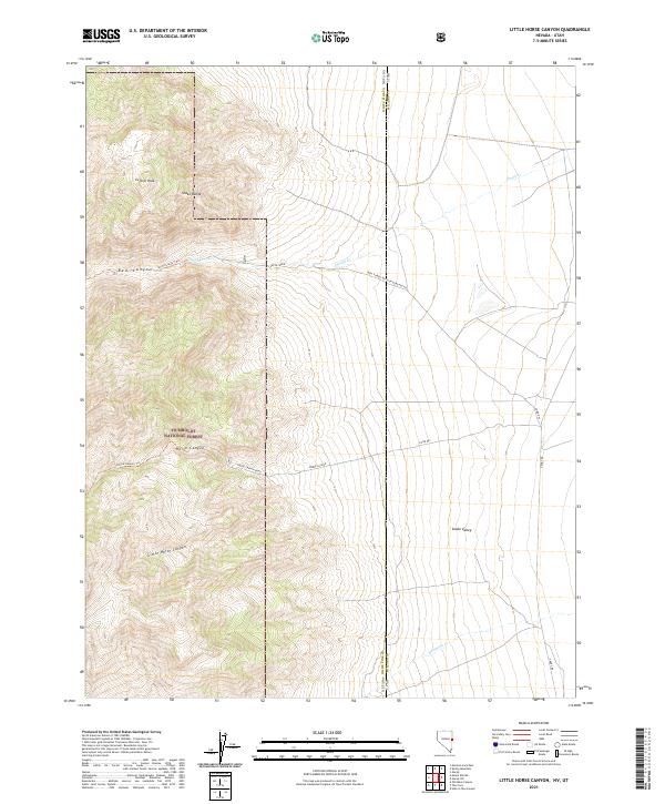
2021 Little Horse Canyon
White Pine County, NV

2021 Long Valley Slough
White Pine County, NV
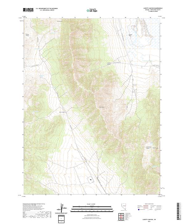
2021 Lusetti Canyon
White Pine County, NV
2021 Majors Place
White Pine County, NV
2021 Marking Corral Summit
White Pine County, NV
2021 Mattier Creek
White Pine County, NV
2021 McBrides Sheep Well
White Pine County, NV
2021 Minerva Canyon
White Pine County, NV
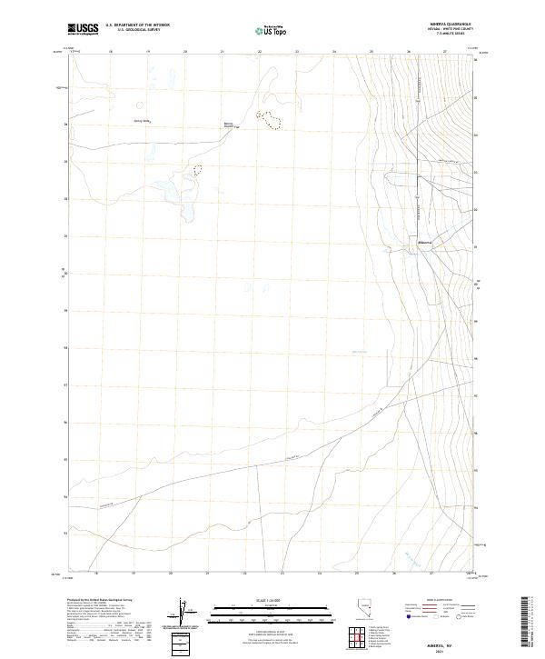
2021 Minerva
White Pine County, NV
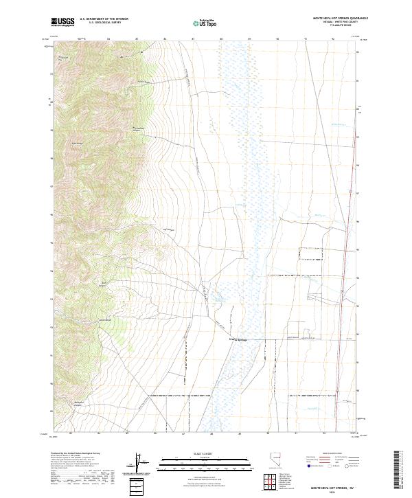
2021 Monte Neva Hot Springs
White Pine County, NV
2021 Mooney Basin Summit
White Pine County, NV
2021 Mormon Jack Pass
White Pine County, NV
2021 Mount Grafton NE
White Pine County, NV
2021 Mount Grafton
White Pine County, NV
2021 Mount Hamilton
White Pine County, NV
2021 Mount Moriah
White Pine County, NV
2021 Ninemile Well NW
White Pine County, NV
2021 Ninemile Well
White Pine County, NV
2021 North Schell Peak
White Pine County, NV
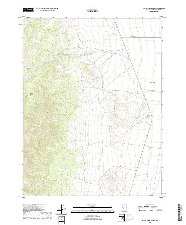
2021 North Spring Point
White Pine County, NV
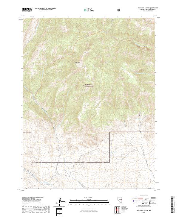
2021 Old Mans Canyon
White Pine County, NV
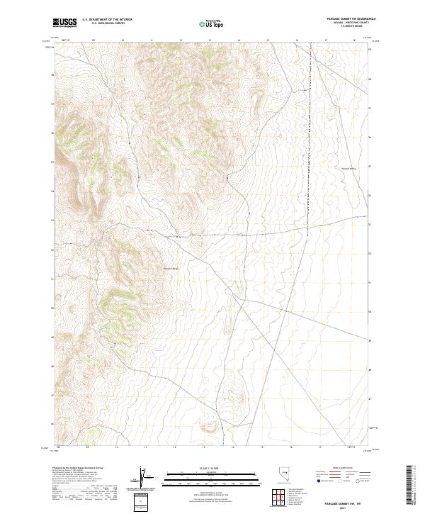
2021 Pancake Summit SW
White Pine County, NV
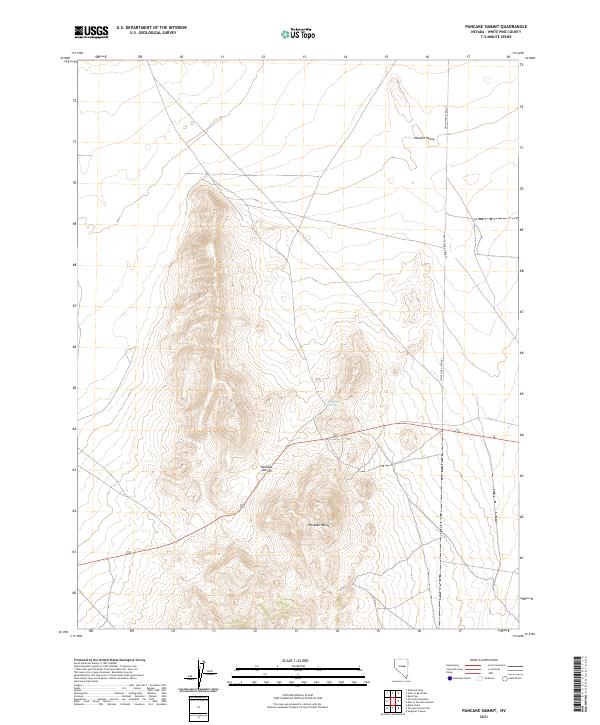
2021 Pancake Summit
White Pine County, NV
2021 Paris Creek
White Pine County, NV
2021 Parker Station
White Pine County, NV
2021 Pogues Station
White Pine County, NV
2021 Pot Spring
White Pine County, NV
2021 Preston Reservoir
White Pine County, NV
2021 Railroad Crossing Dam
White Pine County, NV
2021 Railroad Pass
White Pine County, NV
2021 Rattlesnake Mountain
White Pine County, NV
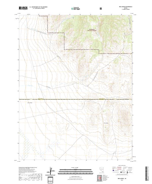
2021 Red Ledges
White Pine County, NV
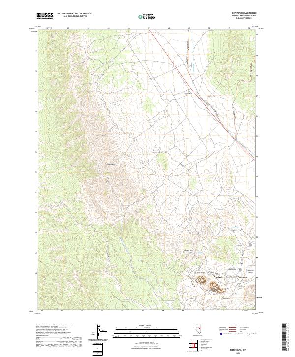
2021 Riepetown
White Pine County, NV
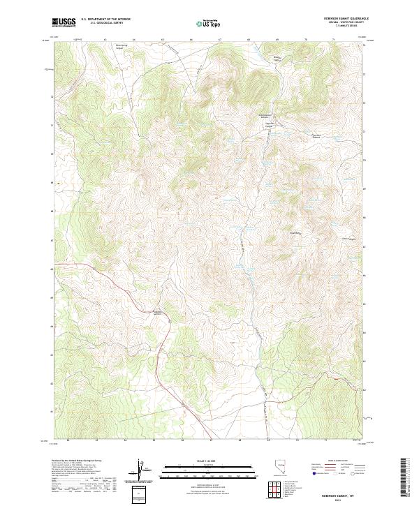
2021 Robinson Summit
White Pine County, NV
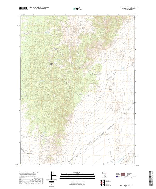
2021 Rock Springs Pass
White Pine County, NV
2021 Ruby Lake SE
White Pine County, NV
2021 Sacramento Pass
White Pine County, NV
2021 Sammy Springs
White Pine County, NV
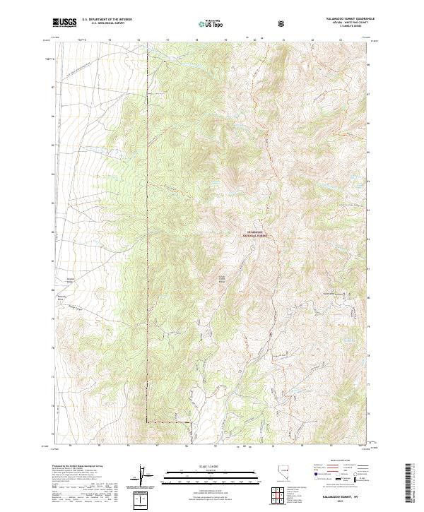
2021 Sawmill Canyon
White Pine County, NV
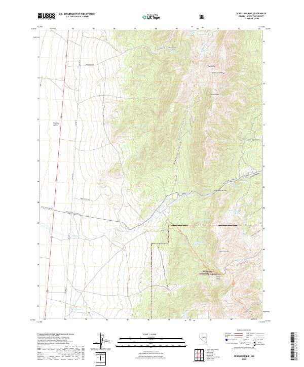
2021 Schellbourne
White Pine County, NV
2021 Seligman Canyon
White Pine County, NV
2021 Sherman Mountain
White Pine County, NV
2021 Silverado Mountain
White Pine County, NV
2021 Silver Canyon
White Pine County, NV
2021 Sixmile Canyon
White Pine County, NV
2021 Skinner Canyon
White Pine County, NV
2021 South Bastian Spring
White Pine County, NV
2021 South Schell Peak
White Pine County, NV
2021 Spring Creek Flat NW
White Pine County, NV
2021 Station Butte
White Pine County, NV
2021 Steptoe Ranch
White Pine County, NV
2021 Steptoe
White Pine County, NV
2021 Stonehouse
White Pine County, NV
2021 Sunset Reservoir
White Pine County, NV
2021 Sunshine Well NW
White Pine County, NV
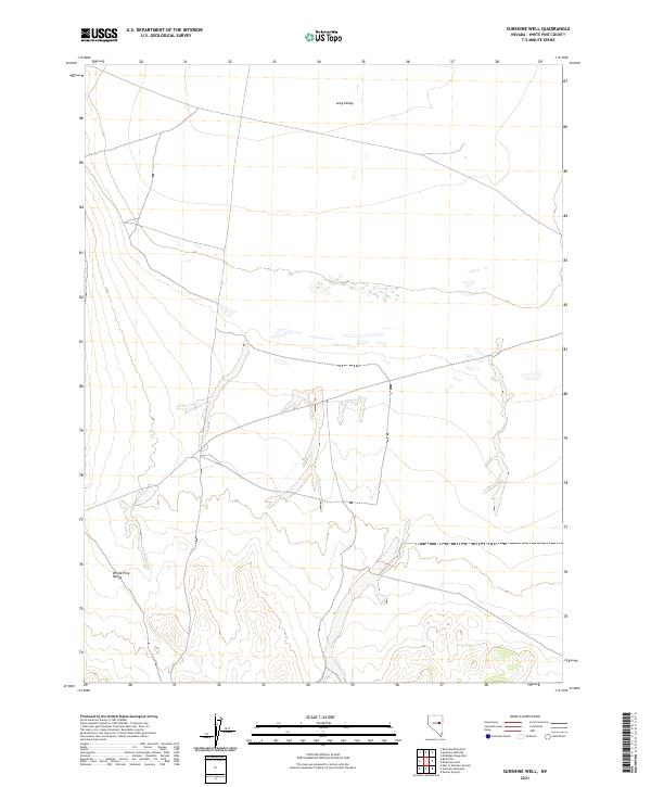
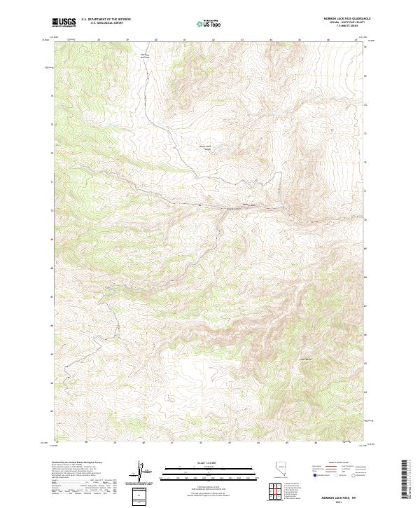
2021 Sunshine Well
White Pine County, NV
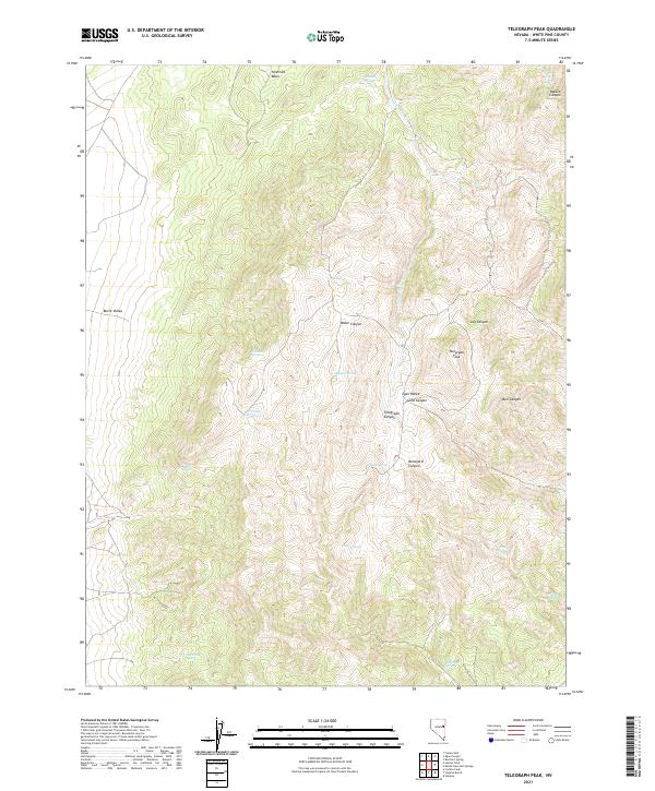
2021 Telegraph Peak
White Pine County, NV
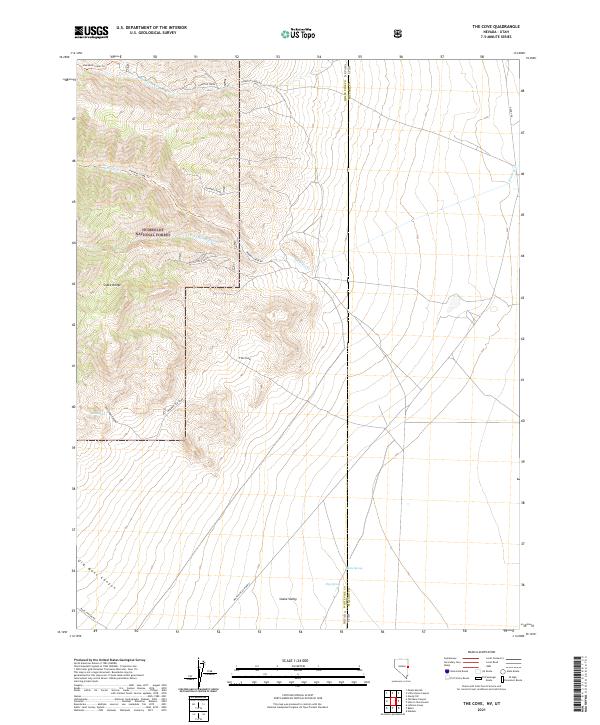
2021 The Cove
White Pine County, NV
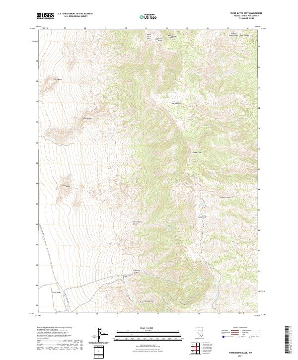
2021 Third Butte East
White Pine County, NV
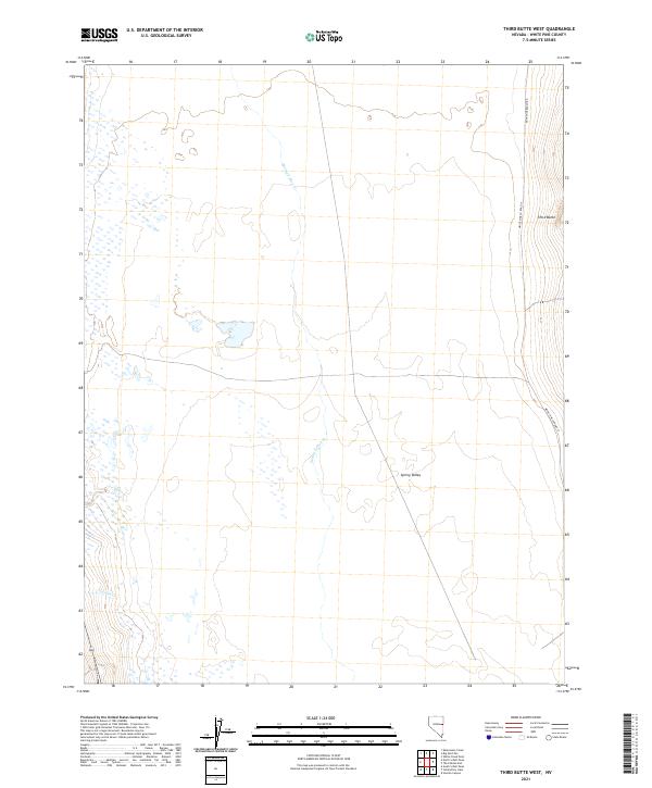
2021 Third Butte West
White Pine County, NV
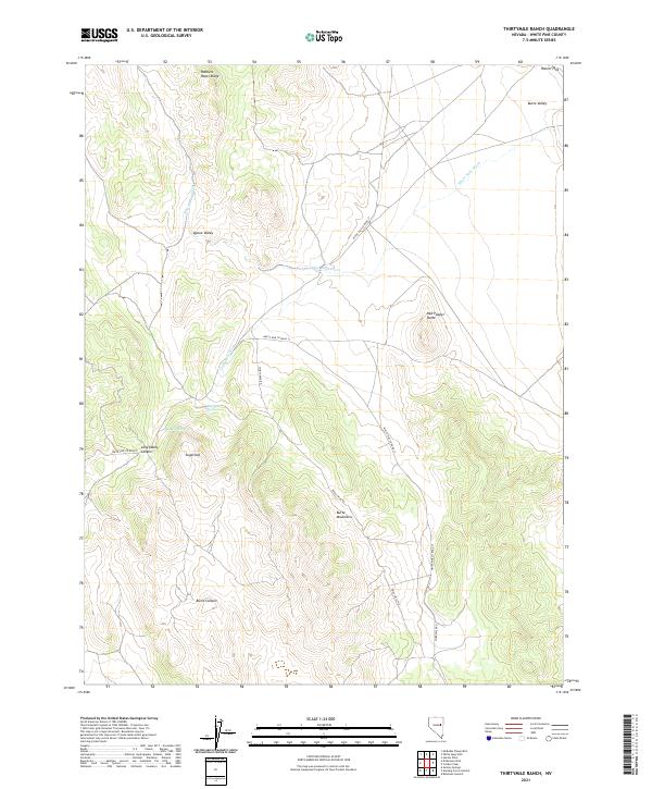
2021 Thirtymile Ranch
White Pine County, NV
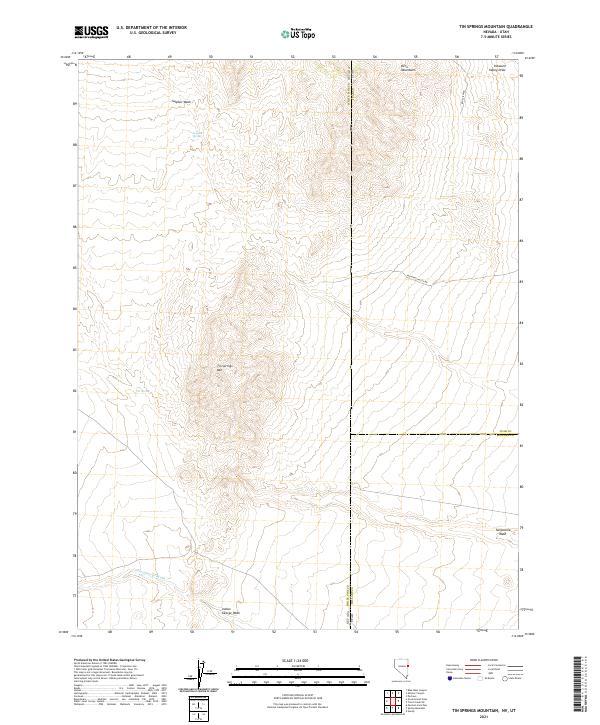
2021 Tin Springs Mountain
White Pine County, NV
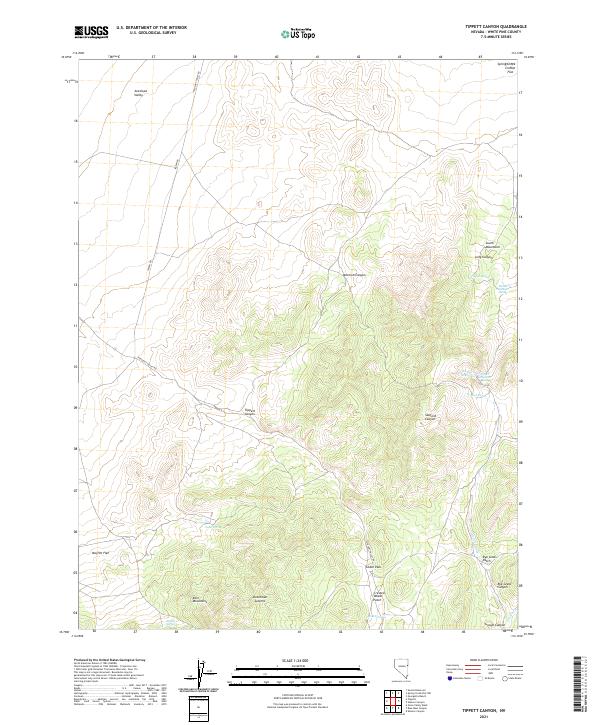
2021 Tippett Canyon
White Pine County, NV
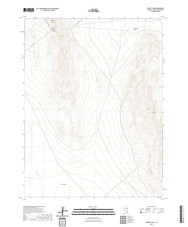
2021 Tippett Pass
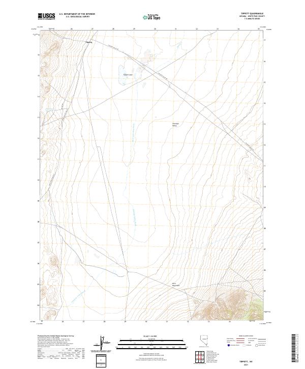
White Pine County, NV
2021 Tippett
White Pine County, NV
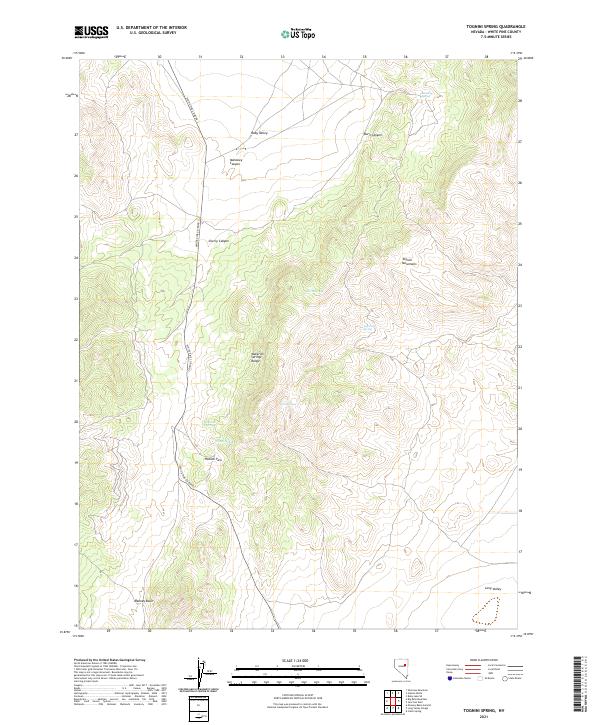
2021 Tognini Spring
White Pine County, NV
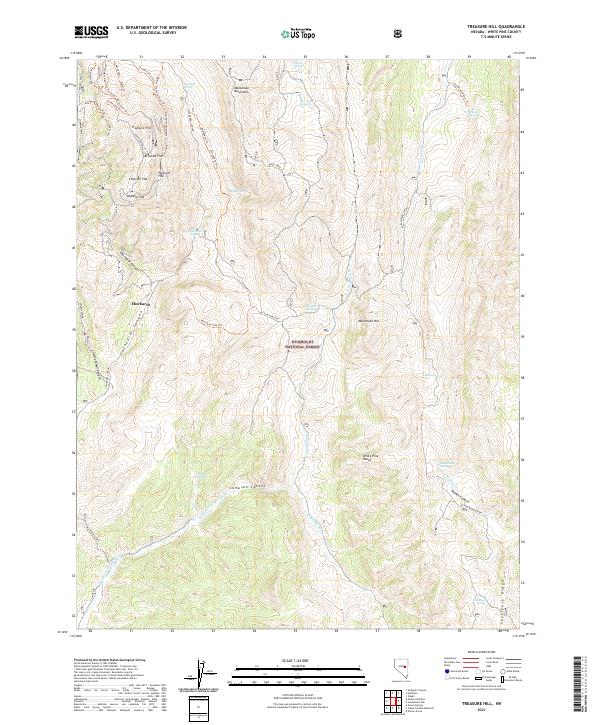
2021 Treasure Hill
White Pine County, NV
2021 Waldy Pond
White Pine County, NV
2021 Walker Canyon
White Pine County, NV
2021 Ward Charcoal Ovens
White Pine County, NV
2021 Ward Mountain
White Pine County, NV
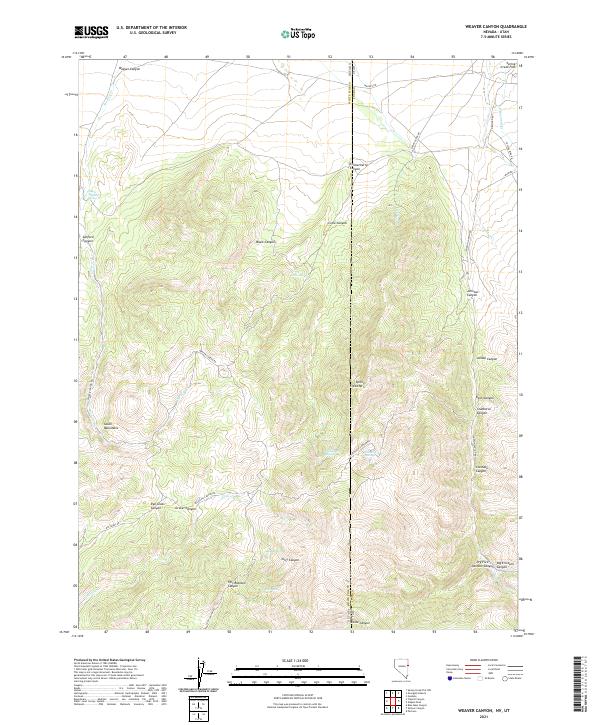
2021 Weaver Canyon
White Pine County, NV
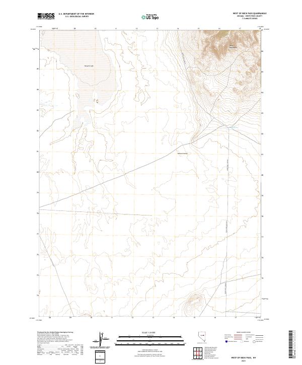
2021 West of Beck Pass
White Pine County, NV
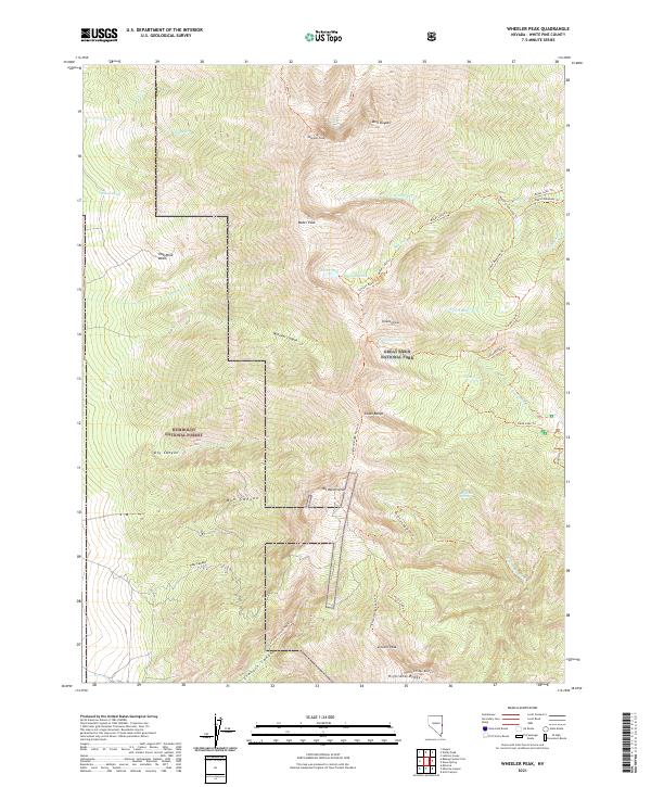
2021 Wheeler Peak
White Pine County, NV
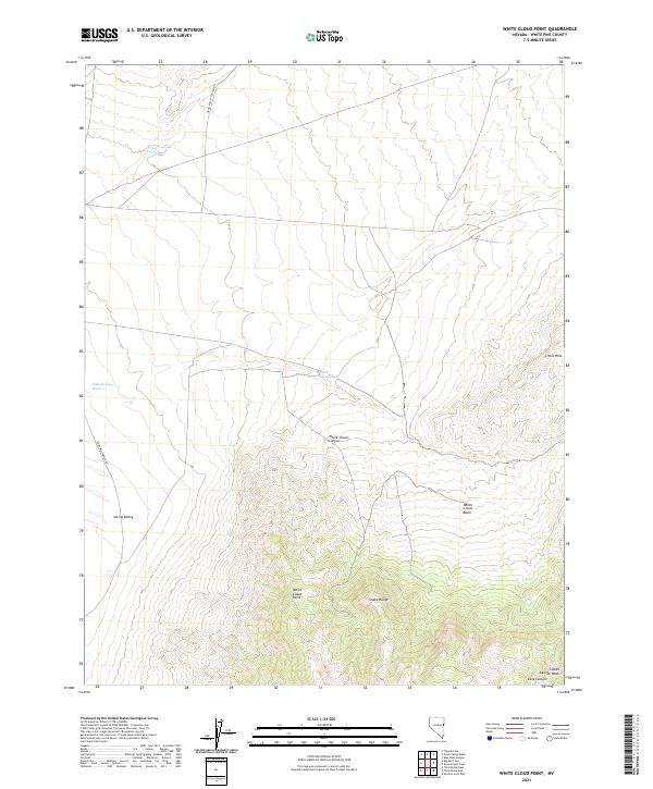
2021 White Cloud Point
White Pine County, NV
2021 White Rock Creek
White Pine County, NV
2021 White Sage Well
White Pine County, NV
2021 Willow Grove
White Pine County, NV
2021 Windy Peak
White Pine County, NV
2021 Yelland Dry Lake
White Pine County, NV